WiserMap — Choose wisely. Connect locally.Choose wisely. Connect locally.Add your business

Moab

No reviews yetCity Utah, United States
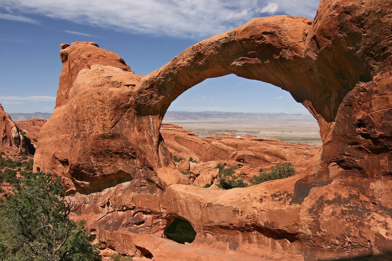
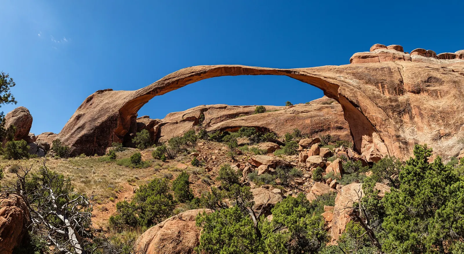
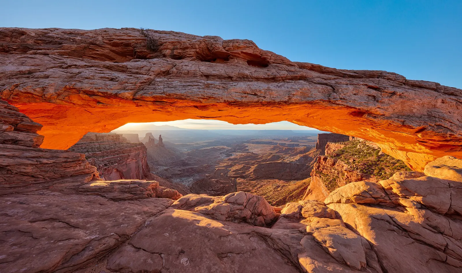
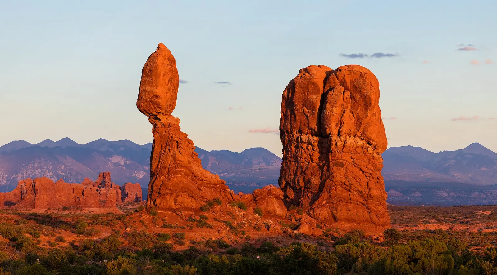
Moab, Utah, United StatesBalanced Rock sits on a pedestal of softer rock beside the main park road, Moab, UtahDouble Arch is a pair of large arches joined at one end in the Windows Section, Moab, UtahLandscape Arch in Devils Garden is one of the longest natural arches in the world, Moab, UtahMesa Arch sits on the rim of Island in the Sky and frames the canyons below, Moab, Utah

About Moab

Moab is a small town in eastern Utah, set beside the Colorado River among red-rock canyons, mesas and slickrock. A uranium boom in the 1950s once drove its economy, but today it serves as the base for Arches and Canyonlands national parks and as a hub for mountain biking, off-roading, rafting and climbing.

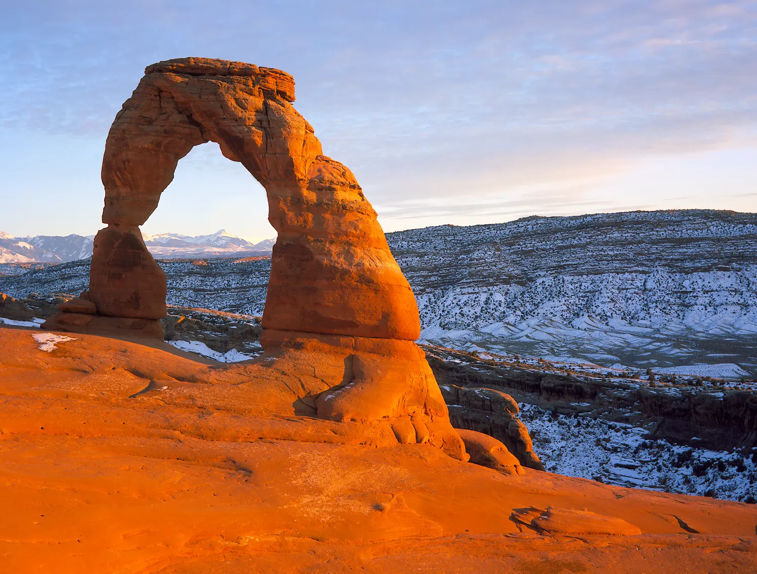
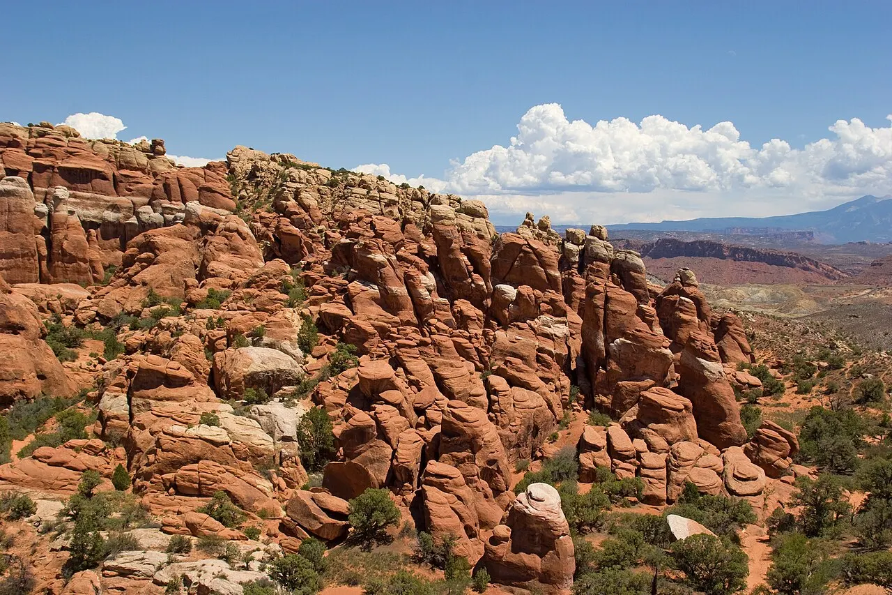
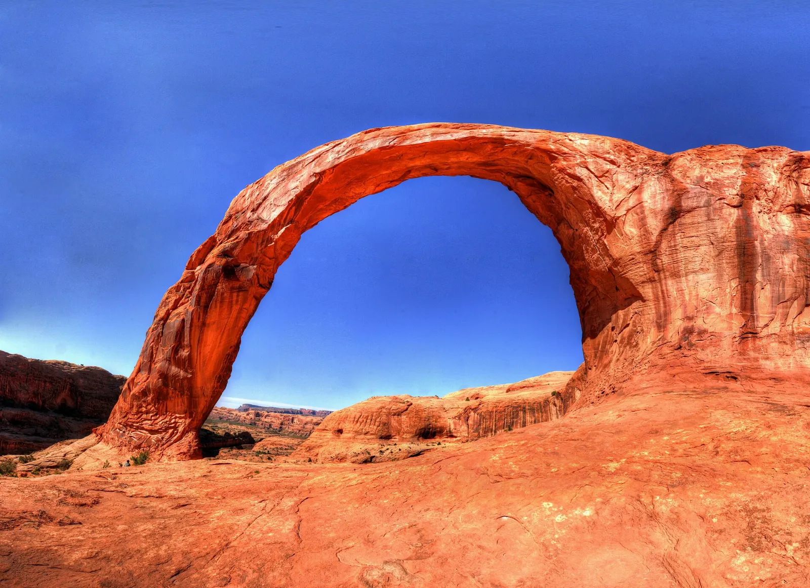
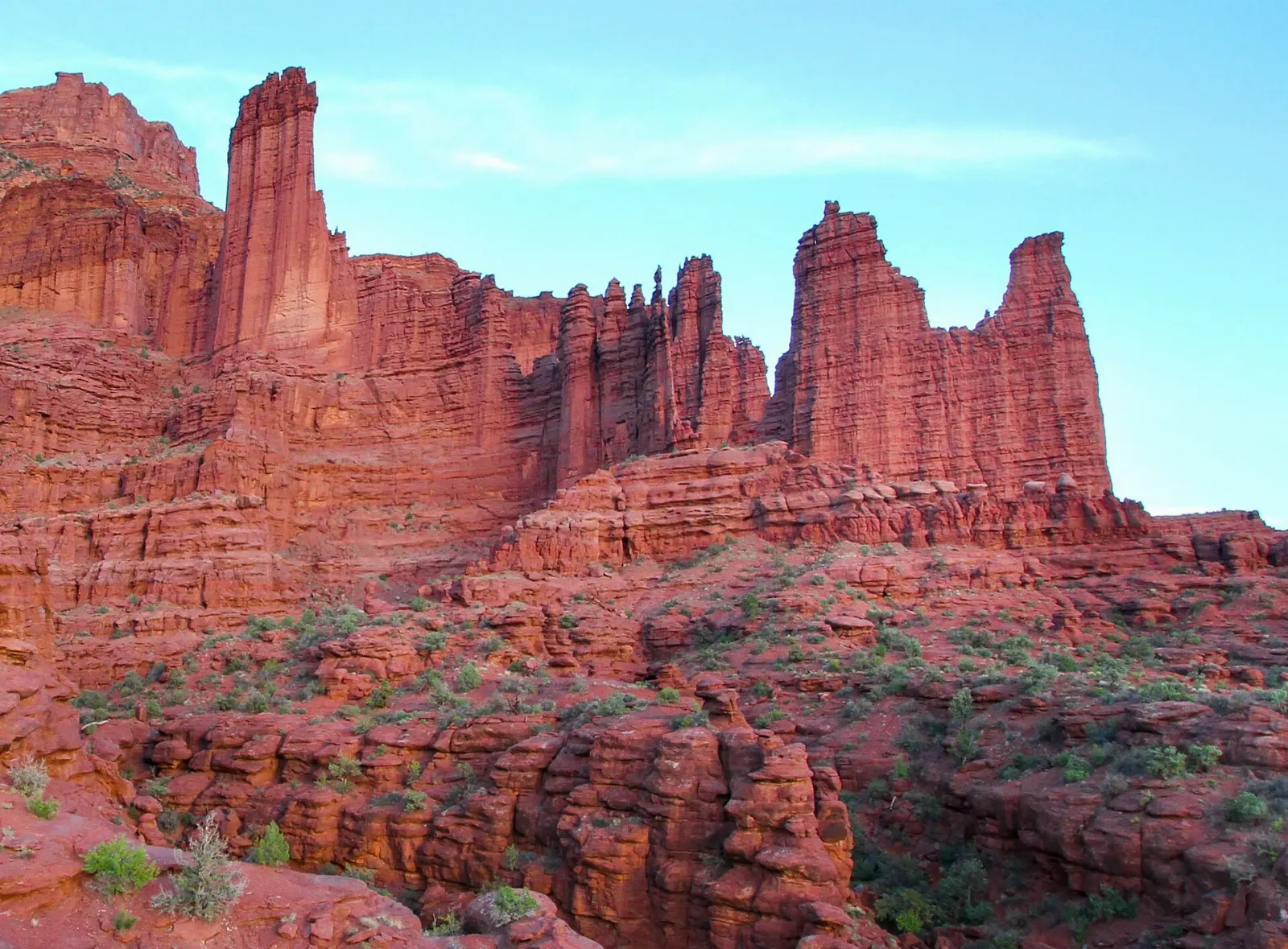
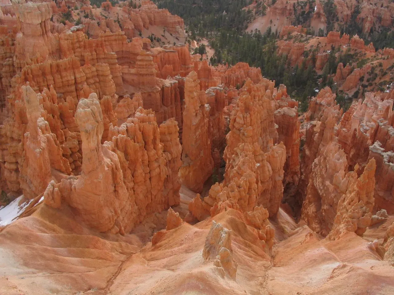
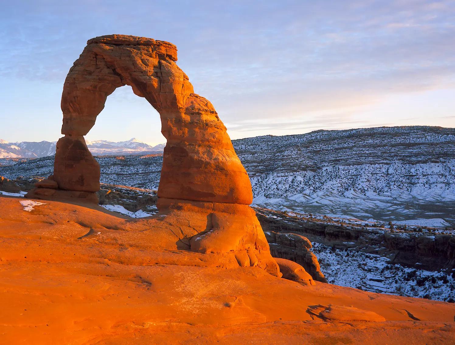
In Arches National Park, the tall sandstone fins of Park Avenue line the start of the main road, and Balanced Rock perches beside it farther on. The Windows Section groups several large openings, including Double Arch, and a hike across bare slickrock leads to Delicate Arch, the state's most recognizable landmark. At the end of the road, Devils Garden offers trails to Landscape Arch, a long and remarkably thin span, while the maze of Fiery Furnace requires a permit or a ranger-led walk. Canyonlands' Island in the Sky district sits on a mesa high above the rivers, and the unpaved Shafer Trail switchbacks down its walls. Dead Horse Point State Park overlooks a sweeping bend in the Colorado. Outside the parks, Corona Arch makes a popular short hike, and the Fisher Towers rise as dark red spires along the river road.

Moab suits active travelers, families and photographers. Summer heat is intense, so outdoor plans should start early. Arches has required timed-entry reservations in busy months, so check current rules before arriving.

Best seasonSpring and fall offer warm days and cool nights, ideal for hiking and biking.
Ideal stayThree to four days covers Arches, Island in the Sky and Dead Horse Point.
ArrivingCanyonlands Regional Airport has limited flights; many travelers drive from Salt Lake City or Grand Junction.
Moab Utah Delicate Arch Dead Horse Point and CanyonlandsWiserMap travel guideMoab Utah Delicate Arch Dead Horse Point and CanyonlandsPlan Moab around Delicate Arch, the Windows, Canyonlands' Island in the Sky, Dead Horse Point, Corona Arch and Fisher Towers, with 2026 park entry tips.Read the guide

Why People Love Moab: 12 Things to Discover

Viewpoints 4

Park Avenue and Balanced Rock, Moab, Utah, United States

Park Avenue and Balanced Rock

Two of the first stops in Arches National Park. Park Avenue is a canyon lined with tall sandstone fins, with a one mile trail thro...
The Windows Section and Double Arch, Moab, Utah, United States

The Windows Section and Double Arch

A cluster of large arches in Arches National Park, including the North and South Windows, Turret Arch and Double Arch, all reached...
Dead Horse Point Overlook, Moab, Utah, United States

Dead Horse Point Overlook

A narrow mesa overlook 2,000 feet above a gooseneck bend of the Colorado River, with views across to Canyonlands. Rim trails link...
Island in the Sky, Moab, Utah, United States

Island in the Sky

The most accessible district of Canyonlands National Park, a high mesa about 40 minutes from Moab. Short walks lead to Mesa Arch,...

Hikes 4

Delicate Arch Trail and Wolfe Ranch, Moab, Utah, United States

Delicate Arch Trail and Wolfe Ranch

Utah's most famous arch, featured on the state license plate, stands alone on the edge of a slickrock bowl. The trail is about thr...
Devils Garden and Landscape Arch, Moab, Utah, United States

Devils Garden and Landscape Arch

The trailhead at the end of the Arches park road leads to Landscape Arch, one of the longest natural arches in the world, after an...
Fiery Furnace, Moab, Utah, United States

Fiery Furnace

A maze of tight sandstone canyons and fins in Arches National Park that can be explored only on a ranger-led hike or with a self-g...
Corona Arch, Moab, Utah, United States

Corona Arch

A large free-standing arch on public land west of Moab off Highway 279, reached by a trail of about three miles round trip. The ro...

Nature 1

Fisher Towers, Moab, Utah, United States

Fisher Towers

Tall, red-brown mudstone and sandstone towers northeast of Moab off Highway 128, including the Titan, one of the tallest freestand...

Scenic Drives 2

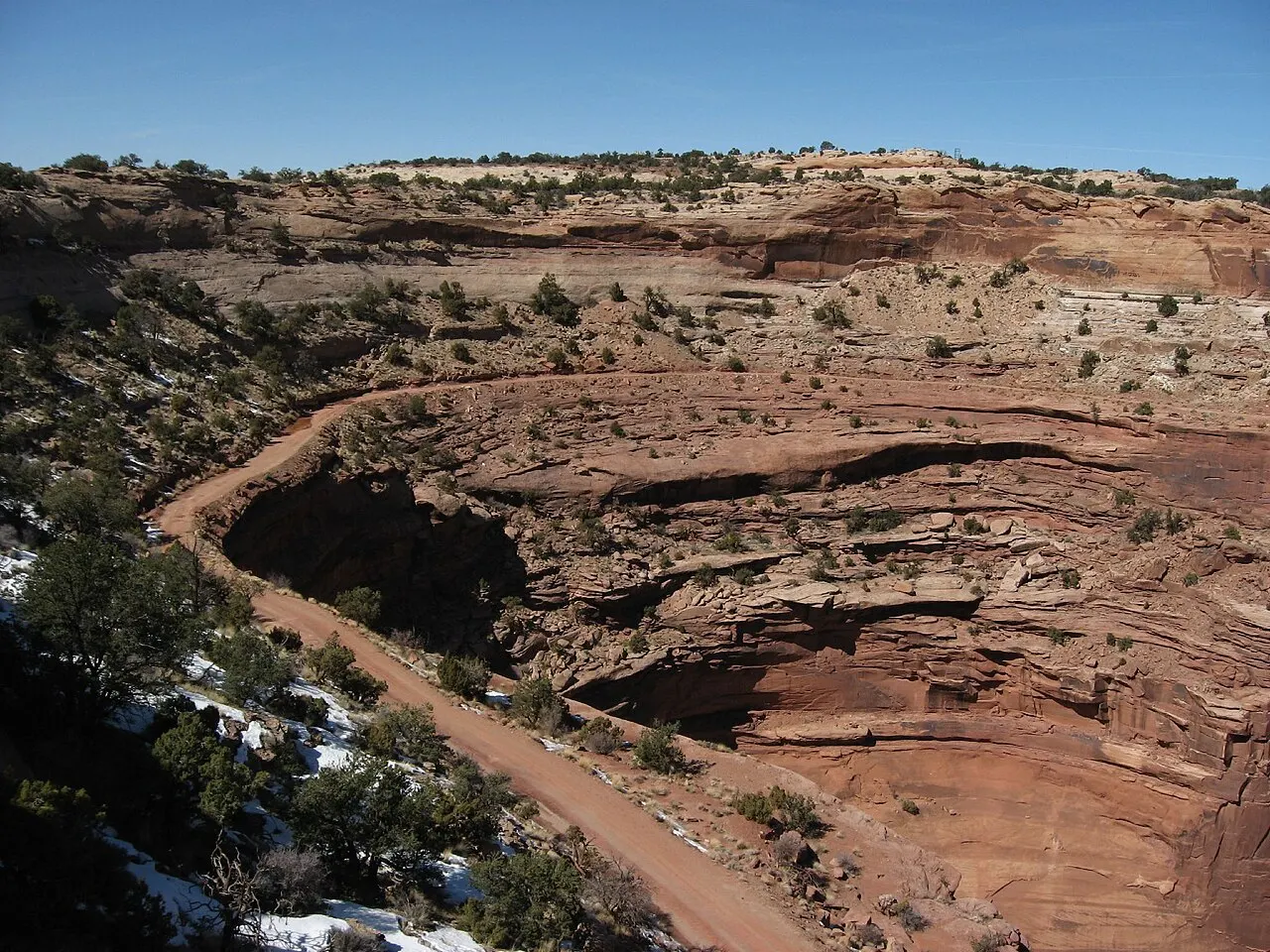
Shafer Trail, Moab, Utah, United States

Shafer Trail

A dramatic dirt road that drops in steep switchbacks from Island in the Sky down to the White Rim and on toward Moab via Potash Ro...
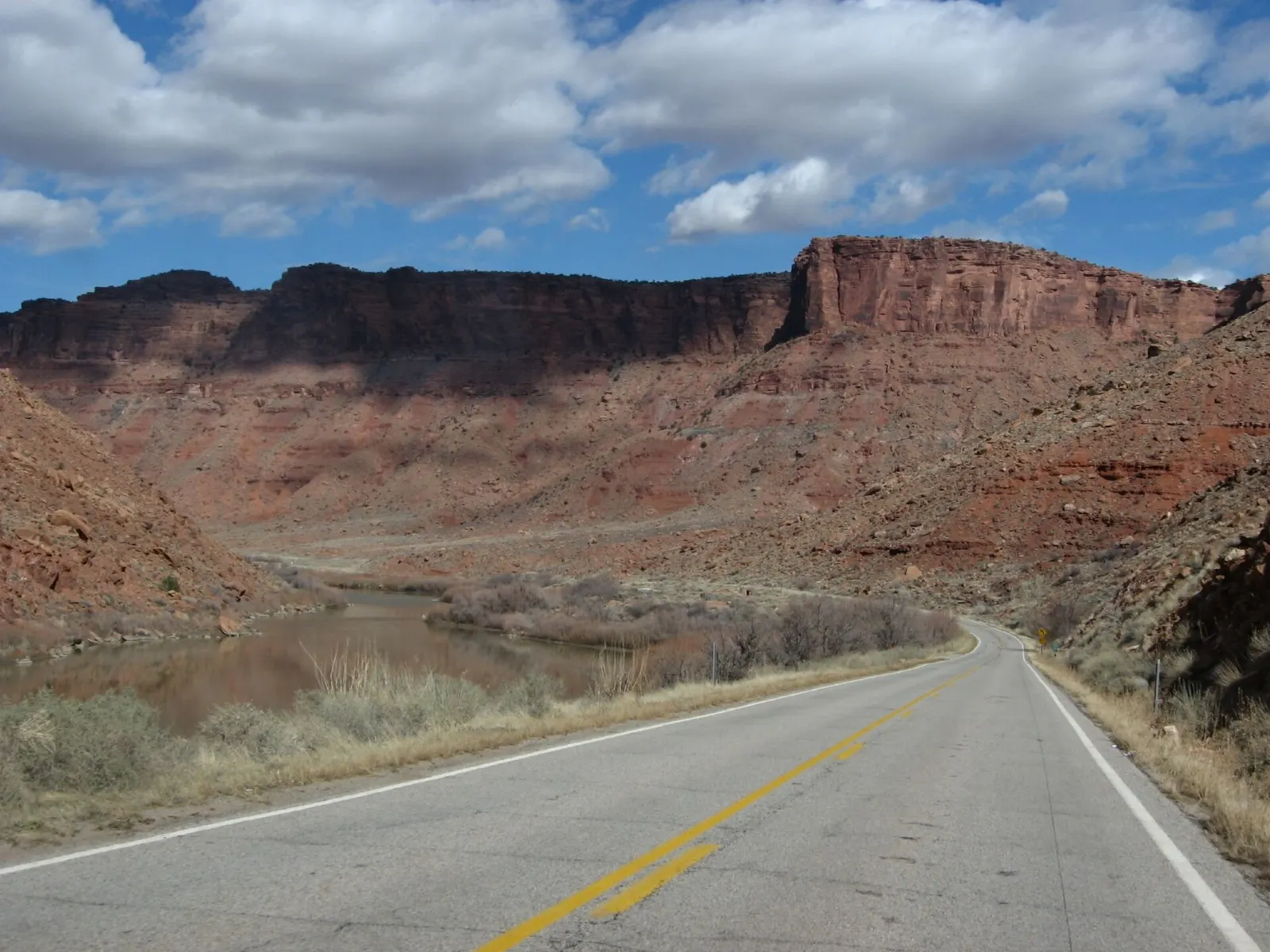
Scenic Byway 128 and the Colorado River, Moab, Utah, United States

Scenic Byway 128 and the Colorado River

Utah Highway 128 follows the Colorado River northeast from Moab through a deep red rock canyon toward Castle Valley and Fisher Tow...

Adventure 1

Slickrock Trail and Sand Flats, Moab, Utah, United States

Slickrock Trail and Sand Flats

The Slickrock Bike Trail on the Sand Flats Recreation Area is a world famous mountain bike route across open, grippy sandstone, ma...

Reviews

No reviews yet. Been to Moab? Be the first to share your experience.

Write a review

Share what you loved, what to skip and tips for other travelers.

Log in to write a review

Share your photos

Been to Moab? Add your best shots to the gallery.

Log in to add photos

More places in Utah

See all places in United States →

Photo credits

Photo: National Park Service Photo, Wikimedia Commons, Public domain

Photo: Thomas Wolf, www.foto-tw.de, Wikimedia Commons, CC BY-SA 3.0

Photo: Flicka, Wikimedia Commons, CC BY-SA 3.0

Photo: Thomas Wolf, www.foto-tw.de, Wikimedia Commons, CC BY-SA 3.0

Photo: Thomas Wolf, www.foto-tw.de, Wikimedia Commons, CC BY-SA 3.0

Photo: Larry D. Moore, Wikimedia Commons, CC BY 4.0

Photo: Michael Grindstaff, Wikimedia Commons, CC BY-SA 3.0

Photo: j.a.woodhouse, Wikimedia Commons, CC BY 2.0

Photo: Ken Lund, Wikimedia Commons, CC BY-SA 2.0

Photo: Albert Backer, Wikimedia Commons, CC BY-SA 3.0

Photo: Mramoeba, Wikimedia Commons, CC BY-SA 4.0
Photo: Quintin Soloviev, Wikimedia Commons, CC BY 4.0

Photo: Ken Lund from Reno, Nevada, USA, Wikimedia Commons, CC BY-SA 2.0

Photo: USGS Geosciences and Environmental Change Science Center, Wikimedia Commons, Public domain

Photo: David Wilson, Wikimedia Commons, CC BY 2.0

Photo: mypubliclands, Wikimedia Commons, Public domain

Photo: KimonBerlin, Wikimedia Commons, CC BY-SA 2.0

Photo: Zach Dischner, Wikimedia Commons, CC BY 2.0

Photo: akampfer, Wikimedia Commons, CC BY-SA 3.0

Photo: Hurricanehink, Wikimedia Commons, CC BY-SA 3.0

Photo: David Hiser, Wikimedia Commons, Public domain

Photo: David Hiser, Wikimedia Commons, Public domain

Photo: David Hiser, Wikimedia Commons, Public domain

Photo: Ken Lund from Reno, Nevada, USA, Wikimedia Commons, CC BY-SA 2.0

Photo: David Hiser, Wikimedia Commons, Public domain

Photo: David Hiser, Wikimedia Commons, Public domain

Photo: David Hiser, Wikimedia Commons, Public domain

Photo: David Hiser, Wikimedia Commons, Public domain

Photo: Greg Willis from Denver, CO, usa, Wikimedia Commons, CC BY-SA 2.0

Photo: Ken Lund from Reno, Nevada, USA, Wikimedia Commons, CC BY-SA 2.0

Photo: Ken Lund from Reno, Nevada, USA, Wikimedia Commons, CC BY-SA 2.0

Photo: Ken Lund from Reno, Nevada, USA, Wikimedia Commons, CC BY-SA 2.0

Photo: Dana Hutchinson, Wikimedia Commons, CC BY 3.0

Photo: Adam Skalecki skalecki, Wikimedia Commons, CC0

Photo: Ken Lund from Reno, Nevada, USA, Wikimedia Commons, CC BY-SA 2.0

Photo: Ken Lund from Reno, Nevada, USA, Wikimedia Commons, CC BY-SA 2.0

Photo: Ken Lund from Reno, Nevada, USA, Wikimedia Commons, CC BY-SA 2.0

Photo: Ken Lund from Reno, Nevada, USA, Wikimedia Commons, CC BY-SA 2.0

Photo: Ken Lund from Reno, Nevada, USA, Wikimedia Commons, CC BY-SA 2.0

Photo: Ken Lund from Reno, Nevada, USA, Wikimedia Commons, CC BY-SA 2.0

Photo: Ken Lund from Reno, Nevada, USA, Wikimedia Commons, CC BY-SA 2.0

Photo: KimonBerlin, Wikimedia Commons, CC BY-SA 2.0

Photo: Arches National Park from Moab, Utah, Wikimedia Commons, Public domain

Photo: Ken Lund from Reno, Nevada, USA, Wikimedia Commons, CC BY-SA 2.0

Photo: Arches National Park from Moab, Utah, Wikimedia Commons, Public domain

Photo: Ken Lund from Reno, Nevada, USA, Wikimedia Commons, CC BY-SA 2.0

Photo: Whitimeg, Wikimedia Commons, CC BY-SA 4.0
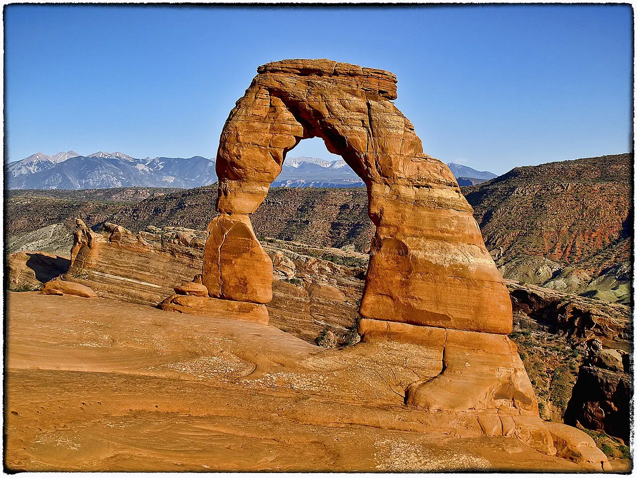
Photo: Ben Goodwin, Wikimedia Commons, CC BY-SA 2.0

Photo: James St. John, Wikimedia Commons, CC BY 2.0

Photo: James St. John, Wikimedia Commons, CC BY 2.0

Photo: BLMUtah, Wikimedia Commons, Public domain

Photo: Bureau of Land Management - Utah, Wikimedia Commons, Public domain

Photo: Murray Foubister, Wikimedia Commons, CC BY-SA 2.0

Photo: Murray Foubister, Wikimedia Commons, CC BY-SA 2.0

Photo: Ken Lund from Reno, Nevada, USA, Wikimedia Commons, CC BY-SA 2.0

Photo: Ken Lund from Reno, Nevada, USA, Wikimedia Commons, CC BY-SA 2.0

Photo: Greg Willis from Denver, CO, usa, Wikimedia Commons, CC BY-SA 2.0

Photo: KimonBerlin, Wikimedia Commons, CC BY-SA 2.0

Photo: KimonBerlin, Wikimedia Commons, CC BY-SA 2.0

Photo: KimonBerlin, Wikimedia Commons, CC BY-SA 2.0

Photo: KimonBerlin, Wikimedia Commons, CC BY-SA 2.0

Photo: KimonBerlin, Wikimedia Commons, CC BY-SA 2.0

Photo: KimonBerlin, Wikimedia Commons, CC BY-SA 2.0

Photo: Carter Pape, Wikimedia Commons, CC BY-SA 4.0