Capitol Reef National Park protects a long, buckled ridge of stone in south-central Utah, and it rewards travelers who slow down.
AT A GLANCE
Best time
April to June and September to October for mild temperatures, orchard blossoms or harvest.
How long
Two full days covers the highlights; add a third for Cathedral Valley or the south district.
Getting there
Drive Utah Highway 24, which crosses the park; the nearest town is Torrey, just west of the boundary.
Why visit Capitol Reef
The park exists to protect the Waterpocket Fold, a monocline nearly a hundred miles long where the rock layers on the west side were lifted thousands of feet higher than those on the east. Erosion has carved that tilted layer cake into cliffs, domes, arches, narrow canyons and natural water pockets, which give the fold its name.

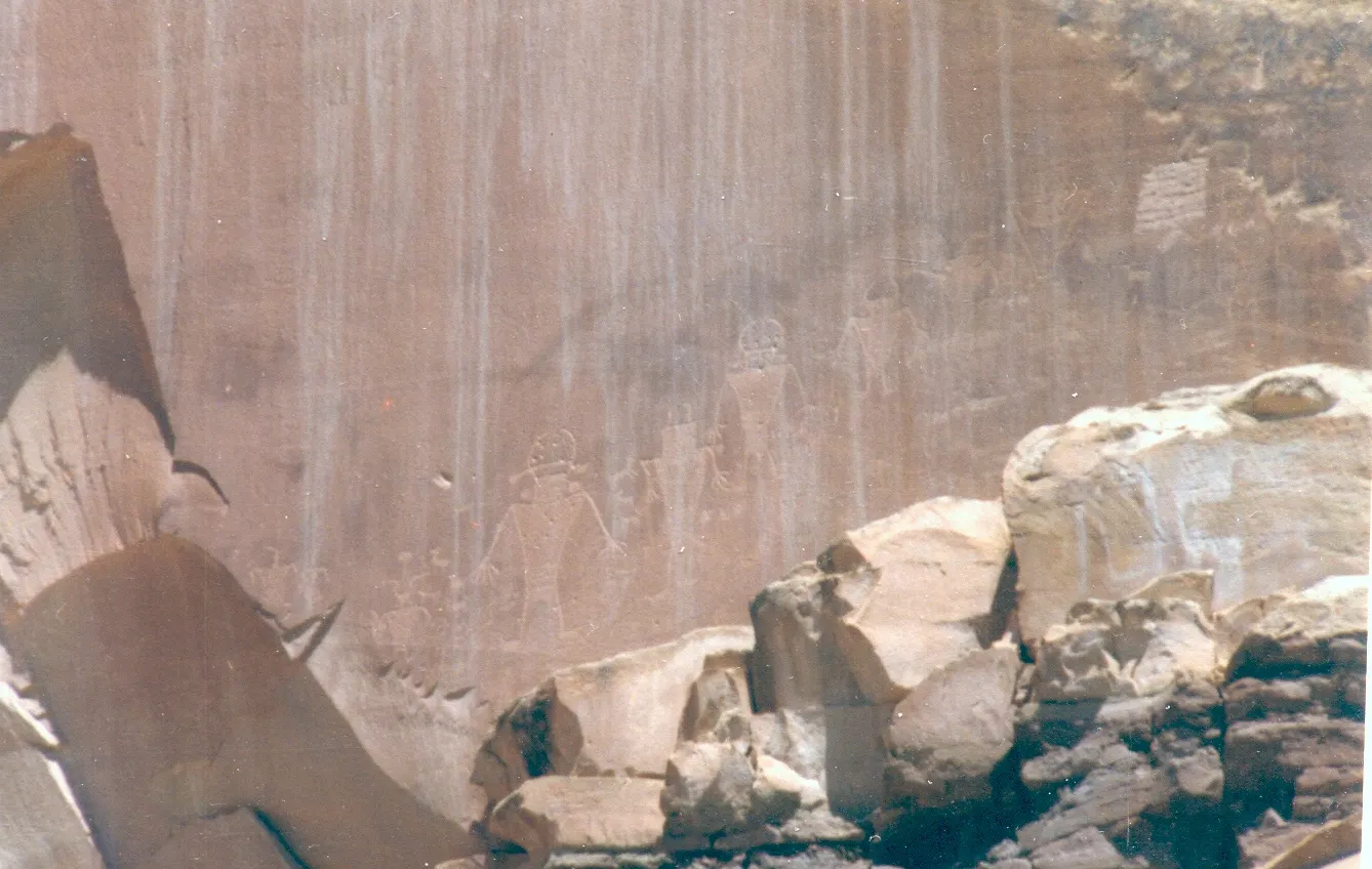
What makes Capitol Reef different from its neighbors is the human story layered on top of the geology. The Fremont people farmed along the rivers here roughly a thousand years ago and left petroglyphs on the canyon walls.
It is also a serious place for stargazing. Capitol Reef was designated an International Dark Sky Park in 2015, and on a clear, moonless night the Milky Way stretches from cliff to cliff above Fruita.
Fruita and the historic heart of the park
Fruita Rural Historic District and the orchards
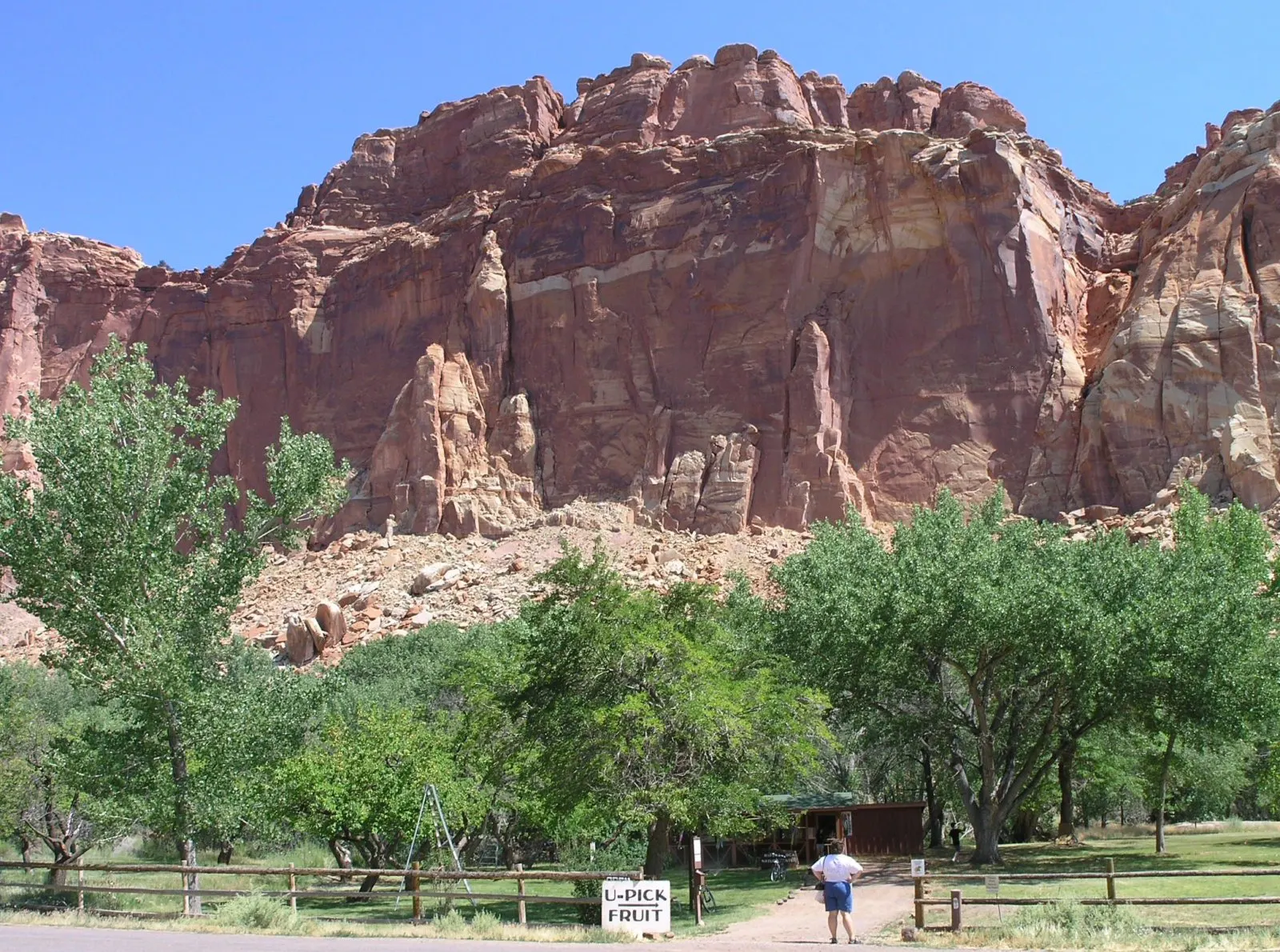
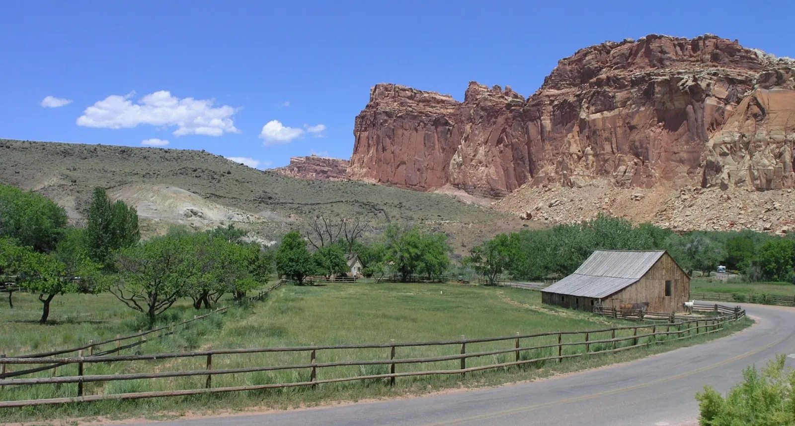
Fruita is the green core of the park, a ribbon of cottonwoods, lawns and roughly two dozen orchards along the Fremont River. Blossoms usually open from March into early May, and harvest runs from early summer cherries through apricots, peaches and pears to autumn apples.
Gifford Homestead
About a mile south of the visitor center along the Scenic Drive, the restored Gifford farmhouse shows how a Fruita family lived in the early twentieth century, with a barn, smokehouse and pasture beside it. The small shop inside is famous among park visitors for its fresh-baked fruit pies, along with jams, salsa and locally made crafts.
Fruita Schoolhouse and the Petroglyph Panel
On Highway 24 just east of the visitor center, the one-room Fruita Schoolhouse served the settlement's children for decades; you can peer through the windows at the desks and stove. A short drive farther east, a boardwalk leads along a cliff decorated with Fremont petroglyphs of bighorn sheep and broad-shouldered human figures with headdresses.
Hickman Bridge
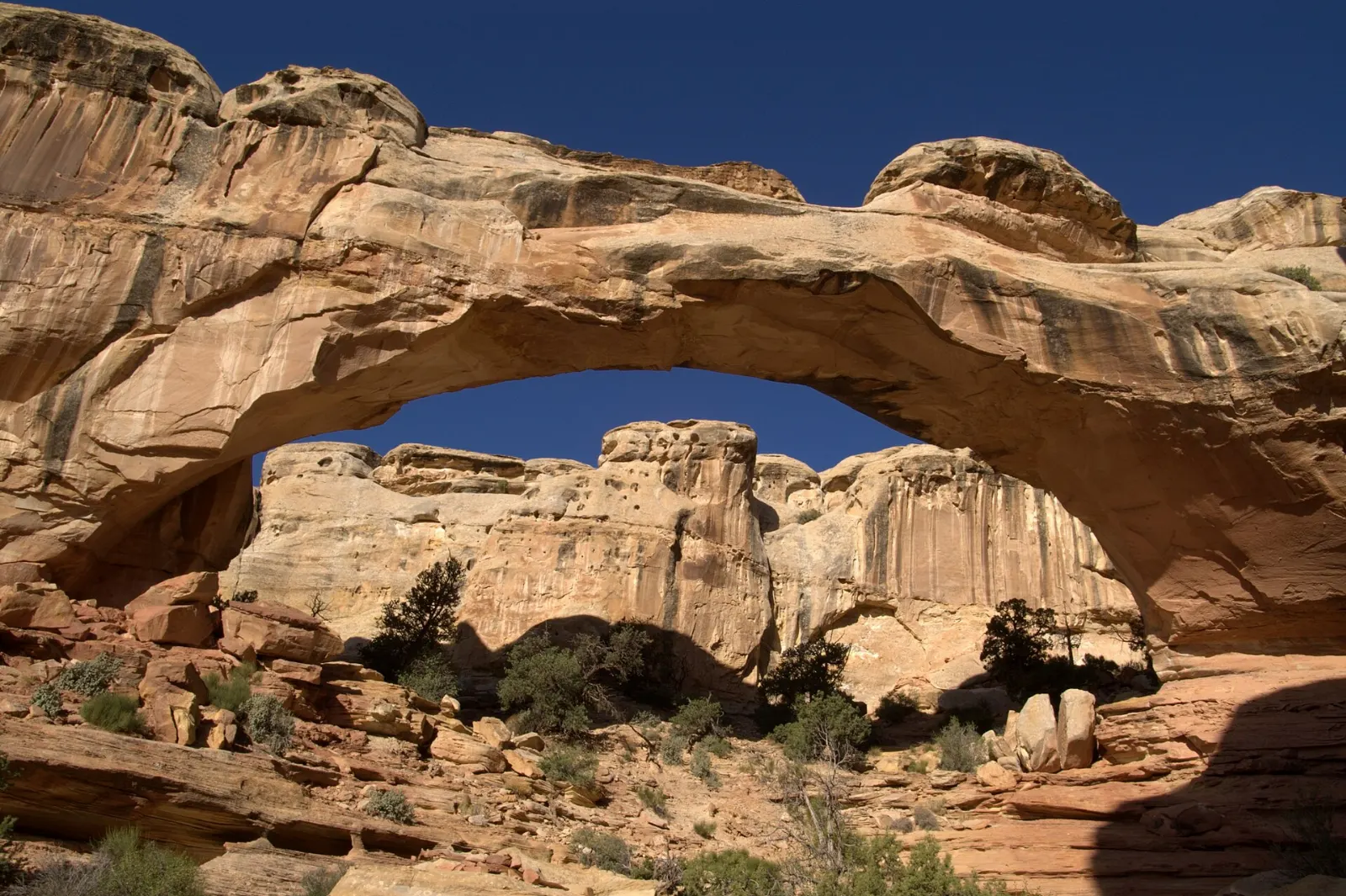
The most popular hike in the park climbs from a trailhead on Highway 24 to a massive natural bridge of Kayenta sandstone, passing a small Fremont granary tucked into a ledge along the way.
The Scenic Drive, Grand Wash and Capitol Gorge
South of Fruita, the paved Scenic Drive runs for about eight miles along the face of the reef, with dirt spurs leading into the canyons. An entrance fee applies beyond the Fruita Campground, so check the official website for current fees and pass options.
Grand Wash and Cassidy Arch
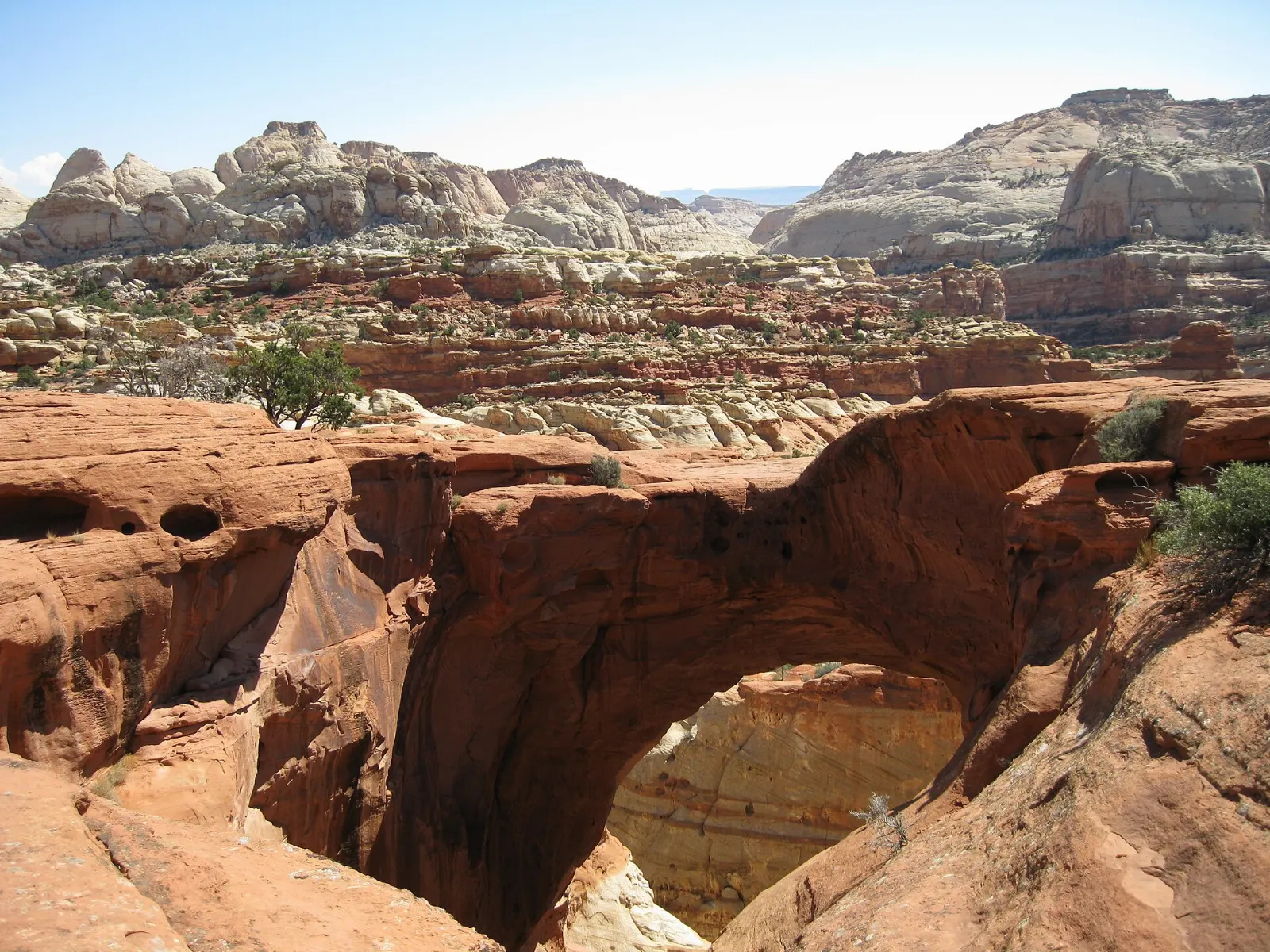
Grand Wash is a broad canyon that narrows dramatically between sheer walls several hundred feet high. From the end of the dirt road you can walk the level wash to the narrows in about an hour round trip.
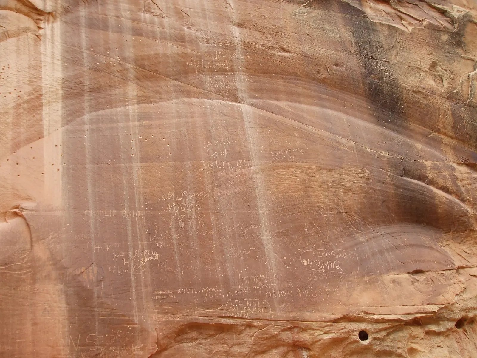
Capitol Gorge and the Pioneer Register
At the end of the Scenic Drive, a graded dirt road winds into Capitol Gorge, which served as the main wagon route through the reef until Highway 24 was built along the Fremont River in 1962.
Panorama Point, Goosenecks and Sunset Point
West of the visitor center, a short side road off Highway 24 leads to Panorama Point, with a broad view of the reef and the distant Henry Mountains. A little farther, the Goosenecks Overlook peers straight down into the twisting canyon of Sulphur Creek, and an easy trail of under a mile each way leads to Sunset Point, where the cliffs glow orange in the last light.
Chimney Rock, Cathedral Valley and the wild south
Chimney Rock
Just west of Panorama Point, a loop trail of about three and a half miles climbs around a dark red spire of Moenkopi rock capped with harder sandstone, with long views over the colorful slopes of the Chinle Formation. Allow two to three hours.
Cathedral Valley
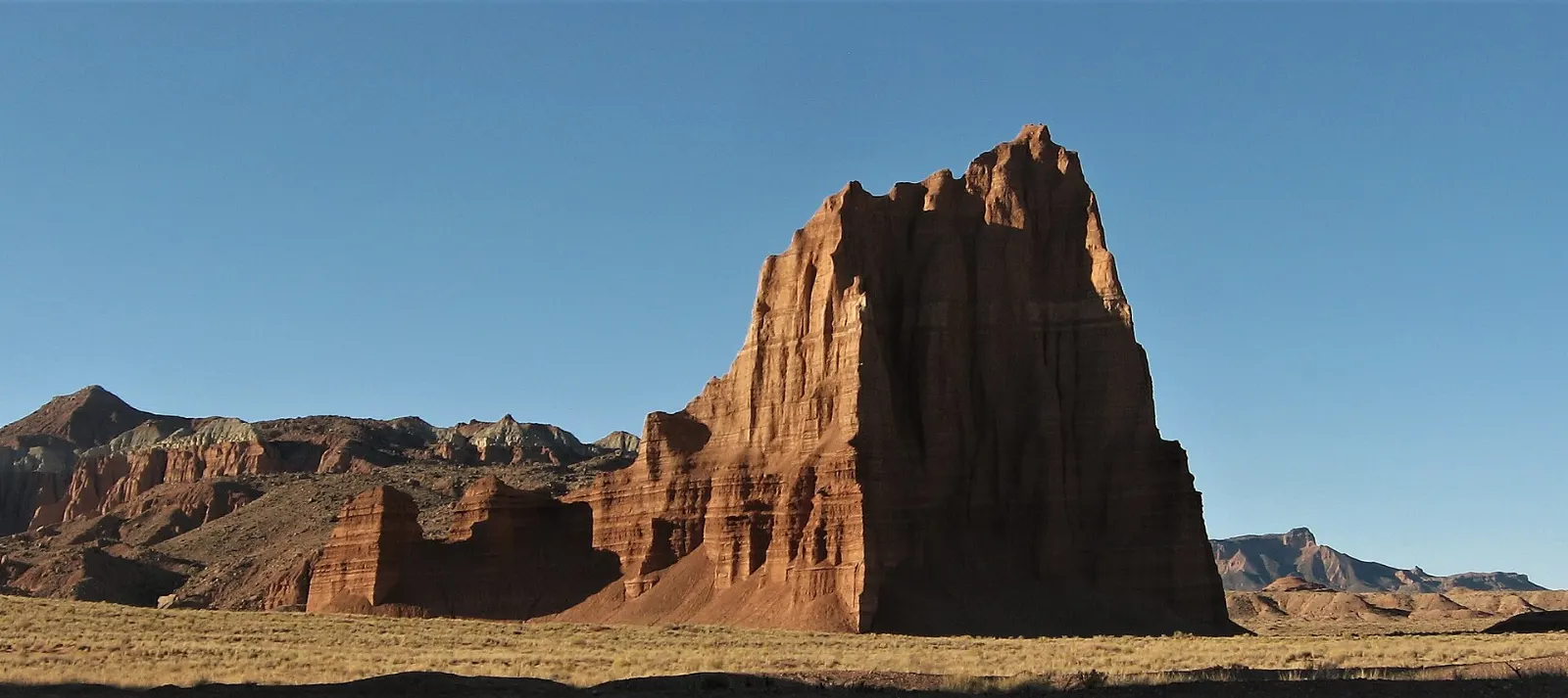
In the park's remote northern district, freestanding monoliths of Entrada sandstone rise from bare valley floors, the best known being the Temple of the Sun and Temple of the Moon.
Notom-Bullfrog Road and the Burr Trail
Along the eastern base of the fold, the Notom-Bullfrog Road runs south through open desert toward the Burr Trail, whose dramatic switchbacks climb the reef and continue west to the town of Boulder. Short detours lead to the Strike Valley Overlook and the trailheads for Upper Muley Twist Canyon.
 Planning a trip to Capitol Reef National Park?Compare hotels, flights and vacation rentals for Capitol Reef National Park on Expedia.Book now
Food and local flavors
Inside the park, food is limited to the pies, baked goods, ice cream and preserves sold at the Gifford Homestead and snacks at the visitor center, so plan picnics around the shaded tables in the Fruita picnic area.
Torrey, about ten miles west of the visitor center, has the area's main cluster of restaurants, cafes and seasonal food trucks, many of which close or shorten their hours in winter.
Popular dishes to try in Capitol Reef National Park


Where to stay
There is no lodge inside the park. The Fruita Campground is the only developed campground, with shaded sites among the orchards and river cottonwoods; it is extremely popular, so reserve as early as possible for the main season.
Torrey is the natural base for most visitors, with motels, cabins, small inns, RV parks and vacation rentals within a short drive of Fruita. It suits anyone who wants restaurants close by and easy access to Highway 12.
Where to stay in Capitol Reef National Park


Best time to visit
Spring brings fruit blossoms in Fruita, desert wildflowers and comfortable hiking weather, though wind and the occasional late snow are possible.
Summer is hot, with afternoon highs often in the upper nineties Fahrenheit, and the monsoon season from about July through September brings sudden thunderstorms, lightning and flash floods.
Getting there and getting around
Capitol Reef is remote, and you will need a car. Salt Lake City International Airport is the most common gateway, a drive of roughly three and a half to four hours via Interstate 15 and Highway 24.
One of the finest approaches is Scenic Byway 12 from Bryce Canyon, which crosses the Escalante country and climbs over Boulder Mountain before dropping into Torrey.
A suggested itinerary
First day
Start at the visitor center for maps and road conditions, then hike to Hickman Bridge while it is still cool.
Second day
Drive the Scenic Drive early, hike Cassidy Arch, then continue to Capitol Gorge for the easy walk to the Pioneer Register and the Tanks.
Third day
With a high-clearance vehicle and good weather, spend the day on the Cathedral Valley loop. Otherwise, drive south on the Notom-Bullfrog Road toward the Burr Trail, or head west over Boulder Mountain on Highway 12 toward Escalante and Bryce Canyon.
Practical tips
- Check the official park website for current fees, Scenic Drive conditions and alerts before you go.
- Reserve Fruita Campground or Torrey lodging well ahead for spring and fall.
- Carry at least a gallon of water per person per day in warm weather; refill at the visitor center and campground.
- Stay on trails and slickrock to protect the fragile biological soil crust.
- Avoid narrow canyons and washes when thunderstorms are forecast anywhere upstream.
- Fill your tank in Torrey or Hanksville; there is no fuel inside the park.
Find local businesses in Torrey on WiserMap
Torrey is the gateway town for Capitol Reef, with cafes, outfitters, lodging and grocery stops just west of the park.