Arches National Park holds more than two thousand natural stone arches, the densest concentration anywhere on earth, packed into a compact park just north of Moab in eastern Utah.
AT A GLANCE
Best time
April to May and mid-September to October for mild hiking weather.
How long
Two days for the main hikes; three or four with Canyonlands and Dead Horse Point.
Getting there
The entrance is on US Route 191, about five miles north of Moab.
Why visit Arches National Park
The arches exist because of what lies underground. A thick layer of salt, deposited by an ancient sea some three hundred million years ago, slowly shifted and swelled beneath the overlying sandstone, cracking it into long parallel fins.
What makes Arches special for visitors is access. Many of the most famous formations are reached by walks of a mile or less from the paved scenic road, while longer trails such as Delicate Arch and Devils Garden offer real adventure without overnight gear.
From the entrance to the Windows
Park Avenue and Courthouse Towers
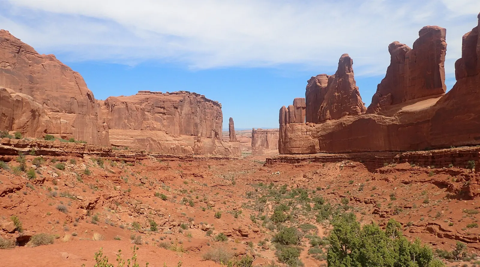
After the switchbacks above the visitor center, the first major stop is Park Avenue, where tall sandstone walls line a dry canyon like a row of city buildings. A trail of about a mile one way runs down the canyon toward the Courthouse Towers, a cluster of massive monoliths including Sheep Rock and the Three Gossips.
Balanced Rock
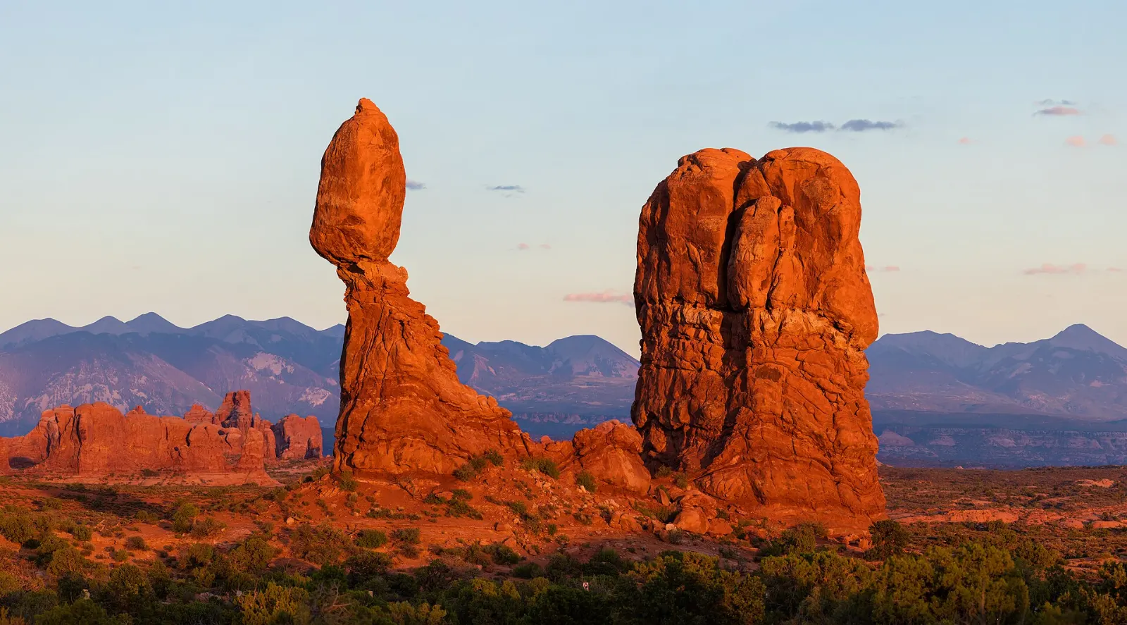
One of the park's most recognizable formations, Balanced Rock is a huge boulder perched on an eroding pedestal of softer stone, standing right beside the main road. A short, easy loop trail circles its base.
The Windows Section
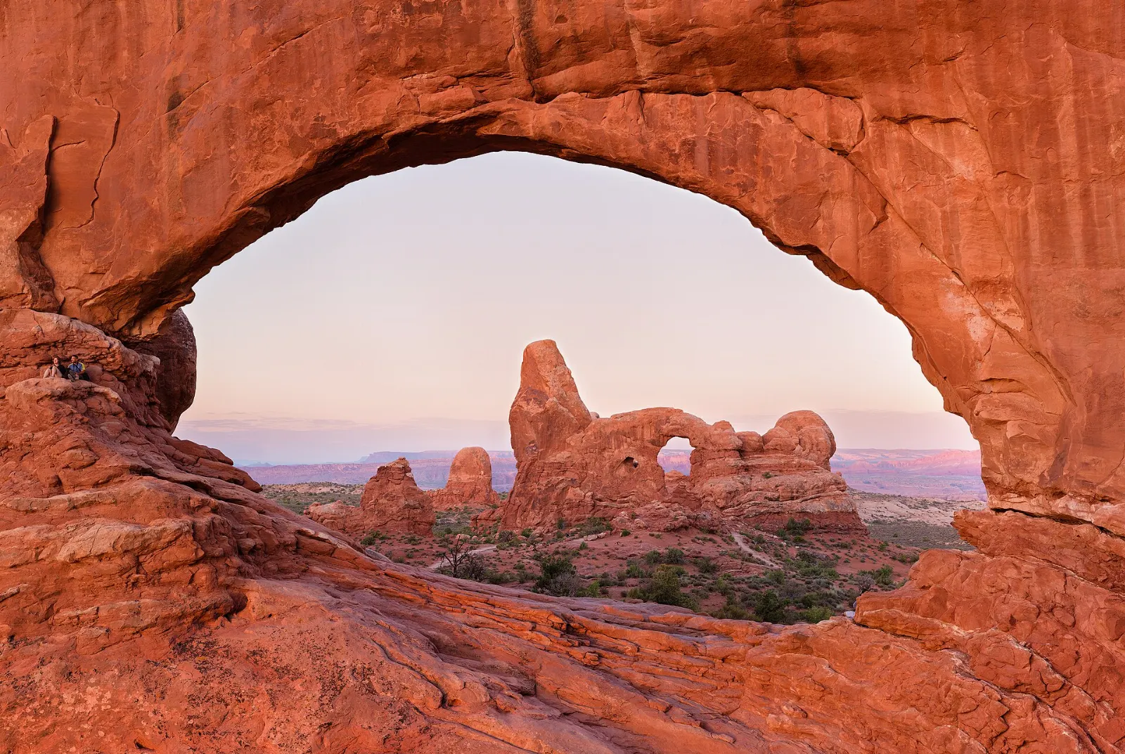
A short spur road leads to the Windows Section, one of the best places in the park to see several big arches with little effort.
Double Arch
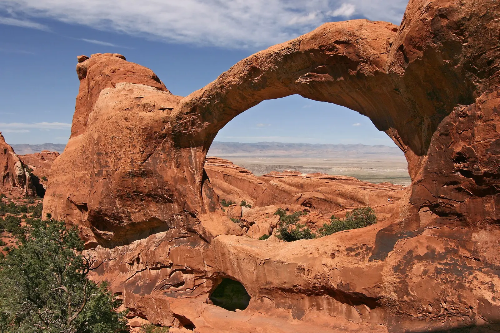
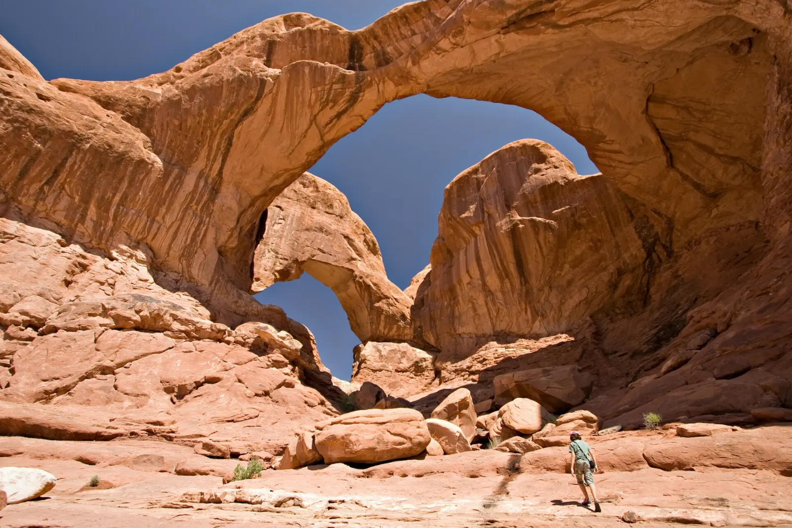
From the same parking area, a flat walk of under half a mile each way leads to Double Arch, two great spans springing from a common base. You can walk right underneath and look up at the vaulted openings.
Delicate Arch, the Fiery Furnace and Devils Garden
Wolfe Ranch and the petroglyph panel
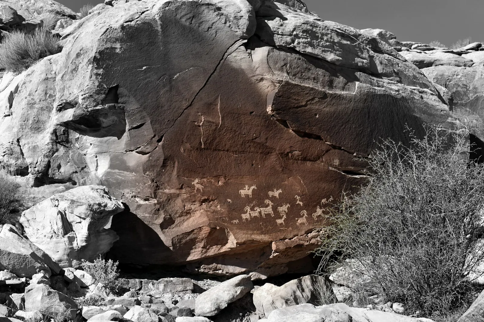
The trail to Delicate Arch begins at Wolfe Ranch, where a weathered log cabin recalls the homestead of John Wesley Wolfe, who settled here in the late 1800s. Just past the start, a short side path leads to a rock art panel showing horseback riders and bighorn sheep, attributed to Ute artists.
Delicate Arch
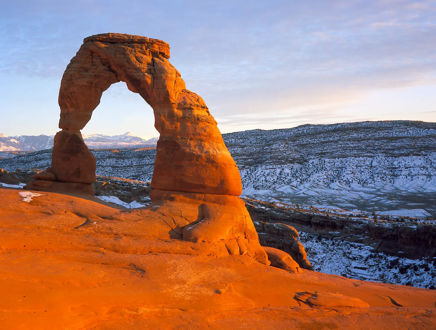
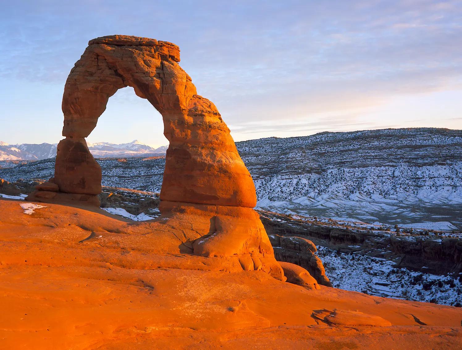
The park's signature arch stands alone at the edge of a sandstone bowl, framing the distant La Sal Mountains.
The Fiery Furnace
This maze of narrow canyons and towering fins is one of the most fascinating places in the park and one of the easiest to get lost in. There are no marked trails, so you must either join a ranger-led hike or obtain a self-guided permit, which involves watching an orientation video.
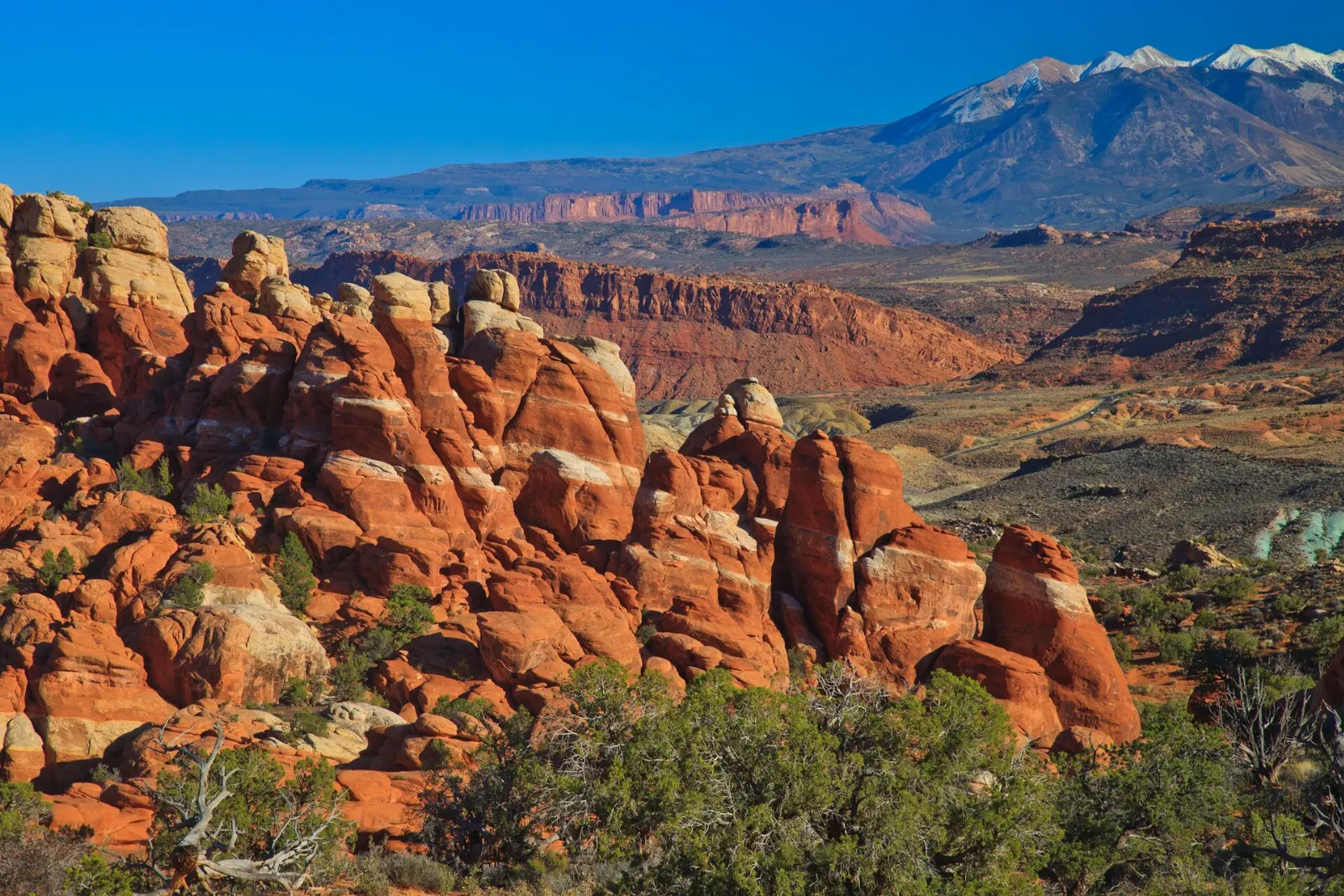
Sand Dune Arch and Skyline Arch
Two short walks sit near the road on the way to Devils Garden. Sand Dune Arch hides in a cool slot between fins with soft sand underfoot, a favorite with children, while Skyline Arch is visible from the road and reached by a brief trail.
Landscape Arch
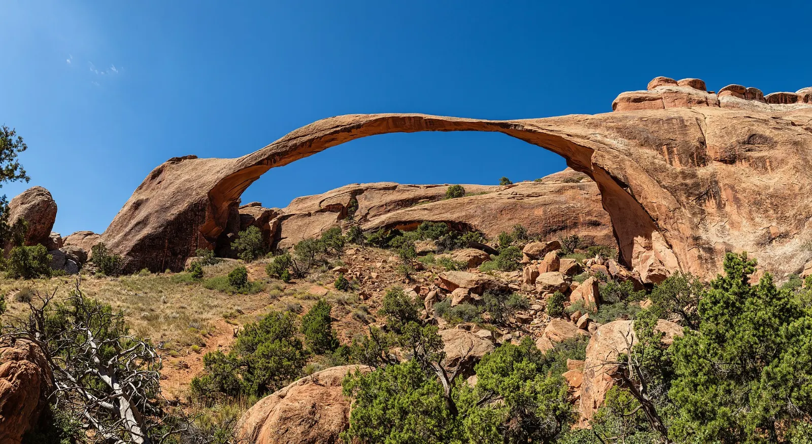
The scenic drive ends at Devils Garden, about eighteen miles from the entrance, where the park's longest trail system begins. An easy, mostly flat walk of under a mile each way leads to Landscape Arch, a remarkably thin ribbon of stone spanning about 290 feet, the longest arch in the park.
Double O Arch and the Primitive Loop
Beyond Landscape Arch the trail grows rougher, climbing onto sandstone fins with steep, exposed sections. It continues past Partition Arch and Navajo Arch to Double O Arch, where a large opening sits directly above a smaller one, roughly four miles round trip from the trailhead.
Klondike Bluffs and Tower Arch
For solitude, the remote northwest corner of the park is reached by an unpaved road that can be rough or impassable after rain. A trail climbs over sandstone ridges and through sand to Tower Arch, set among tall spires, passing the formation known as the Marching Men.
 Planning a trip to Arches National Park?Compare hotels, flights and vacation rentals for Arches National Park on Expedia.Book now
Beyond the park: Moab's other viewpoints
Dead Horse Point State Park
About forty minutes from Moab, this narrow mesa ends in an overlook about two thousand feet above a sweeping gooseneck of the Colorado River, one of the most photographed views in Utah.
Canyonlands National Park, Island in the Sky
Next door, the Island in the Sky district of Canyonlands sits on a high mesa above layered canyons carved by the Colorado and Green rivers.
The Colorado River Scenic Byway
Utah State Route 128 follows the Colorado River northeast from Moab through a deep red-rock canyon, with riverside picnic spots, trailheads and views of the Fisher Towers. Allow two to three hours for a scenic drive.
Food and local flavors
There is no food service inside Arches, so pack a picnic and plenty of water each day. Water bottle filling is available at the visitor center and near the Devils Garden trailhead.
Southwestern flavors show up across local menus, from green chile and smothered burritos to Navajo-style frybread.
Popular dishes to try in Arches National Park


Where to stay
Downtown Moab puts you within walking distance of restaurants and shops and about ten minutes from the park entrance.
North Moab along US Route 191 has many chain hotels closest to the park entrance, a practical choice for early starts.
Devils Garden Campground, the only campground inside the park, sits among fins at the end of the scenic drive.
Castle Valley and the La Sal foothills offer rentals and cooler nights farther from town, best for longer stays with a car.
Where to stay in Arches National Park


Best time to visit
Spring, from April through May, and fall, from mid-September through October, bring warm days and cool nights that are ideal for hiking, along with the biggest crowds.
Winter is the quiet season.
Getting there and getting around
The park entrance is on US Route 191, about five miles north of downtown Moab. Moab's small regional airport has limited commercial service, so most visitors fly into Grand Junction, Colorado, about two hours away by road, or Salt Lake City, about four hours away.
A car is the usual way to explore, with a paved scenic road running from the visitor center to Devils Garden and short spurs to the Windows and Delicate Arch.
A suggested itinerary
First day
Enter early and drive to Devils Garden for the hike to Landscape Arch, continuing to Double O Arch if you are comfortable on exposed rock.
Second day
Hike to Delicate Arch at sunrise, visiting the petroglyph panel and Wolfe Ranch on the way.
Third day
Watch sunrise at Dead Horse Point or Mesa Arch, then explore Canyonlands' Island in the Sky, including Grand View Point.
Practical tips
- Check the National Park Service website for any timed-entry reservation requirement, fees and current trail conditions before you go.
- Carry at least a gallon of water per person per day in warm weather, plus salty snacks.
- Start hikes at sunrise to beat heat, crowds and full parking lots.
- Stay on trails, slickrock or sandy washes to protect fragile biological soil crust.
- Do not climb on arches; it is prohibited and dangerous.
- Reserve Fiery Furnace tours or permits and Devils Garden campsites as early as possible.
Find local businesses in Moab on WiserMap
Moab is the gateway town for Arches National Park.