This guide covers the places most worth your time, from the twin districts of Saguaro National Park to the white mission south of town, along with where to eat Sonoran food, where to stay, how to time your trip around the heat and the monsoon, and a three-day plan you can adapt.
At a glance Tucson
Best timeOctober through April for mild days; late spring for saguaro blooms.
How longThree to four days covers the city, both park districts and Mount Lemmon.
Getting thereFly into Tucson International or drive about two hours from Phoenix on I-10.
Ad
Why visit Tucson
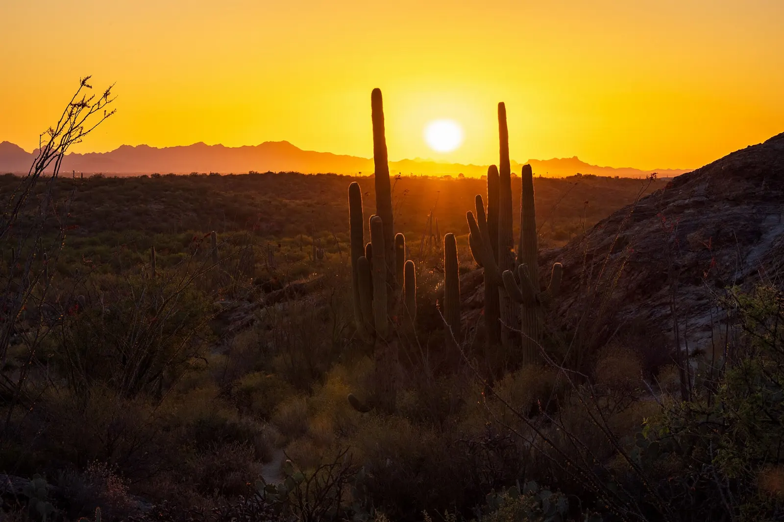
Few American cities sit this close to wild desert. Tucson is wrapped by the Sonoran Desert, the only place in the world where the saguaro cactus grows naturally, and the city has protected huge pieces of it.
The human story runs just as deep. The Hohokam farmed this valley for centuries, and their descendants among the Tohono O'odham still live here. Spanish missionaries arrived in the late 1600s, a Spanish presidio was founded in 1775, and the town belonged to Mexico until the Gadsden Purchase made it part of the United States in 1853.
Tucson also eats well. In 2015 it became the first city in the United States named a UNESCO City of Gastronomy, recognition of a food culture built on Sonoran ranching, desert harvests and family kitchens that have been cooking the same dishes for generations.
Saguaro country and the desert west
Saguaro National Park, Rincon Mountain District
The eastern district is the larger and older half of the park, rising from desert flats into the forested Rincon Mountains. Most visitors start at the visitor center and then drive Cactus Forest Loop Drive, a paved one-way loop through an old, dense saguaro stand with pullouts, picnic areas and short trails.
Cactus Forest Loop Drive is a paved scenic loop in the Rincon Mountain District, east of the city. Photo: tippeni, Wikimedia Commons, CC BY 2.0
Saguaro National Park, Tucson Mountain District
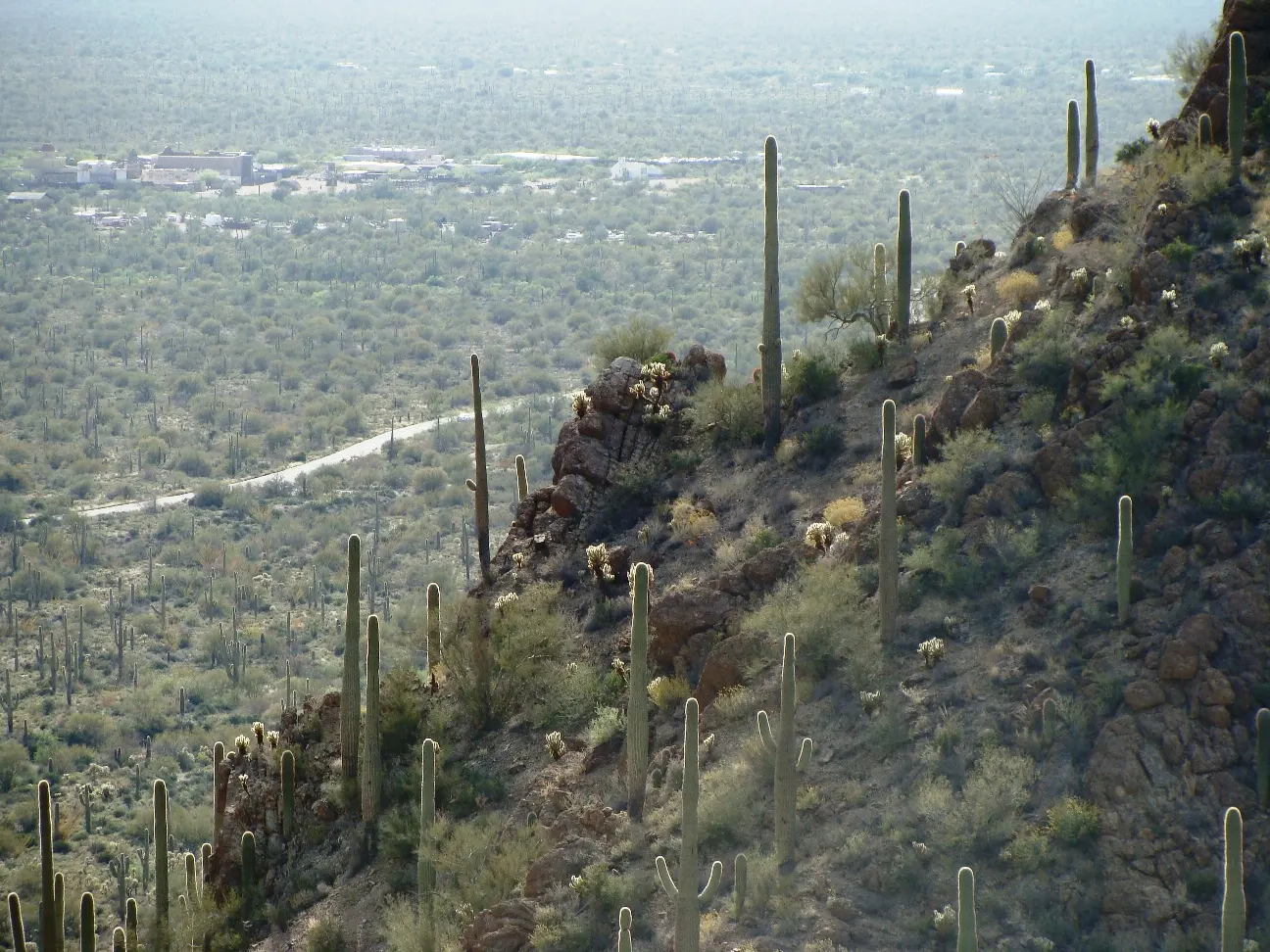
West of the city, the Tucson Mountain District has the denser, younger-looking cactus forests that appear on postcards. Stop at the Red Hills Visitor Center for maps and its wide view, then follow the unpaved Bajada Loop Drive, which is usually fine for ordinary cars in dry weather.
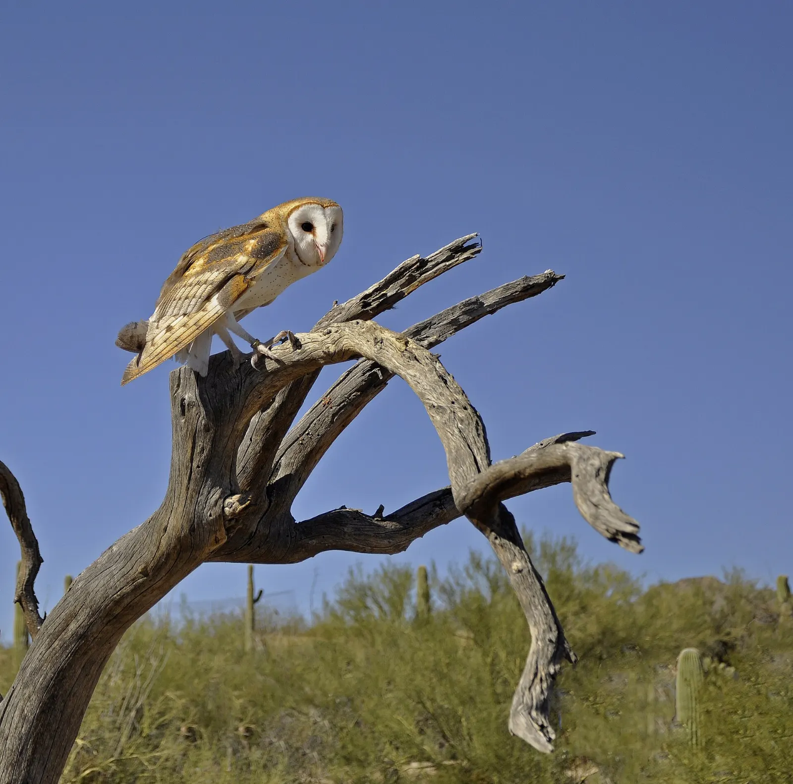
Despite the name, this is mostly an outdoor experience: about two miles of paths wind past mountain lions, coyotes, javelinas, Mexican wolves, a walk-in hummingbird aviary, a cactus garden and a cave exhibit on regional geology.
The Arizona-Sonora Desert Museum combines a zoo, botanical garden and natural history displays, mostly outdoors. Photo: P. Hughes, Wikimedia Commons, CC BY-SA 4.0
Tucson Mountain Park and Gates Pass
Adjoining the national park, this county park has an excellent trail network through healthy saguaro stands and some of the best sunset views in the region. The Gates Pass overlook, on the winding road between the city and the west side, fills with locals in the evening as the sun drops behind the Avra Valley.
Gates Pass crosses the Tucson Mountains and is a favorite local spot for sunset. Photo: Zereshk, Wikimedia Commons, CC BY-SA 3.0
Ad
Canyons and sky islands north of town
Sabino Canyon Recreation Area
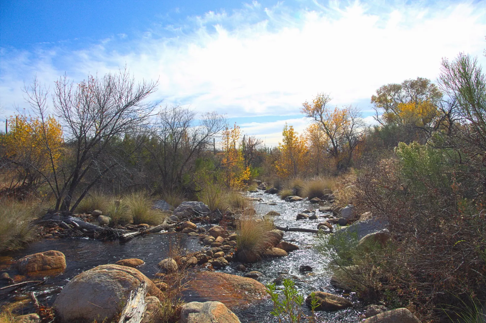
Sabino Canyon slices into the Santa Catalina Mountains at the city's northeast edge, and after winter rains or the summer monsoon its creek runs with pools and small falls. Cars are not allowed on the canyon road, so you can walk, bike at permitted times or ride the narrated shuttle tram that climbs into the upper canyon. Hikers often ride up and walk back down on the road or the Phoneline Trail, which traces the canyon wall high above the creek.
Sabino Canyon cuts into the Santa Catalina Mountains in the Coronado National Forest north of Tucson. Photo: Knaupter, Wikimedia Commons, CC BY-SA 2.0
Mount Lemmon and the Catalina Highway
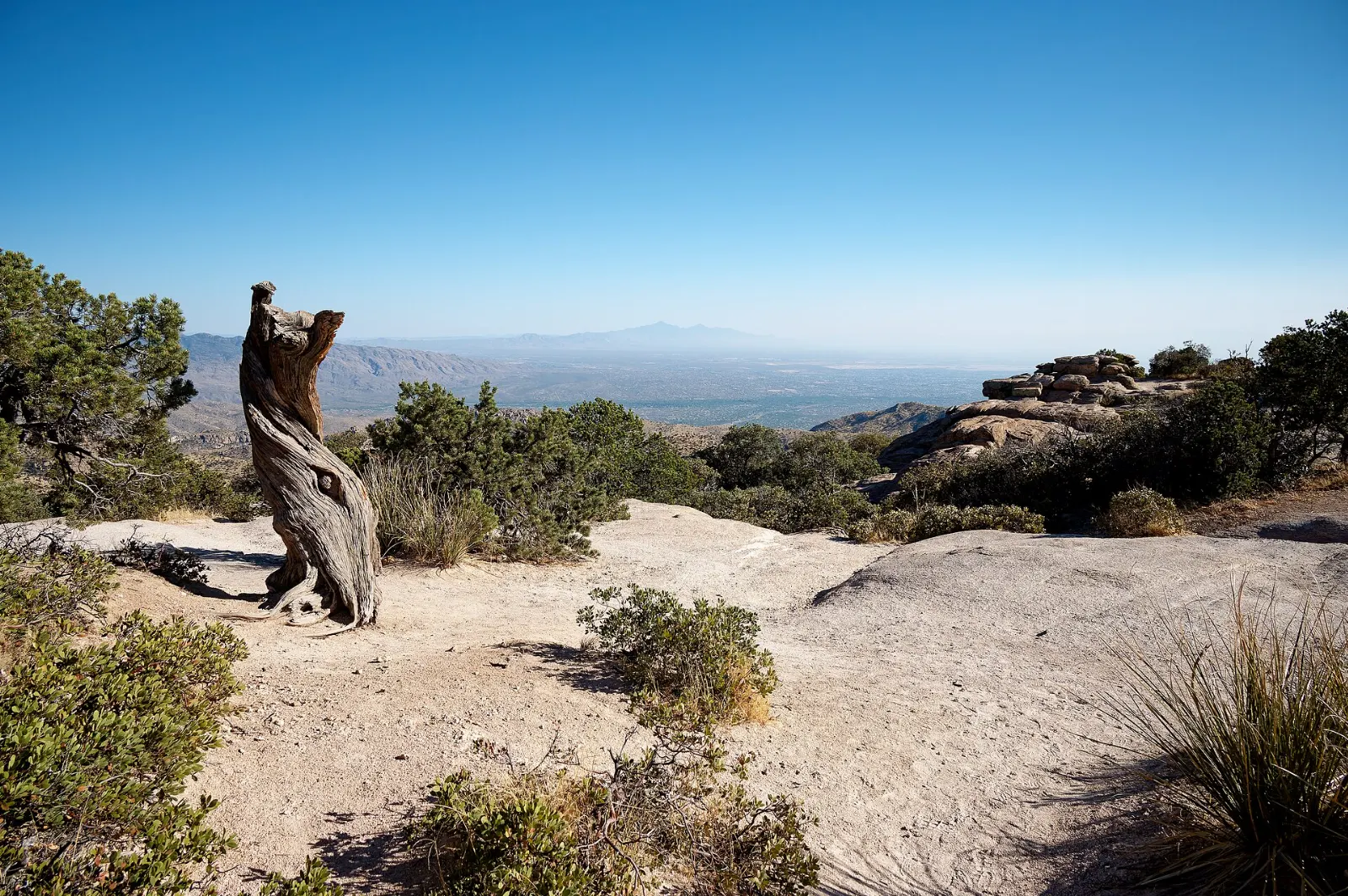
At 9,171 feet, Mount Lemmon is the highest point in the Santa Catalinas, and the drive up the Catalina Highway is one of the great scenic roads in the Southwest. You climb through saguaro desert, oak woodland and finally ponderosa pine and fir, passing through life zones that would otherwise take a drive from Mexico to Canada. Windy Point Vista, with its weathered granite towers, is the most popular stop on the way.
Windy Point Vista is one of the main pullouts on the Catalina Highway up Mount Lemmon. Photo: Laurens R. Krol, Wikimedia Commons, CC BY 4.0
Missions, barrios and museums
Mission San Xavier del Bac
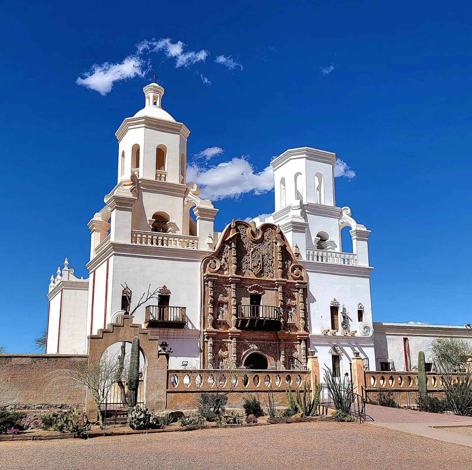
About ten miles south of downtown on the San Xavier District of the Tohono O'odham Nation, this mission was founded by the Jesuit missionary Eusebio Kino in the late 1600s, and the present church was completed in 1797. Its gleaming white walls earned it the nickname White Dove of the Desert, and the interior is filled with painted statues, murals and carved decoration that have been carefully restored.
Mission San Xavier del Bac, completed in 1797, stands on the San Xavier District of the Tohono O'odham Nation. Photo: Cullen328, Wikimedia Commons, CC BY-SA 4.0
Barrio Viejo and El Tiradito
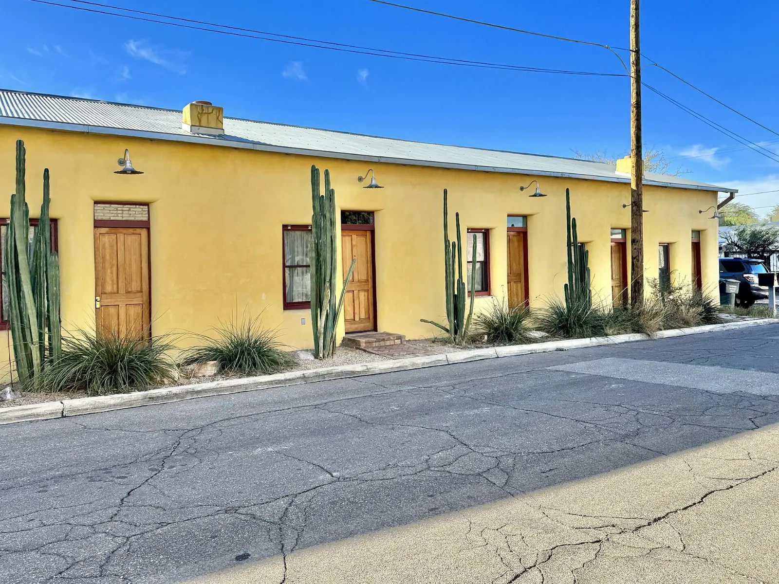
Just south of downtown, Barrio Viejo preserves rows of nineteenth-century adobe houses painted in turquoise, ochre and rose. Much of the original neighborhood was cleared for the convention center in the 1960s, which makes the surviving streets all the more valued.
Barrio Viejo is one of Tucson's oldest neighborhoods, known for its colorful adobe facades. Photo: w_lemay, Wikimedia Commons, CC BY-SA 2.0
El Presidio, downtown and Fourth Avenue
The downtown core grew up around the Spanish presidio, and a reconstructed corner of the fort now stands near the Tucson Museum of Art, whose campus includes several historic adobe houses and strong collections of Latin American and Western art. A few blocks away, Congress Street is lined with restored theaters and the historic Hotel Congress, where members of John Dillinger's gang were captured in 1934.
Pima Air and Space Museum
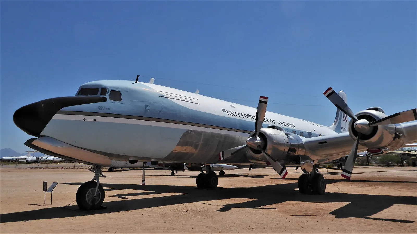
One of the largest aerospace museums in the world displays hundreds of aircraft across several hangars and a large outdoor field, from early propeller planes to bombers, presidential aircraft and spy planes. Volunteers, many of them veterans, are often on hand to share stories. Allow three to four hours, longer for aviation fans.
The Pima Air and Space Museum displays hundreds of aircraft outdoors and in hangars. Photo: Scotwriter21, Wikimedia Commons, CC BY-SA 4.0
Ad
Food and local flavors
Tucson's cooking is rooted in Sonora, the Mexican state just across the border, and it tastes different from the Tex-Mex you may know.
The signature street food is the Sonoran hot dog: a bacon-wrapped hot dog tucked into a soft bolillo roll and piled with pinto beans, onions, tomatoes, mayonnaise, mustard and jalapeño salsa.
For browsing, head to the Mercado San Agustín area west of downtown, where shops, cafes and a weekly farmers market gather near the streetcar's western end.
Popular dishes to try in Tucson
Sonoran hot dog The signature street food is the Sonoran hot dog: a bacon-wrapped hot dog tucked into a soft bolillo roll and piled with pinto beans, onions, tomatoes, mayonnaise, mustard and…Photo: https://www.flickr.com/photos/accidentalhedonist/, Wikimedia Commons, CC BY 2.0Chimichanga The chimichanga, a deep-fried burrito, has a strong claim to having been invented here.Photo: Corn cheese, Wikimedia Commons, CC BY-SA 4.0Carne seca Look for carne seca, beef that is dried in the sun and then shredded and cooked with chiles, along with flour tortillas made thin and large, cheese crisps, red chile stews and…Photo: Maria Hsu, Wikimedia Commons, CC BY 2.0Prickly pear Desert ingredients also show up on menus around town, including mesquite flour, prickly pear fruit, cholla buds and tepary beans, a drought-tolerant bean long grown by the…Photo: Tomás Castelazo, Wikimedia Commons, CC BY-SA 2.5
Where to stay
Downtown and the Mercado district suit travelers who want to walk to restaurants, bars and live music and use the streetcar.
The University and Fourth Avenue area is lively and central, with older motels and guesthouses close to campus museums.
The Catalina Foothills on the north side hold most of the city's resorts, with spa-style stays, golf and mountain views.
The west side near the Tucson Mountains has ranch-style properties and guest ranches with dark skies and easy access to the western park district and the desert museum.
Where to stay in Tucson
Mercado Where to stayDowntown and the Mercado district suit travelers who want to walk to restaurants, bars and live music and use the streetcar.Photo: H. Zell, Wikimedia Commons, CC BY-SA 3.0Fourth Avenue The University and Fourth Avenue area is lively and central, with older motels and guesthouses close to campus museums.Photo: InSapphoWeTrust from Los Angeles, California, USA, Wikimedia Commons, CC BY-SA 2.0Sabino Canyon It suits couples and anyone who wants a quiet base close to Sabino Canyon and Mount Lemmon, though you will need a car.Photo: Vagabondah, Wikimedia Commons, CC BY-SA 4.0Mount Lemmon It suits couples and anyone who wants a quiet base close to Sabino Canyon and Mount Lemmon, though you will need a car.Photo: Laurens R. Krol, Wikimedia Commons, CC BY 4.0
Wood and Stone AZ is a remodeling business serving the Arizona area. Wood & Stone AZ provides remodeling services to transform houses into dream homes.
NOS is a computer sales, service, and repair business serving Tucson and Marana. NOS offers PC/MAC servicing, virus removal, custom builds, diagnostics, and on-...
Datadrive is a full-service Tucson computer repair facility offering fast, affordable repairs, data recovery, virus removal, and IT support for home and busines...
R S Herder Corporation is a waterproofing and specialty coating contractor serving Tucson, AZ, providing solutions for balconies, roof decks, walk decks, and hi...
Zona Dry Restoration LLC is a building restoration business serving Tucson, Phoenix, and surrounding areas, specializing in mold remediation, water damage resto...
ATI Restoration is a restoration business serving Henderson, NV. ATI Restoration provides water damage restoration, fire & smoke damage restoration, and mold re...
October through April is peak season, with sunny days, cool nights and comfortable hiking. Winter highs are usually mild, though a few nights each year dip below freezing and snow sometimes dusts Mount Lemmon.
Summer is hot, with highs that regularly approach or exceed one hundred degrees Fahrenheit. The monsoon season officially runs from mid-June through September, bringing humidity and dramatic afternoon thunderstorms that can cause flash flooding in washes and on low streets.
Getting there and getting around
Tucson International Airport, on the south side of the city, has nonstop flights from many US cities. Phoenix Sky Harbor is about two hours away on Interstate 10, and Amtrak's Sunset Limited stops downtown a few days a week.
A car is close to essential for the parks, the mission and Mount Lemmon.
Ad
A suggested itinerary
First day
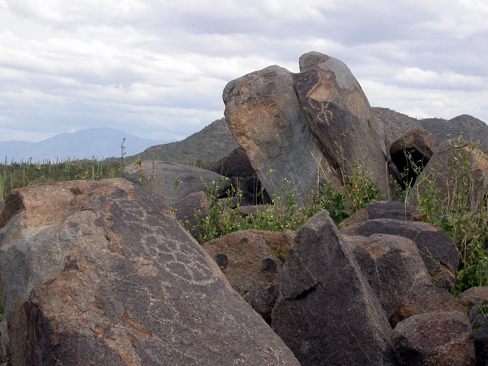
Start early at the Arizona-Sonora Desert Museum, then drive into the Tucson Mountain District of Saguaro National Park for the Red Hills Visitor Center, the Bajada Loop Drive and Signal Hill's petroglyphs.
Second day
Visit Mission San Xavier del Bac in the morning light, then return to town to walk Barrio Viejo, El Tiradito and the El Presidio blocks around the Tucson Museum of Art.
Third day
Hike Sabino Canyon early, then drive the Catalina Highway up Mount Lemmon, stopping at Windy Point Vista on the way.
Practical tips
Carry more water than you think you need on any hike, and turn around early if you run low. Heat illness is a real risk from spring through fall.
Wear closed shoes and watch where you put your hands; cholla spines detach easily and rattlesnakes are active in warm months.
Use strong sun protection all year, including a hat and sunglasses, since the desert sun is intense even in winter.
Book rooms well ahead for the gem show weeks in late winter and for big university events.
Respect Mission San Xavier as a working church on tribal land, and ask before photographing people.
Check flash flood warnings during the monsoon and never cross running water in a wash or on a road.
Ad
Find local businesses in Tucson on WiserMap
Looking for a Sonoran kitchen, a gear shop before your hike or a reliable service while you are in town?