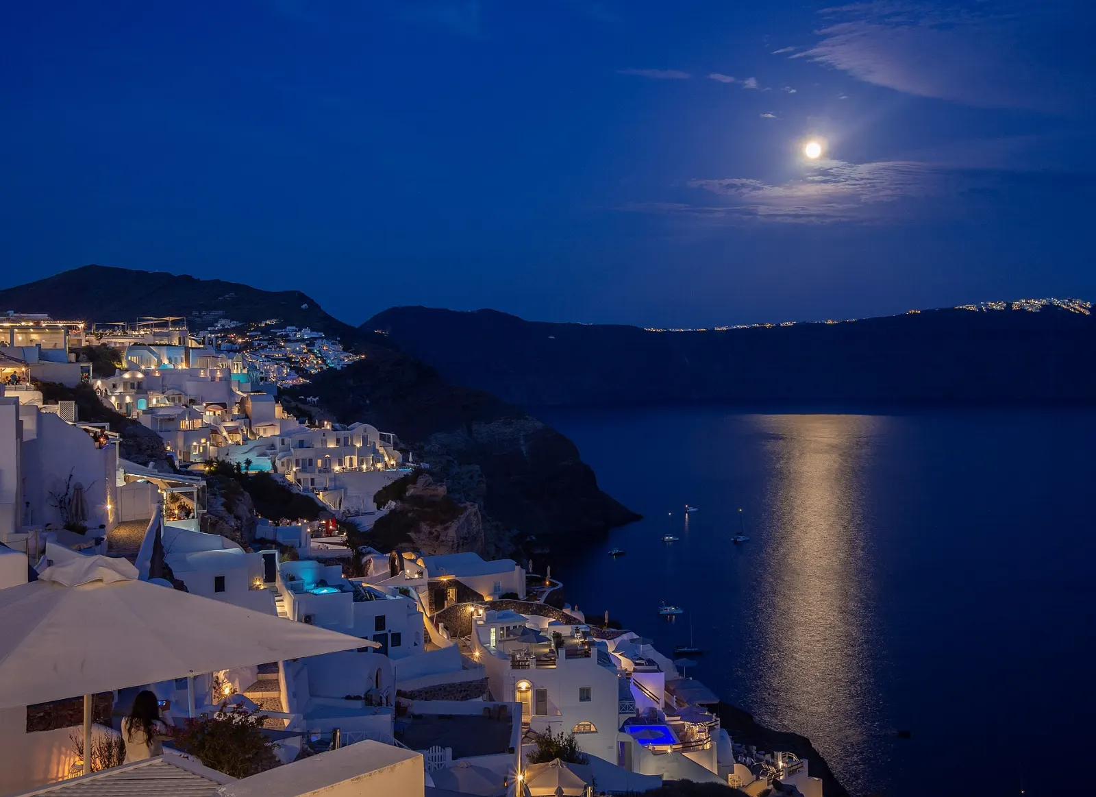
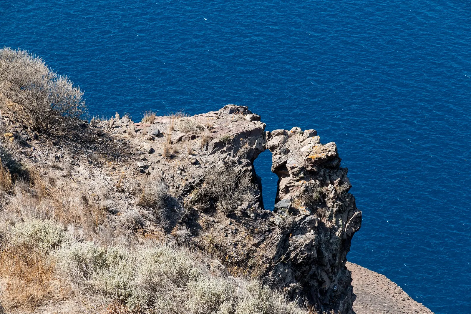
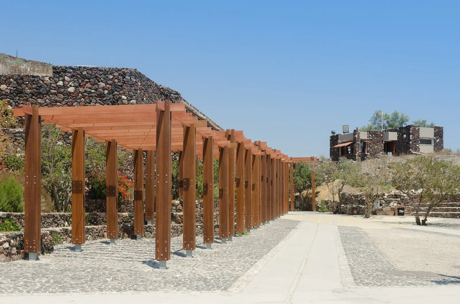
This guide covers the villages, ancient sites, beaches and boat trips worth your time, plus what to eat and drink, where to base yourself and how to plan around the crowds that arrive each summer.
At a glance Santorini
Best timeApril to June and September to October for mild weather and thinner crowds.
How longThree to four days lets you see the caldera, the south and the volcano.
Getting thereShort flights from Athens or ferries from Piraeus to the port of Athinios.
Ad
Why visit Santorini
The setting is unlike anywhere else in the Mediterranean. From the caldera rim you look straight down cliffs banded in black, red and cream volcanic rock to deep blue water, with the islands of Nea Kameni, Palea Kameni and Thirasia scattered across the bay.
The island's history is just as layered. The eruption buried a thriving Bronze Age town at Akrotiri so completely that its streets, houses and painted walls survived, earning comparisons with Pompeii.
Then there is the food and wine. Santorini's dry volcanic soil produces small, intensely flavored tomatoes, yellow split peas and capers, and vines trained low into basket shapes to shelter the grapes from wind.
The caldera villages and the rim trail
Oia
Oia stretches along the narrow northern tip of the island, a maze of marble lanes, cave houses, blue-domed churches and old windmills. The main pedestrian street is lined with galleries and shops, but the real draw is the view in every direction.
Ammoudi Bay
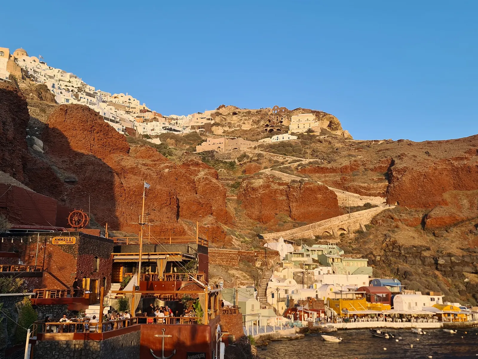
Below Oia, a long stairway of about three hundred steps zigzags down to Ammoudi Bay, a tiny harbor of fishing boats and seafood tavernas set against red cliffs. Swimmers follow a rough path around the headland to rocks where people jump into the deep water, and boats leave from nearby for Thirasia.
Ammoudi Bay is the small fishing harbor at the foot of the cliffs below Oia. Photo: Anthony Baratier, Wikimedia Commons, CC BY-SA 4.0
Fira
The island's capital and transport hub clings to the cliff above the old port. Its lanes are busy with shops, bars and restaurants, and its museums are the best on the island: the Museum of Prehistoric Thera displays wall paintings and finds from Akrotiri, while the Archaeological Museum covers later periods.
Fira, the island's main town, sits on the caldera rim high above its old port. Photo: Dietmar Rabich, Wikimedia Commons, CC BY-SA 4.0
Firostefani, Imerovigli and Skaros Rock
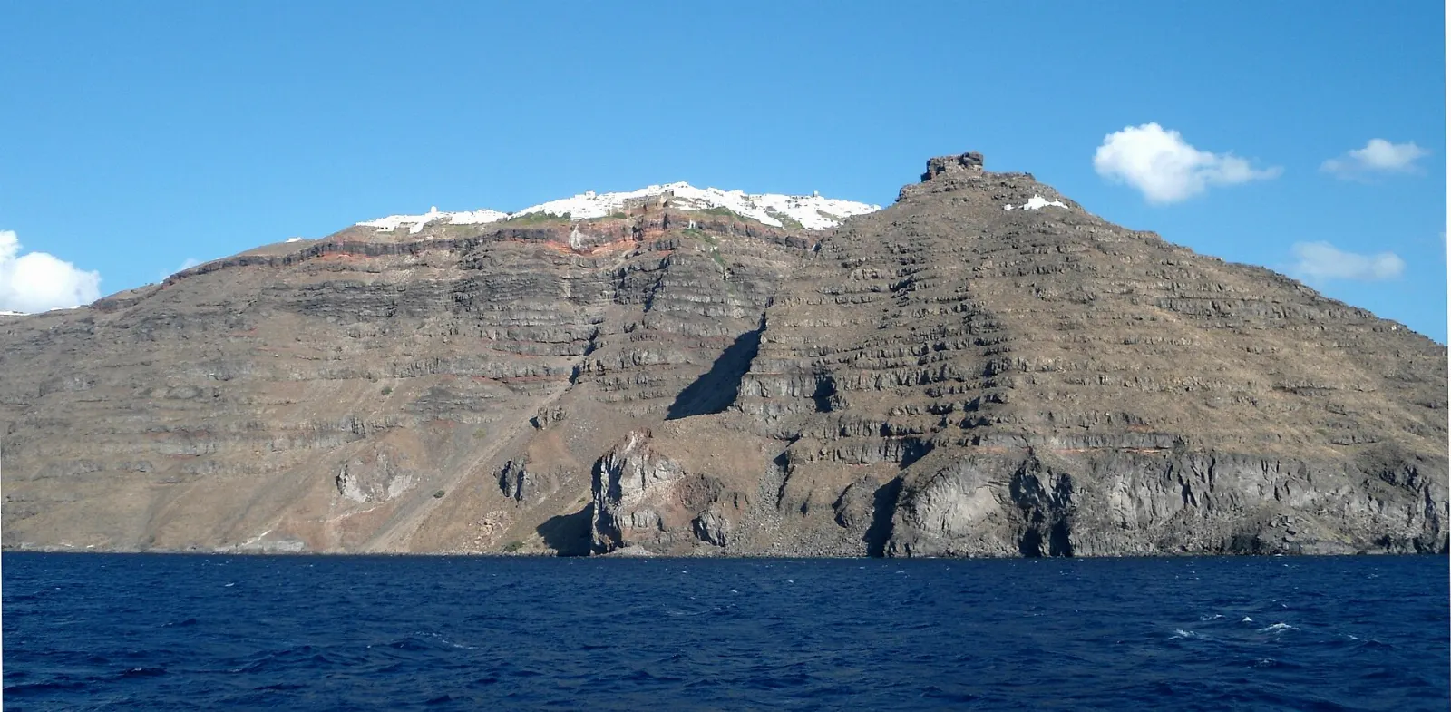
North of Fira the rim rises through Firostefani to Imerovigli, the highest of the caldera villages and one of the quietest. From Imerovigli a path descends to Skaros Rock, a headland that once held a fortified medieval town; little remains of the castle, but the walk out is dramatic and the views back along the cliffs are superb.
Skaros Rock once held a medieval castle and is now reached by a path from Imerovigli. Photo: Rebexho, Wikimedia Commons, CC BY-SA 3.0
The Fira to Oia hike
The trail along the caldera rim from Fira to Oia is the best walk on the island, about ten kilometers of paved paths, village lanes and rough volcanic tracks with constant views. Most people take three to five hours. Walking from Fira toward Oia keeps the best scenery ahead of you, and you can catch a bus back.
Ad
Ancient sites, inland villages and the south
Akrotiri archaeological site
Near the island's southwestern tip lies one of the most important sites in the Aegean. Akrotiri was a prosperous Bronze Age port town with multi-story buildings, drainage systems and vividly painted walls. It was abandoned before the great eruption and then buried under deep volcanic ash, which preserved it remarkably well.
Akrotiri was a Bronze Age town buried by the great eruption and is now protected under a roof. Photo: Norbert Nagel, Wikimedia Commons, CC BY-SA 3.0
Red Beach
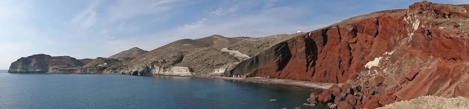
A short walk from the Akrotiri site, this beach sits beneath towering cliffs of rust-red volcanic rock, with dark sand and pebbles at their base. It is one of the most photographed spots on the island. Allow an hour or two.
Red Beach near Akrotiri takes its color from iron-rich volcanic rock. Photo: Bernard Gagnon, Wikimedia Commons, CC BY-SA 3.0
Pyrgos and Profitis Ilias
Pyrgos is an inland hill village that grew up around a Venetian castle, with narrow lanes, arched passageways and many small churches climbing to the top. It feels calmer than the caldera villages and has wide views across the island in all directions.
Pyrgos is an inland hill village built around the ruins of a Venetian castle. Photo: Dietmar Rabich, Wikimedia Commons, CC BY-SA 4.0
Ancient Thera
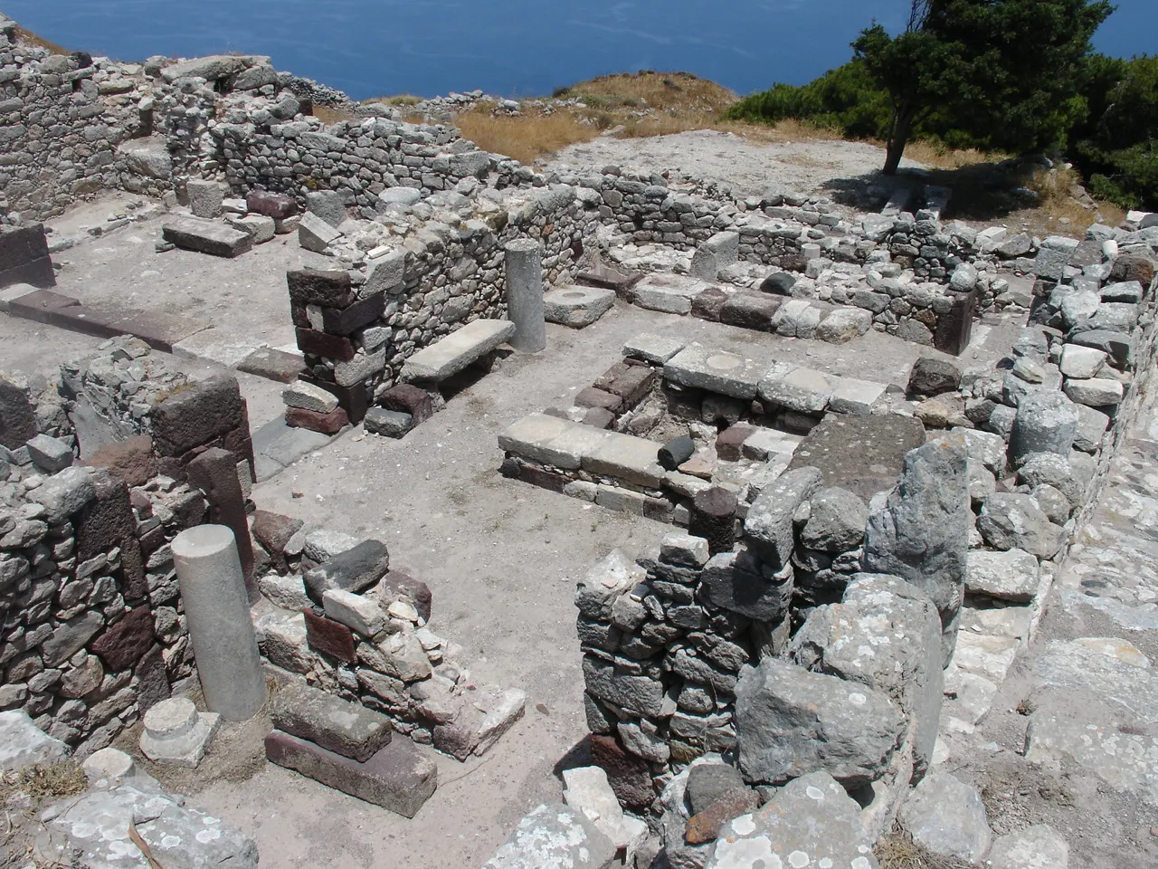
On the ridge of Mesa Vouno, high above Kamari and Perissa, lie the ruins of the ancient city of Thera, inhabited from around the ninth century BCE through Roman and early Byzantine times. You can walk its main street past the remains of an agora, a theater, temples and houses, with sweeping views of the sea on both sides.
The ruins of Ancient Thera spread along the ridge of Mesa Vouno above Kamari. Photo: Stan Zurek, Wikimedia Commons, CC BY-SA 3.0
Emporio, Megalochori and the black sand beaches
The village of Emporio has a well-preserved medieval castle quarter with tight lanes and few shops, while Megalochori is a pretty village of mansions, bell towers and wineries. On the southeast coast, Kamari and Perissa have long beaches of black volcanic sand and pebbles lined with cafes and sun loungers, separated by the great headland of Mesa Vouno.
Perissa's long black sand beach lies on the island's southeast coast below Mesa Vouno. Photo: Norbert Nagel, Wikimedia Commons, CC BY-SA 3.0
The volcano and Thirasia
Nea Kameni and Palea Kameni
The islands in the middle of the caldera are the volcano's most recent work, built by eruptions over the past two thousand years, the latest in 1950. Boat trips from the old port below Fira land you on Nea Kameni, where a marked trail climbs across black lava fields to a summit crater with small steaming vents and views of the entire caldera.
The second inhabited island of the group is a fragment of the old caldera wall, with a handful of villages and a slow, traditional feel. Boats connect it with Ammoudi Bay and Fira's old port, and many caldera cruises stop at its small harbor for lunch.
Ad
Food and local flavors
Start with fava, a smooth puree of the island's yellow split peas served with olive oil, onion and capers.
Wine is the island's great product.
For good-value meals, look beyond the busiest caldera terraces to the inland villages and the beach towns of Kamari and Perissa, where family tavernas serve grilled fish, souvlaki and seasonal vegetables.
Popular dishes to try in Santorini
Fava Food and local flavorsStart with fava, a smooth puree of the island's yellow split peas served with olive oil, onion and capers.Photo: HaJunkiyada, Wikimedia Commons, CC BY-SA 4.0Tomatokeftedes Tomatokeftedes are fritters made with Santorini's small cherry tomatoes, and you will also find white eggplant, chloro, a soft fresh goat cheese, and dishes flavored with local…Photo: Sam Holt, Wikimedia Commons, CC BY-SA 4.0Assyrtiko Vines here are often woven into low basket shapes called kouloura that protect the grapes from wind, and the dry Assyrtiko whites are crisp, mineral and ideal with seafood.Photo: AkatsukiKuro, Wikimedia Commons, CC0
Where to stay
Fira is the most practical base, with the bus hub, the widest choice of restaurants and the busiest nightlife.
Firostefani and Imerovigli offer caldera views with more calm, a short walk from Fira.
Oia has the most famous views and many cave-house hotels.
Kamari and Perissa are beach towns with more affordable rooms and easy swimming.
Pyrgos and Megalochori are traditional inland villages close to the wineries, good for travelers with a car who want character and quiet.
Where to stay in Santorini
Imerovigli Firostefani and Imerovigli offer caldera views with more calm, a short walk from Fira.Photo: Bernard Gagnon, Wikimedia Commons, CC BY-SA 3.0Fira Where to stayFira is the most practical base, with the bus hub, the widest choice of restaurants and the busiest nightlife.Photo: Norbert Nagel, Wikimedia Commons, CC BY-SA 3.0Perissa Kamari and Perissa are beach towns with more affordable rooms and easy swimming.Photo: Norbert Nagel, Wikimedia Commons, CC BY-SA 3.0Megalochori Pyrgos and Megalochori are traditional inland villages close to the wineries, good for travelers with a car who want character and quiet.Photo: Norbert Nagel, Wikimedia Commons, CC BY-SA 3.0
Ad
Best time to visit
The season runs roughly from around Easter to the end of October.
From November to March many hotels and restaurants close, especially outside Fira, and the weather is cooler and wetter, but it can be a peaceful time to walk and see the island as residents do.
Getting there and getting around
Santorini's airport, near Kamari on the east coast, has frequent flights from Athens taking under an hour, plus seasonal direct flights from many European cities.
The public KTEL bus network is cheap and runs out of Fira to Oia, Kamari, Perissa, Akrotiri, the airport and the port, with frequent service in summer; you usually need to change in Fira to cross the island. Taxis are limited, so book ahead for early flights and ferries.
Ad
A suggested itinerary
First day
Explore Fira in the morning, visiting the Museum of Prehistoric Thera, then walk the rim north through Firostefani to Imerovigli and out to Skaros Rock.
Second day
Start early on the trail from Imerovigli to Oia, arriving before the crowds.
Third day
Head south to the Akrotiri archaeological site and the Red Beach viewpoint, then visit a winery near Megalochori for a tasting.
Fourth day
Take a boat trip to Nea Kameni and the hot springs of Palea Kameni, then spend the afternoon on the black sand at Perissa or Kamari, or climb to Ancient Thera if you have energy left.
Practical tips
Book accommodation and ferries well ahead for June through September, especially caldera-view rooms.
Pack comfortable shoes with grip; marble lanes are slippery and many paths involve long stairways.
Carry water, a hat and strong sunscreen, since shade is scarce and the summer sun is fierce.
Check cruise ship schedules and plan Fira and Oia visits for early morning or evening on heavy days.
Respect private terraces and rooftops; many photogenic spots belong to homes and hotels.
Keep some cash for buses, small tavernas and boat tickets, though cards are widely accepted.