WiserMap — Choose wisely. Connect locally.Choose wisely. Connect locally.Add your business
Medicine Hat, Alberta · Travel guide

Medicine Hat Alberta Saamis Tepee and Medalta Pottery

Medicine Hat sits on the South Saskatchewan River in the dry, sunny prairie of southeastern Alberta, and it has more to see than its small-city size suggests. Natural gas, clay and the railway built the town, and their legacy shows in pottery factories, old gas lamps and a giant tepee.

By WiserMap TravelUpdated October 2026 8 places8 min read
FacebookXLinkedIn
At a glance Medicine Hat
  1. Best timeSummer for river parks and Cypress Hills, with the sunniest days of the year.
  2. How longPlan one to two days in town, and a third for Cypress Hills or Dinosaur Provincial Park.
  3. Getting thereDrive the Trans-Canada Highway, or take a coach from Calgary or other prairie cities.

Why visit Medicine Hat

The name Medicine Hat is an English interpretation of Saamis, the Blackfoot word for the eagle tail feather headdress worn by medicine men.

It is also one of the sunniest places in Canada, with about 2,500 hours of sunshine each year. That makes it a pleasant stop for travellers on the Trans-Canada Highway who want to stretch their legs and find something distinctive.

Landmarks, culture and pottery

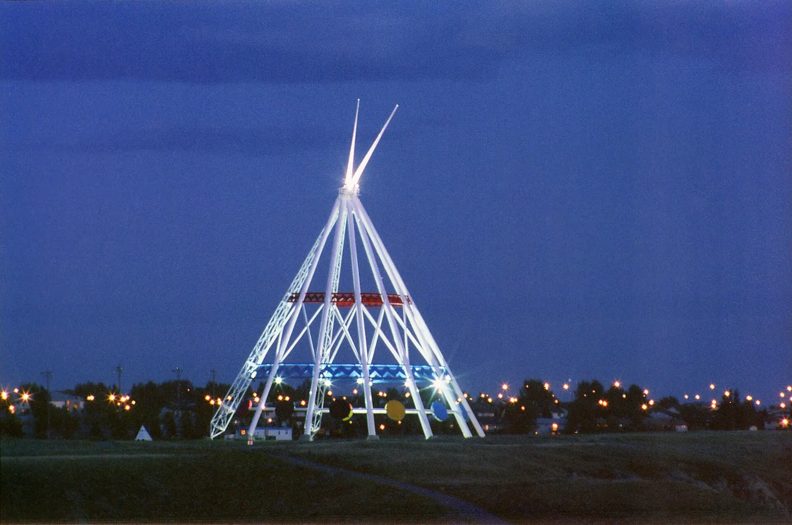
The Saamis Tepee rising above the Medicine Hat valley, Alberta

Saamis Tepee

Billed as the world's largest tepee, this structure was built for the 1988 Winter Olympics in Calgary. Its interior panels carry original First Nations artwork added by the city.

The Saamis Tepee was built for the 1988 Winter Olympics in Calgary. Photo: Ken Eckert, Wikimedia Commons, CC BY-SA 4.0
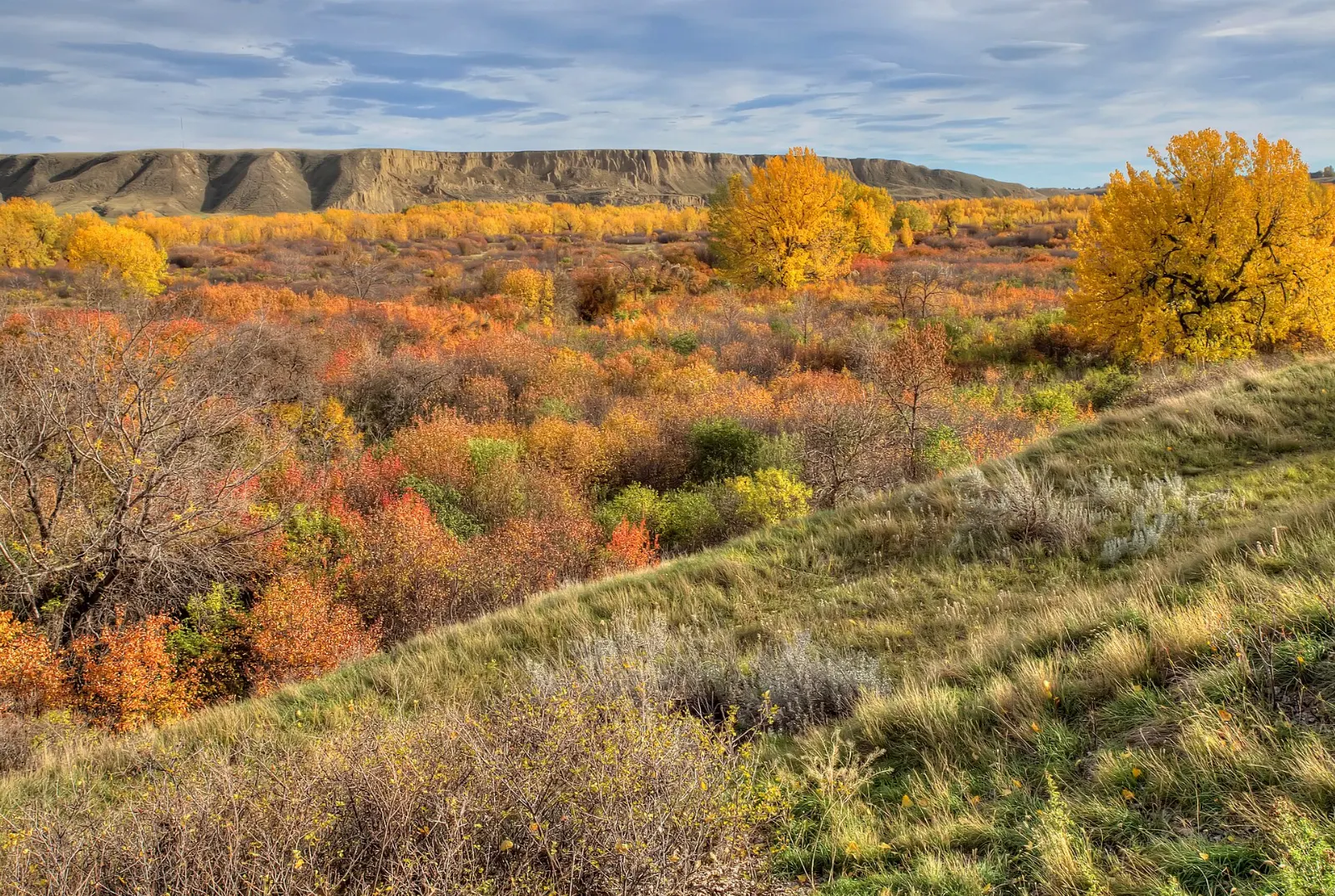
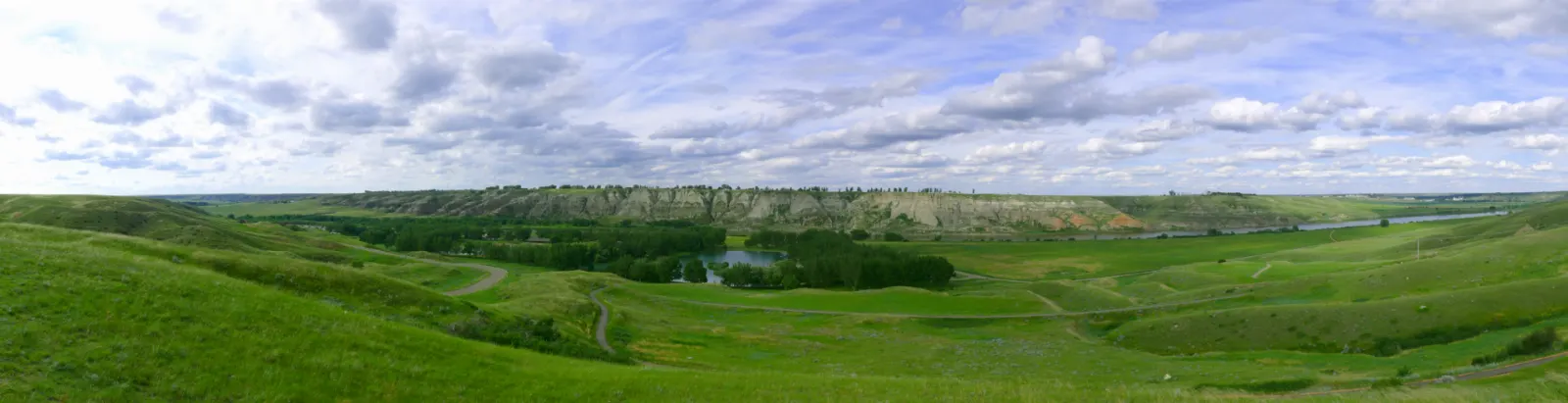
The Gothic Revival concrete St. Patrick's Church in Medicine Hat, Alberta

St. Patrick's Church

This Gothic Revival church is a heritage site and one of the largest continuously poured concrete structures in the world.

St. Patrick's Church is one of the largest continuously poured concrete structures in the world. Photo: The joy of all things, Wikimedia Commons, CC BY-SA 4.0

Brick kilns of the historic Medalta pottery district, Medicine Hat, Alberta

Medalta Potteries and the historic clay district

Medalta operated from 1916 to 1954 and was the first Western Canadian manufacturer to ship its products east of Ontario. The national historic district now holds thousands of ceramic pieces, guided tours and educational programs.

Medalta Potteries produced ceramics in Medicine Hat from 1916 to 1954. Photo: Jason Woodhead, Wikimedia Commons, CC BY 2.0

The Esplanade cultural centre in downtown Medicine Hat, Alberta

The Esplanade

This downtown cultural centre combines a theatre of more than 700 seats, an art gallery, a museum, archives and a cafe. It is a good wet-weather stop and a place to learn the region's history.

The Esplanade combines a theatre, art gallery, museum and archives. Photo: Unknown authorUnknown author, Wikimedia Commons, Public domain

Giant chess set and gas lamps

Near the Esplanade, a full-sized chess set invites anyone to play, with the king standing about 1.2 metres tall.

Railway depot and river memorial

The historic Canadian Pacific Railway depot is a National Historic Site, and Riverside Veterans' Memorial Park near City Hall holds a cenotaph, a Sherman tank and two railway locomotives.

River parks and trails

Walking paths beside the river in Police Point Park, Medicine Hat, Alberta

Police Point Park

The former North-West Mounted Police outpost covers about 300 acres with shale paths along the South Saskatchewan River.

Police Point Park is a well-known birding area beside the South Saskatchewan River. Photo: Bobbijogrunewald, Wikimedia Commons, CC BY-SA 4.0

Strathcona Island Park

On the south bank of the river, this park has about 5 kilometres of walking trails, playgrounds and a water park. It is a good choice for families on warm days.

The swimming lake and trees at Echodale Regional Park, Medicine Hat, Alberta

Echodale Regional Park

This park has a swimming lake, a beach, walking trails, canoe rentals and a historic ranch. The site includes a restored 1887 house, a blacksmith shop and a coal mine.

Echodale Regional Park has a swimming lake, trails and a restored 1887 house. Photo: Michael Ireland, Wikimedia Commons, CC BY-SA 3.0

Kin Coulee Park

Along Seven Persons Creek, this manicured park has a band shell, playgrounds, volleyball courts and fire pits. It is the main venue for the Canada Day festival and fireworks.

Day trips from Medicine Hat

Forested slopes and lake in Cypress Hills Interprovincial Park, Medicine Hat, Alberta

Cypress Hills Interprovincial Park

The hills rise about 200 metres above the prairie and reach 1,468 metres, the highest point in Canada between the Rockies and Labrador. The park straddles the Alberta and Saskatchewan border, and the Elkwater townsite is about 65 kilometres southwest of Medicine Hat on Highway 41.

Cypress Hills rises about 200 metres above the surrounding prairie. Photo: ZcarstvnzAuthor of original photo: Vonsulnasaga, Wikimedia Commons, CC BY-SA 4.0

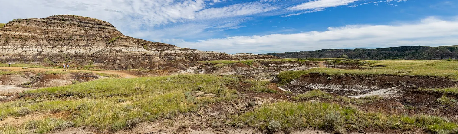
Eroded badlands in Dinosaur Provincial Park, Medicine Hat, Alberta

Dinosaur Provincial Park

About 125 kilometres northwest, this World Heritage Site is known for hiking and guided tours through fossil beds. Guided tours and hiking trails are available, so check what is offered when you plan.

Dinosaur Provincial Park is a World Heritage Site known for its fossil beds. Photo: Qwexcxewq, Wikimedia Commons, CC BY 4.0

Food and local flavors

Prairie cooking here is hearty. Alberta beef shows up as steaks and burgers at local restaurants and steakhouses. Perogies, the filled dumplings brought by Eastern European settlers, are common across the prairies, and saskatoon berry pie is a classic sweet made with a native berry.

Downtown, Sweet Regards on 3rd Street SE is the city's only candy store, with nostalgic sweets and unusual treats. The Medicine Hat Brewing Company offers tours that explain its brewing process and local history.

Popular dishes to try in Medicine Hat

Alberta beef in Medicine Hat
Alberta beef Alberta beef shows up as steaks and burgers at local restaurants and steakhouses.Photo: Mack Male from Edmonton, AB, Canada, Wikimedia Commons, CC BY-SA 2.0
Perogies in Medicine Hat, Alberta
Perogies Perogies, the filled dumplings brought by Eastern European settlers, are common across the prairies, and saskatoon berry pie is a classic sweet made with a native berry.Photo: Jen Arrr, Wikimedia Commons, CC BY-SA 2.0
Saskatoon berry pie in Medicine Hat, Alberta
Saskatoon berry pie Perogies, the filled dumplings brought by Eastern European settlers, are common across the prairies, and saskatoon berry pie is a classic sweet made with a native berry.Photo: Jonathan Schilling, Wikimedia Commons, CC BY-SA 4.0

Where to stay

There are no hotels in downtown Medicine Hat, so most visitors stay on the outskirts, a short drive from the centre.

Trans-Canada Way has several hotels and suits road-trippers who want easy access to the highway and the visitor information centre.

Ross Glen Drive offers larger lodgings with pools and amenities and suits families who want facilities on site.

Elkwater, in Cypress Hills Interprovincial Park, suits campers and outdoor lovers who prefer forest, lake and trail access.

Where to stay in Medicine Hat

Trans-Canada Way, Medicine Hat, Alberta
Trans-Canada Way Trans-Canada Way has several hotels and suits road-trippers who want easy access to the highway and the visitor information centre.Photo: Janusz Sobolewski, Wikimedia Commons, CC BY 2.0
Elkwater, Medicine Hat, Alberta
Elkwater Elkwater, in Cypress Hills Interprovincial Park, suits campers and outdoor lovers who prefer forest, lake and trail access.Photo: Qwexcxewq, Wikimedia Commons, CC BY 4.0
Medicine Hat old town, Medicine Hat, Alberta
Medicine Hat old town One of the best areas to base yourself in Medicine Hat.Photo: The original uploader was Geogre at English Wikipedia., Wikimedia Commons, Public domain

Best time to visit

Medicine Hat has a semi-arid climate. Summers are hot and dry, with occasional afternoon thunderstorms, and autumn is short and generally mild. September can still bring heat.

Late spring is variable, and snow in April or even late May is not unheard of. For outdoor activities, the best months are June through September. Canada Day brings a festival and fireworks at Kin Coulee Park, the Tigers hockey season fills arenas in winter, and the drag racing season at the speedway runs from May to September.

Getting there and getting around

Medicine Hat is on the Trans-Canada Highway (Highway 1) and is the eastern terminus of the Crowsnest Highway (Highway 3). It is about 295 kilometres southeast of Calgary and 169 kilometres east of Lethbridge. The airport has no scheduled passenger service, so most visitors arrive by car.

FlixBus connects the city with Calgary, Edmonton, Red Deer, Regina and Winnipeg, and a shuttle operates from Calgary. City transit buses run daily with reduced Sunday service and none on holidays, so check schedules.

A suggested itinerary

First day

Visit the Saamis Tepee in the morning, then see St. Patrick's Church and spend the afternoon at Medalta.

Second day

Walk or cycle through Police Point Park and Strathcona Island Park.

Third day

Drive to Cypress Hills for forest trails and views, or head to Dinosaur Provincial Park for a guided fossil walk.

Practical tips

  • Bring sun protection, a hat and plenty of water, as summer days are hot and dry.
  • Check seasonal hours for Medalta and tours before you plan your day.
  • Fill your fuel tank before day trips to Cypress Hills or Dinosaur Provincial Park.
  • Book guided tours at Dinosaur Provincial Park ahead of time in summer.
  • Pack layers, since prairie weather and wind can change quickly.
  • Carry binoculars for birding at Police Point Park.
Medicine HatWISERMAP PLACEMedicine Hat: photos, reviews & things to doSee traveler photos and reviews, or share your own →

More places to visit

All travel guides →