WiserMap — Choose wisely. Connect locally.Choose wisely. Connect locally.Add your business
Geirangerfjord, Norway · Travel guide

Geirangerfjord Norway Seven Sisters Falls and Eagle Road

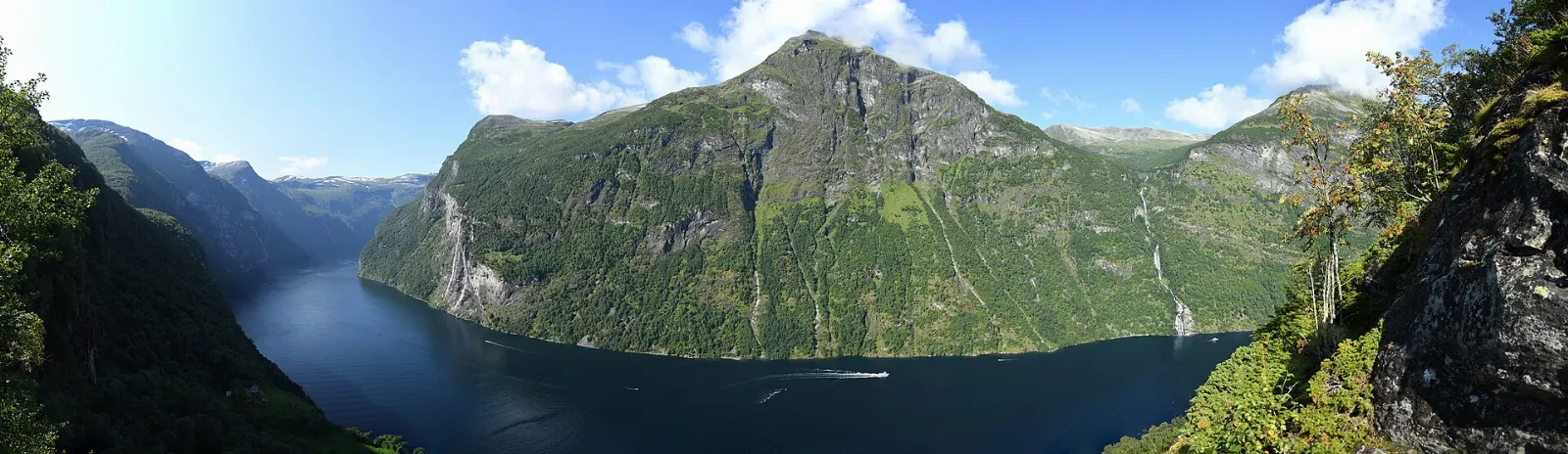
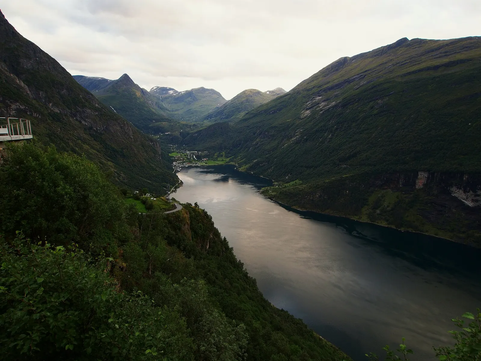
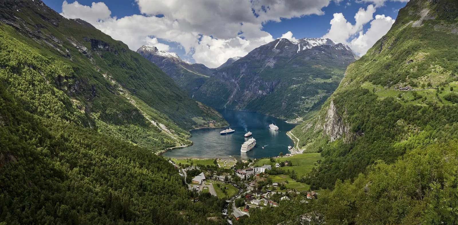
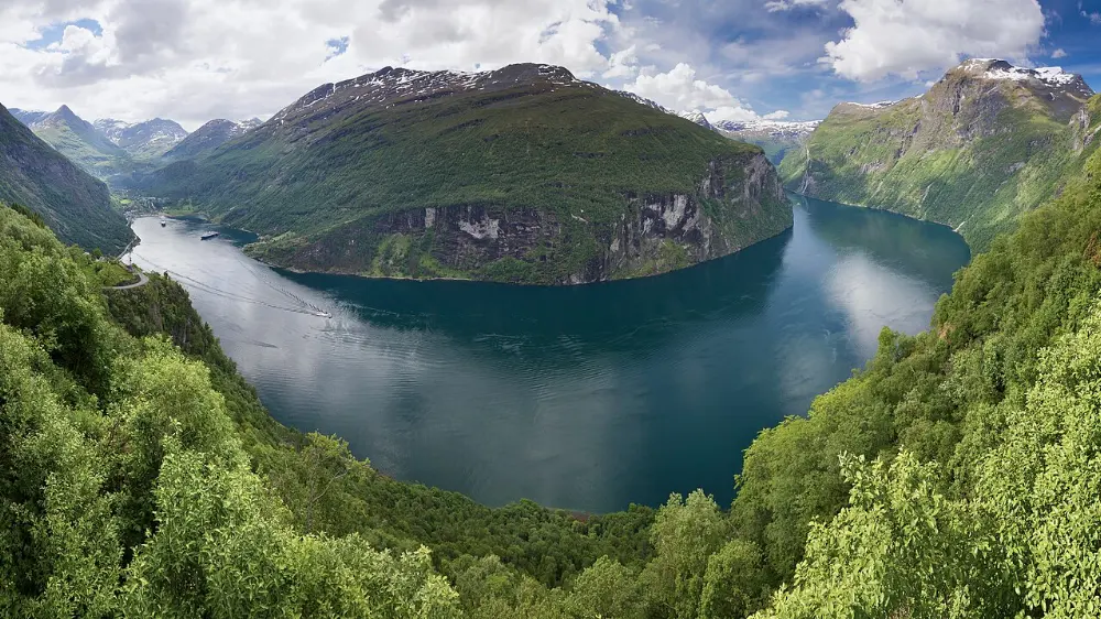
The Geirangerfjord is a narrow, fifteen-kilometre arm of water in the Sunnmøre region of western Norway, the inner end of the long Storfjorden system. Its walls rise almost straight from the water, and waterfalls pour down them, including the famous Seven Sisters.

By WiserMap TravelUpdated October 2026 9 places10 min read
FacebookXLinkedIn

At the head of the fjord is Geiranger, a village of only a few hundred residents that becomes very busy in summer as cruise ships, ferries and coaches arrive. At the other end lies Hellesylt, linked by a scenic car ferry.

At a glance Geirangerfjord
  1. Best timeLate May to mid-September, when mountain roads, ferries and viewpoints are open.
  2. How longTwo to three nights lets you sail the fjord, drive the viewpoints and hike to a farm.
  3. Getting thereFly to Ålesund, then drive or take a summer bus; or arrive by ferry from Hellesylt.

Why visit Geirangerfjord

Many Norwegian fjords are beautiful, but few are so compact and dramatic. Within a few hours you can sail beneath roaring waterfalls, drive up to a viewpoint over the whole fjord, and stand on a mountaintop where snow often lingers into summer.

The fjord also carries a human story. The farms perched on its cliffs were worked for centuries by families who carried everything up steep paths, some secured to the rock with iron bolts and rings.

On the water: waterfalls and cliff farms

The best way to grasp the scale of the fjord is from the water itself, by ferry, sightseeing boat or kayak.

Geiranger to Hellesylt ferry

The car ferry between Geiranger and Hellesylt runs the full length of the fjord in roughly an hour and doubles as a sightseeing cruise, with commentary in several languages.

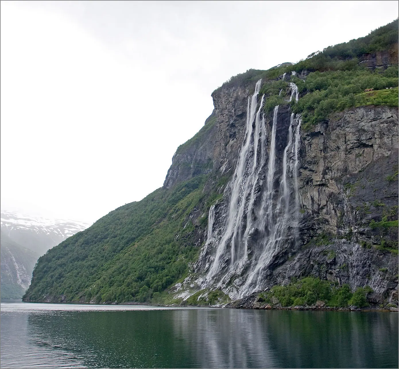
Several parallel streams of the Seven Sisters waterfall falling down a cliff into the fjord, Geirangerfjord, Norway

Seven Sisters and the Suitor

About halfway along the fjord, the Seven Sisters waterfall falls down the cliff in several separate streams; how many you count depends on recent rain and snowmelt, and they are fullest in early summer. Directly across the water, the Suitor waterfall is said to be trying to woo the sisters.

The Seven Sisters waterfall drops down the cliffs directly into the Geirangerfjord. Photo: Sergey Ashmarin, Wikimedia Commons, CC BY-SA 3.0
Small abandoned farm buildings on a green ledge high above the Geirangerfjord, Norway

Skageflå farm

High on a ledge above the fjord, Skageflå was farmed until the early twentieth century and its small buildings have been restored by volunteers. You can reach it by taking a boat to the landing below and climbing a steep path, or by hiking from Geiranger over the mountain.

Skageflå is an abandoned mountain farm on a ledge high above the fjord. Photo: Carsten Steger, Wikimedia Commons, CC BY-SA 4.0

Kayaking the fjord

Kayak rentals and guided paddles start from Geiranger village in summer. A short paddle along the shore gives quiet views of the cliffs; longer guided trips go toward the waterfalls.

Viewpoints and mountain roads

Geiranger sits at the meeting point of two famous roads: the Eagle Road climbing north toward Eidsdal, and the Geiranger road climbing south toward Dalsnibba and Grotli. Both are part of a national scenic route.

Viewing platform on a hairpin road high above the Geirangerfjord and village, Norway

Ørnesvingen on the Eagle Road

The Eagle Road, opened in 1955, zigzags up the north side of the fjord in a series of hairpin bends.

The Ørnesvingen viewpoint sits on a hairpin bend of the Eagle Road above Geiranger. Photo: rheins, Wikimedia Commons, CC BY 3.0

Rocky overhang viewpoint looking down the valley to Geiranger and the fjord, Geirangerfjord, Norway

Flydalsjuvet

A few kilometres up Route 63 from the village toward Grotli, Flydalsjuvet has two viewing areas on a rocky ledge with a fine angle back down the valley to Geiranger and the fjord, often with a cruise ship anchored below.

Flydalsjuvet is a viewpoint on Route 63 a few kilometres above Geiranger village. Photo: Ximonic (Simo Räsänen), Wikimedia Commons, CC BY-SA 3.0

View from the summit of Dalsnibba over snowy mountains and the valley toward Geirangerfjord, Norway

Dalsnibba

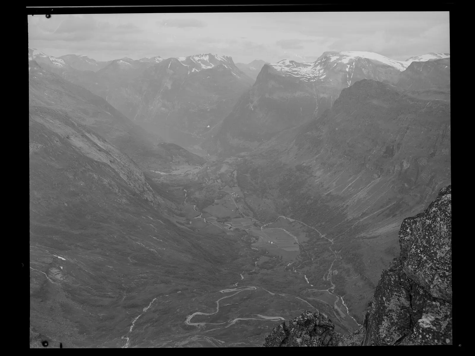
Further up Route 63, a private toll road called Nibbevegen climbs to the summit of Dalsnibba, about fifteen hundred metres above the fjord.

Dalsnibba is a mountain of about fifteen hundred metres reached by a toll road from Route 63. Photo: Unknown authorUnknown author, Wikimedia Commons, Public domain

Ljøen viewpoint near Hellesylt

On Route 60 between Hellesylt and Stranda, a viewpoint near the hamlet of Ljøen looks out over the meeting of the Sunnylvsfjord and the mouth of the Geirangerfjord. It is a good stop if you arrive or leave via Hellesylt.

Geiranger village, Hellesylt and beyond

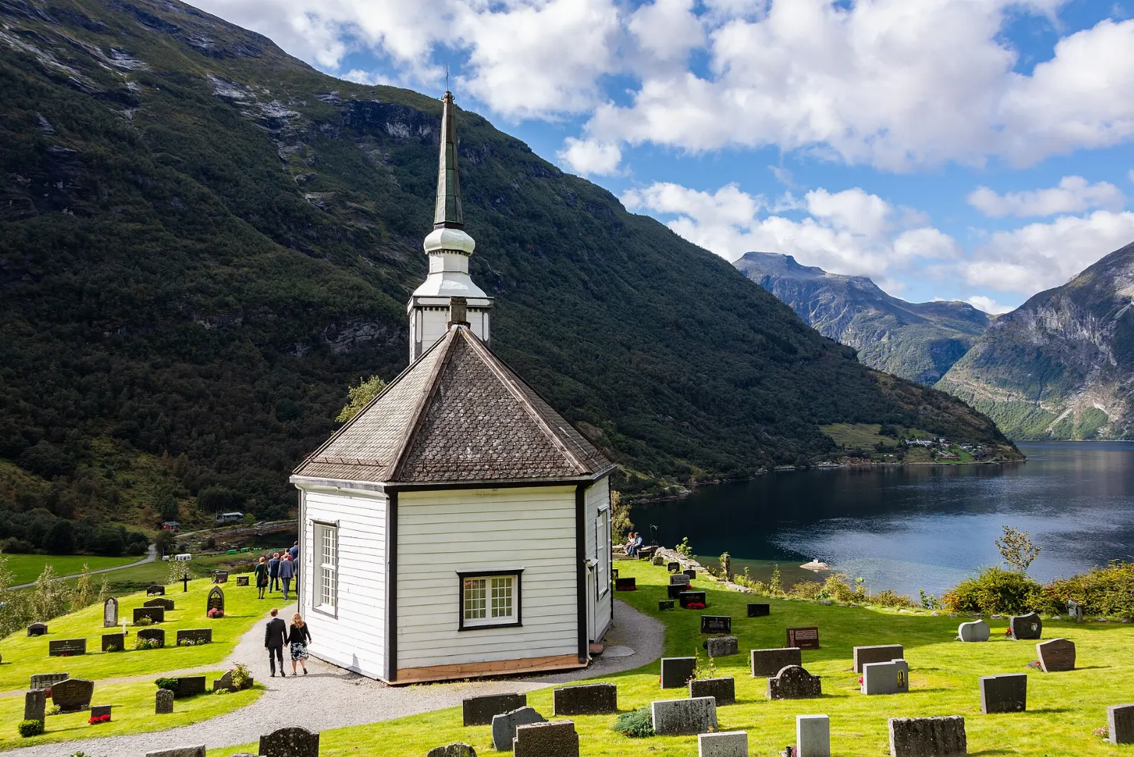
White octagonal wooden church on a hillside above the Geirangerfjord, Norway

Geiranger Church

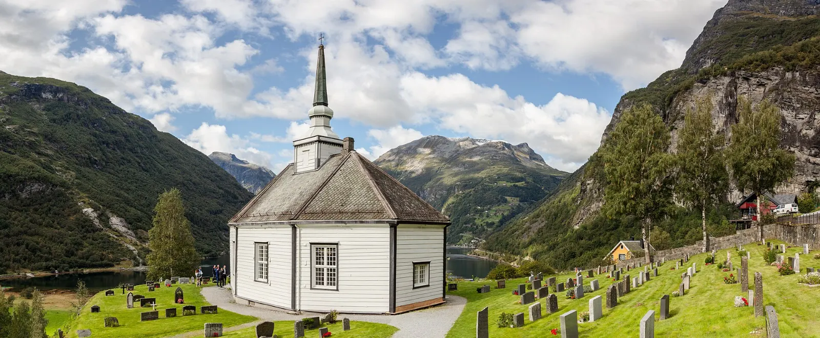
Built in 1842, the white octagonal wooden church stands on a hillside above the village with views over the fjord. It remains the parish church, so be respectful if a service is underway.

Geiranger Church is an octagonal wooden church built in 1842. Photo: Diego Delso, Wikimedia Commons, CC BY-SA 4.0

Waterfall rushing past metal stairs and railings on the waterfall walk in Geiranger, Geirangerfjord, Norway

The waterfall walk and the Norwegian Fjord Centre

A path with hundreds of metal steps and railings follows the Geirangelva river as it tumbles through the village, from near the waterfront up to the Norwegian Fjord Centre. Expect spray and noise.

A path of steps follows the Geirangelva river and its waterfalls up through the village. Photo: Diego Delso, Wikimedia Commons, CC BY-SA 4.0

Westerås and Storseterfossen

Above the village, the old farm of Westerås is the starting point for a popular hike to Storseterfossen, a waterfall you can walk behind on a rocky path.

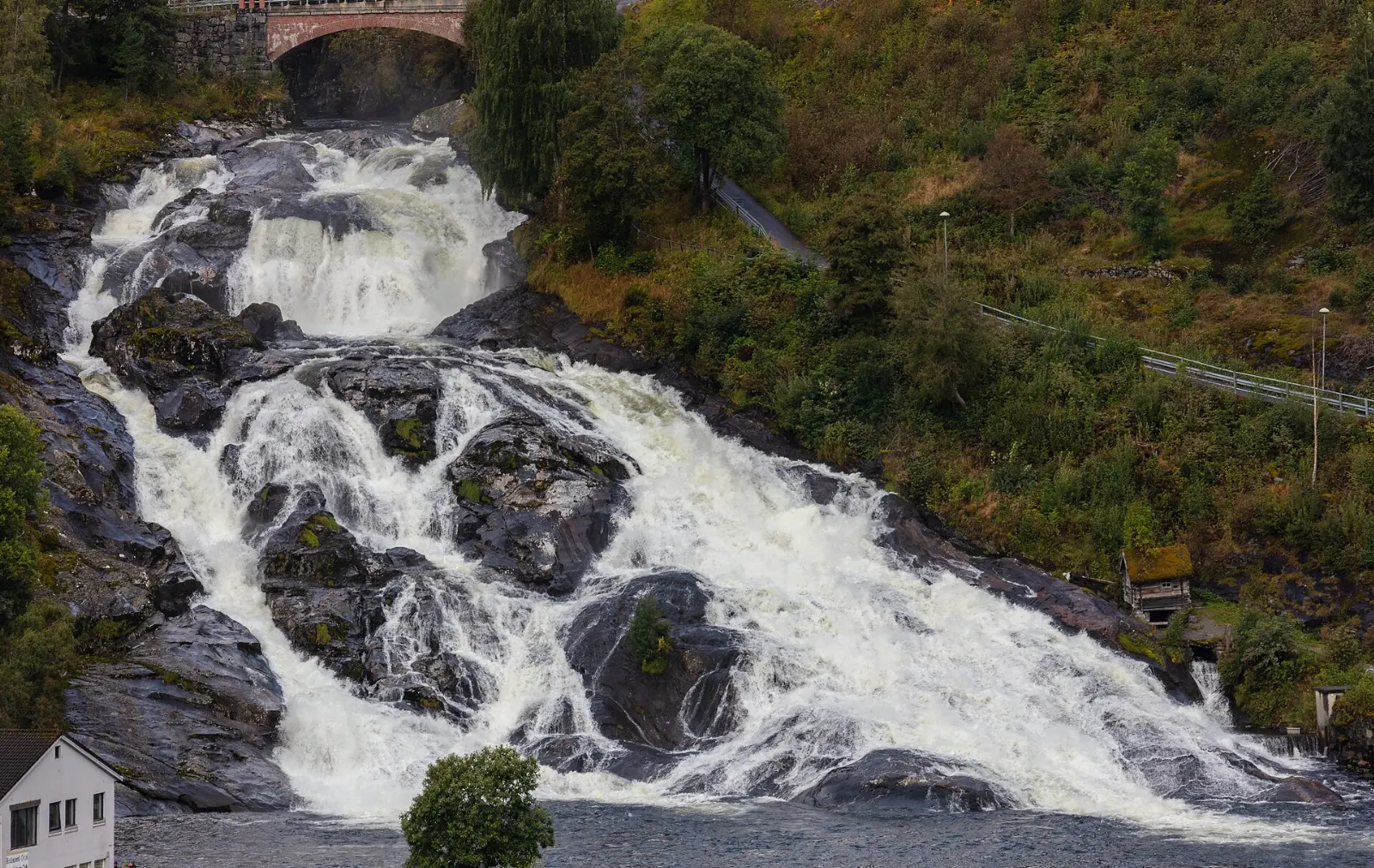
Waterfall tumbling through the small village of Hellesylt beside a bridge, Geirangerfjord, Norway

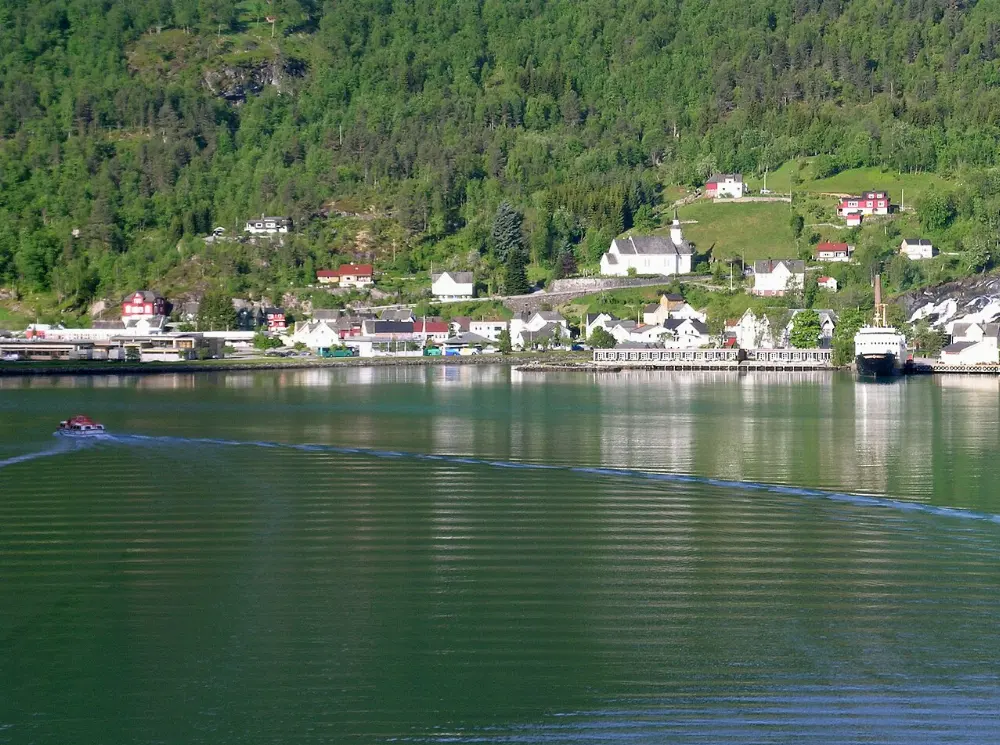
Hellesylt

At the western end of the ferry route, Hellesylt is a quieter village where a waterfall rushes right through the centre beside the road bridge.

A waterfall runs through the centre of Hellesylt, at the western end of the Geirangerfjord route. Photo: Diego Delso, Wikimedia Commons, CC BY-SA 4.0

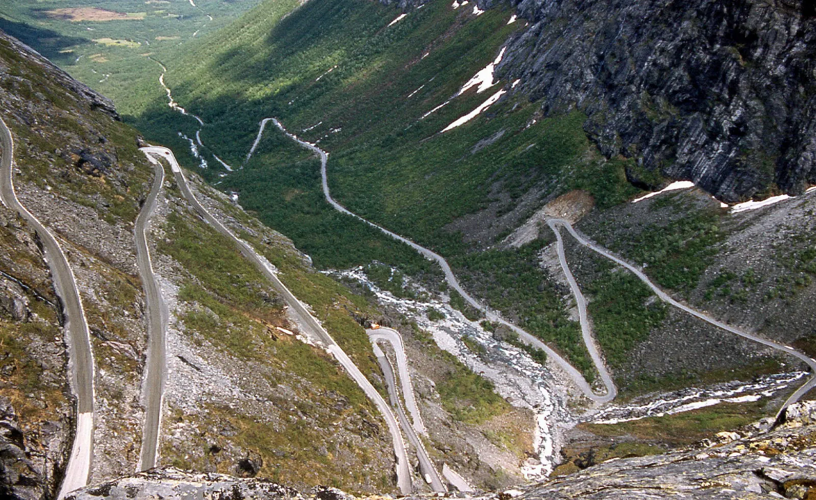
Hairpin bends of the Trollstigen mountain road climbing a steep valley wall, Geirangerfjord, Norway

Trollstigen and Valldal

North of Geiranger, Route 63 continues over the mountains and down to Eidsdal, where a short ferry crosses to Linge. Beyond lies Valldal, known for its strawberry farms, and then Trollstigen, a road of steep hairpins dropping down a valley wall toward Åndalsnes, with a viewing platform at the top.

Trollstigen is a mountain road with steep hairpin bends on the route between Valldal and Åndalsnes. Photo: W. Bulach, Wikimedia Commons, CC BY-SA 4.0

Food and local flavors

Food in the fjord country is simple and hearty.

In summer, berries are a highlight, particularly the strawberries from Valldal, which ripen late in the cool northern summer and are sold at roadside stands.

Popular dishes to try in Geirangerfjord

Brown cheese in Geirangerfjord, Norway
Brown cheese Look for brunost, the sweet caramel-coloured brown cheese, served on bread or on waffles with jam.Photo: Rohini, Wikimedia Commons, CC BY-SA 3.0

Salmon in Geirangerfjord, Norway
Salmon Salmon and trout, fresh or smoked, appear on almost every menu, and the nearby coast around Ålesund is known for klippfisk, salted and dried cod used in a tomato-based stew…Photo: Andy Li, Wikimedia Commons, CC0
Waffles in Geirangerfjord, Norway
Waffles Look for brunost, the sweet caramel-coloured brown cheese, served on bread or on waffles with jam.Photo: Michael Rivera, Wikimedia Commons, CC BY-SA 4.0

Where to stay

Geiranger village is the obvious base, and staying overnight is the best way to enjoy the fjord once cruise passengers and day buses leave in the late afternoon. Places along the waterfront suit those who want to walk to the ferry, boats and restaurants, while lodgings higher on the hillside have wide views and are good for couples.

Hellesylt is quieter and often easier to book, suiting travellers who want calm evenings and plan to take the ferry. Valldal and the Norddal area to the north suit those combining the fjord with Trollstigen and outdoor activities.

Where to stay in Geirangerfjord

Geiranger, Geirangerfjord, Norway
Geiranger Where to stayGeiranger village is the obvious base, and staying overnight is the best way to enjoy the fjord once cruise passengers and day buses leave in the late afternoon.Photo: Ximonic (Simo Räsänen), Wikimedia Commons, CC BY-SA 3.0
Hellesylt, Geirangerfjord, Norway
Hellesylt Hellesylt is quieter and often easier to book, suiting travellers who want calm evenings and plan to take the ferry.Photo: Hajotthu, Wikimedia Commons, CC BY 3.0
Norddal, Geirangerfjord, Norway
Norddal Valldal and the Norddal area to the north suit those combining the fjord with Trollstigen and outdoor activities.Photo: Den yngre, Wikimedia Commons, CC BY-SA 3.0
Ålesund, Geirangerfjord, Norway
Ålesund If you are touring the wider region, Ålesund, with its Art Nouveau town centre, has the most choice and works for a day trip, though the drive is long.Photo: Mariordo (Mario Roberto Durán Ortiz), Wikimedia Commons, CC BY-SA 4.0

Best time to visit

The main season runs from late May to mid-September. In late May and June, snowmelt makes the waterfalls powerful and the slopes vivid green, and the long northern days give you light late into the evening.

September is quieter, with autumn colour and settled days mixed with rain.

Getting there and getting around

The nearest major airport is Ålesund, roughly a three-hour drive away, including a short ferry crossing. Ørsta-Volda and Molde airports are other regional options, and Oslo is a full day's drive.

By road, Route 63 reaches Geiranger from the north over the Eagle Road and from the south via the Geiranger road from Grotli. Route 60 leads to Hellesylt, from where the car ferry crosses to Geiranger.

A suggested itinerary

First day

Arrive via the Hellesylt ferry to see the Seven Sisters, the Suitor and the cliff farms from the water.

Second day

Drive up Route 63 in the morning to Flydalsjuvet and on to the summit of Dalsnibba if the sky is clear.

Third day

Hike to Skageflå for the view across to the Seven Sisters, or drive north over the Eagle Road, cross from Eidsdal to Linge, pick up strawberries in Valldal and descend Trollstigen toward Åndalsnes.

Practical tips

  • Book summer accommodation and car ferry space well in advance, especially in July and August.
  • Check the cruise ship calendar for Geiranger and plan viewpoints for days or times with fewer ships in port.
  • Confirm road openings for Dalsnibba, the Geiranger road and Trollstigen before you travel in spring and autumn.
  • Pack waterproof layers, warm clothing and sturdy boots; mountain weather can turn cold and wet within an hour.
  • Use low gears on the steep descents and never stop on hairpin bends to take photos.
  • Follow marked paths to the cliff farms and turn back in rain, ice or fog, as the routes are steep and exposed.
GeirangerfjordWISERMAP PLACEGeirangerfjord: photos, reviews & things to doSee traveler photos and reviews, or share your own →

More places to visit

All travel guides →