Yosemite National Park California Glacier Point and Sequoias
Yosemite has a way of making everything else look small. Granite walls rise thousands of feet straight from a green valley floor, waterfalls leap from the rim in long white ribbons and ancient sequoias stand in quiet groves on the edge of the park.
By WiserMap TravelUpdated October 20269 places10 min read
This guide covers the best places to visit in Yosemite National Park, from the icons of Yosemite Valley to Glacier Point, the Mariposa Grove and Tuolumne Meadows.
At a glance Yosemite National Park
Best timeMay to June for waterfalls; September to October for calmer trails and settled weather.
How longThree days covers the Valley, Glacier Point and the sequoias; add a day for the high country.
Getting thereDrive from the Bay Area, Fresno or Sacramento, or take Amtrak to Merced and a YARTS bus.
Ad
Why visit Yosemite
Yosemite was set aside for protection in 1864, when President Lincoln signed the Yosemite Grant, and became a national park in 1890, helped along by the writing of John Muir. Its landscape was carved by glaciers that scoured the granite of the Sierra Nevada into sheer cliffs, rounded domes and hanging valleys, leaving waterfalls tumbling from the rims.
Beyond the Valley, the park covers well over a thousand square miles of wilderness. You can walk among giant sequoias that have stood for thousands of years, picnic beside an alpine lake or watch climbers inch up El Capitan through binoculars.
Yosemite Valley icons
Most visitors spend the bulk of their time in Yosemite Valley, where the famous cliffs and waterfalls are linked by a loop road, a free shuttle and miles of flat paths and bike lanes.
Tunnel View
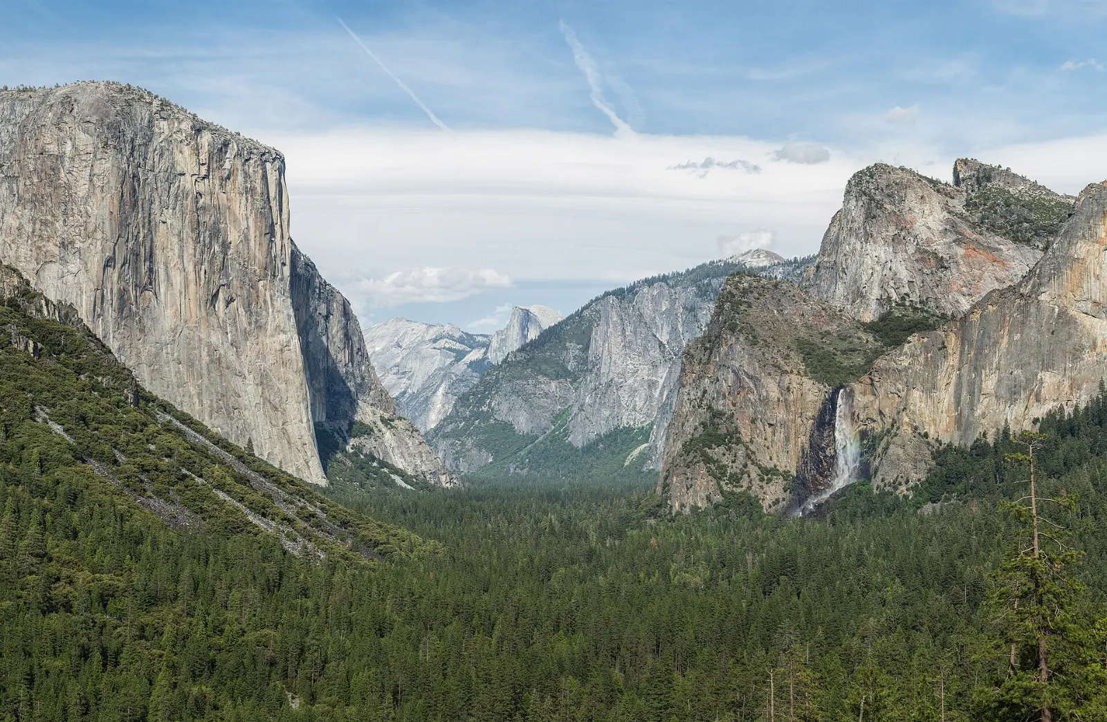
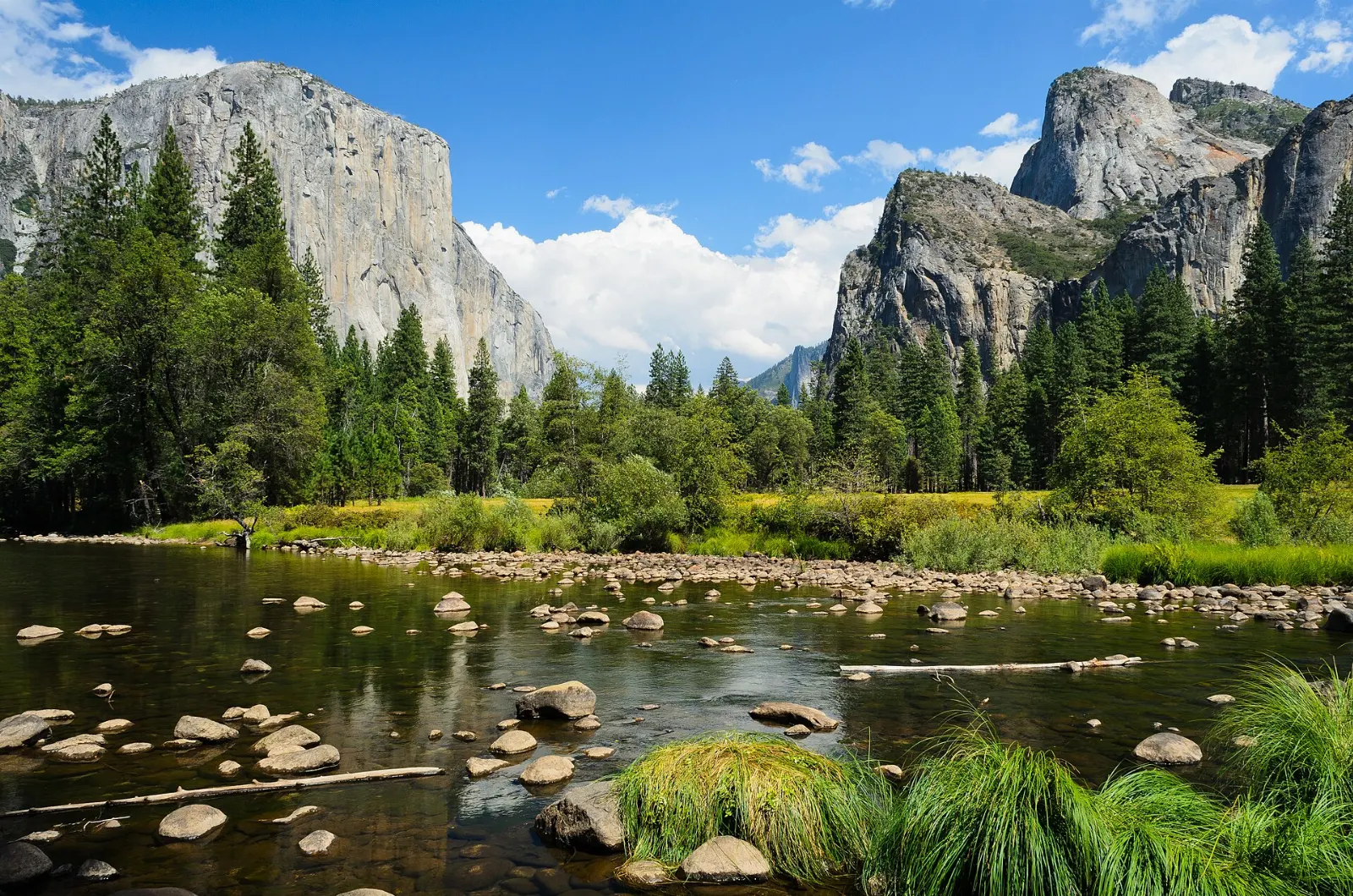
Driving in on Wawona Road, you emerge from a tunnel to the most famous view in the park, with El Capitan on the left, Bridalveil Fall on the right and Half Dome glowing at the far end.
El Capitan
This granite monolith rises about three thousand feet from the Valley floor and is a magnet for big wall climbers from around the world.
El Capitan rises about three thousand feet above the floor of Yosemite Valley. Photo: King of Hearts, Wikimedia Commons, CC BY-SA 3.0
Yosemite Falls
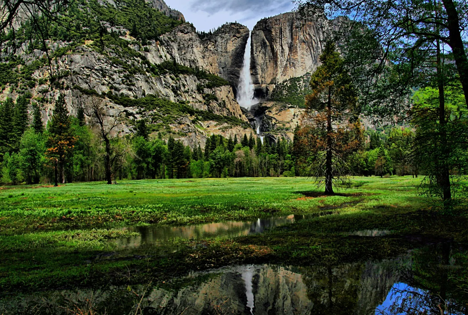
Dropping in three tiers from the north rim, Yosemite Falls is among the tallest waterfalls in North America and roars at its peak during the spring snowmelt.
Yosemite Falls drops in three sections and is among the tallest waterfalls in North America. Photo: Brocken Inaglory, Wikimedia Commons, CC BY-SA 3.0
Bridalveil Fall
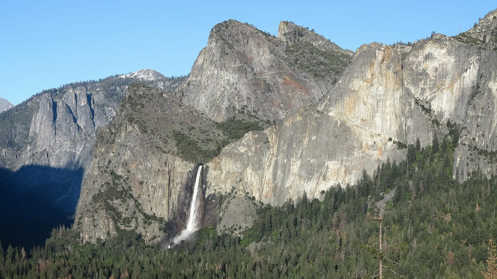
One of the first waterfalls you see on arrival, Bridalveil Fall flows all year and often sways in the wind, throwing mist across the trail. A short walk from the parking area leads to a viewing spot at its base.
Bridalveil Fall flows all year, though it is strongest during the spring snowmelt. Photo: Dave Riggs, Wikimedia Commons, CC BY-SA 2.0
Ad
Trails, domes and Glacier Point
Mist Trail to Vernal and Nevada Falls
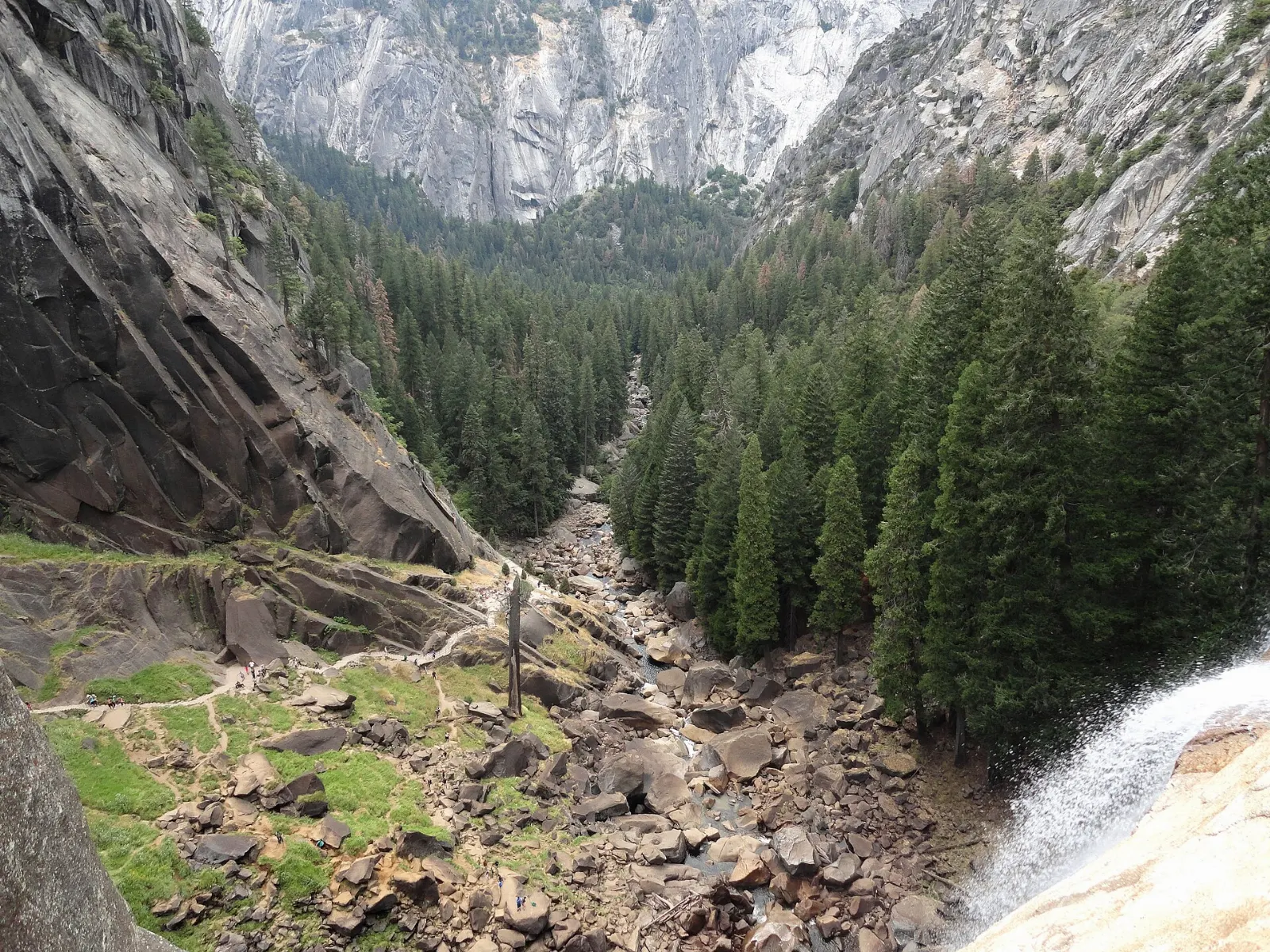
The Mist Trail, starting at Happy Isles, is the park's most popular hike for good reason. A paved stretch climbs to the Vernal Fall footbridge, then hundreds of granite steps lead up beside Vernal Fall, where spring spray soaks you, to the top of the fall.
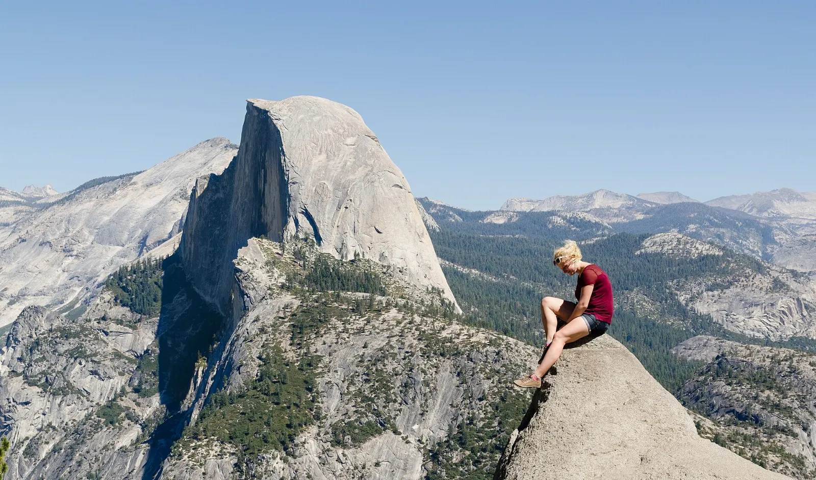
About an hour's drive from the Valley, Glacier Point sits roughly three thousand feet above the Valley floor and looks straight across at Half Dome, Vernal and Nevada Falls and the high peaks beyond. Glacier Point Road usually opens in late spring and closes with the first heavy snows; in 2026 it opened in early May.
Glacier Point looks straight across at Half Dome and down onto Yosemite Valley. Photo: Tuxyso, Wikimedia Commons, CC BY-SA 3.0
Half Dome
The park's signature granite dome can be admired from almost anywhere, but climbing it is a serious undertaking: a very long day hike that ends with a steep ascent on metal cables.
Mirror Lake
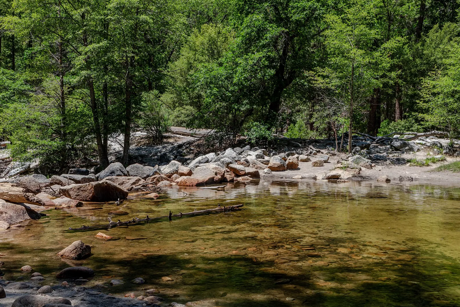
A gentle walk of about a mile from the shuttle stop leads to Mirror Lake, a seasonal pool in Tenaya Canyon beneath the face of Half Dome. In spring it reflects the cliffs beautifully; by late summer it often becomes a meadow.
Mirror Lake sits in Tenaya Canyon beneath the northwest face of Half Dome. Photo: Dietmar Rabich, Wikimedia Commons, CC BY-SA 4.0
Giant sequoias and the high country
Mariposa Grove
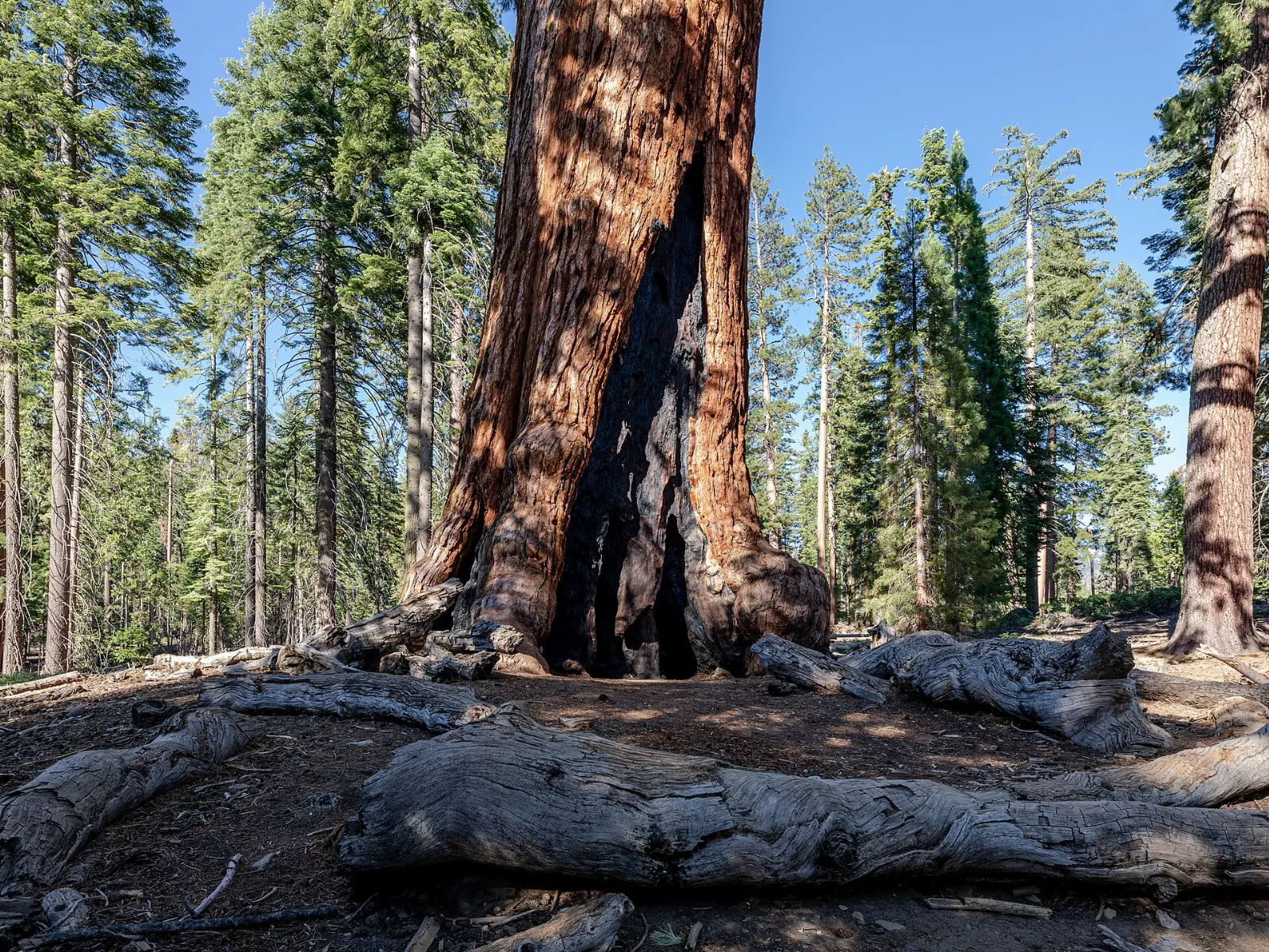
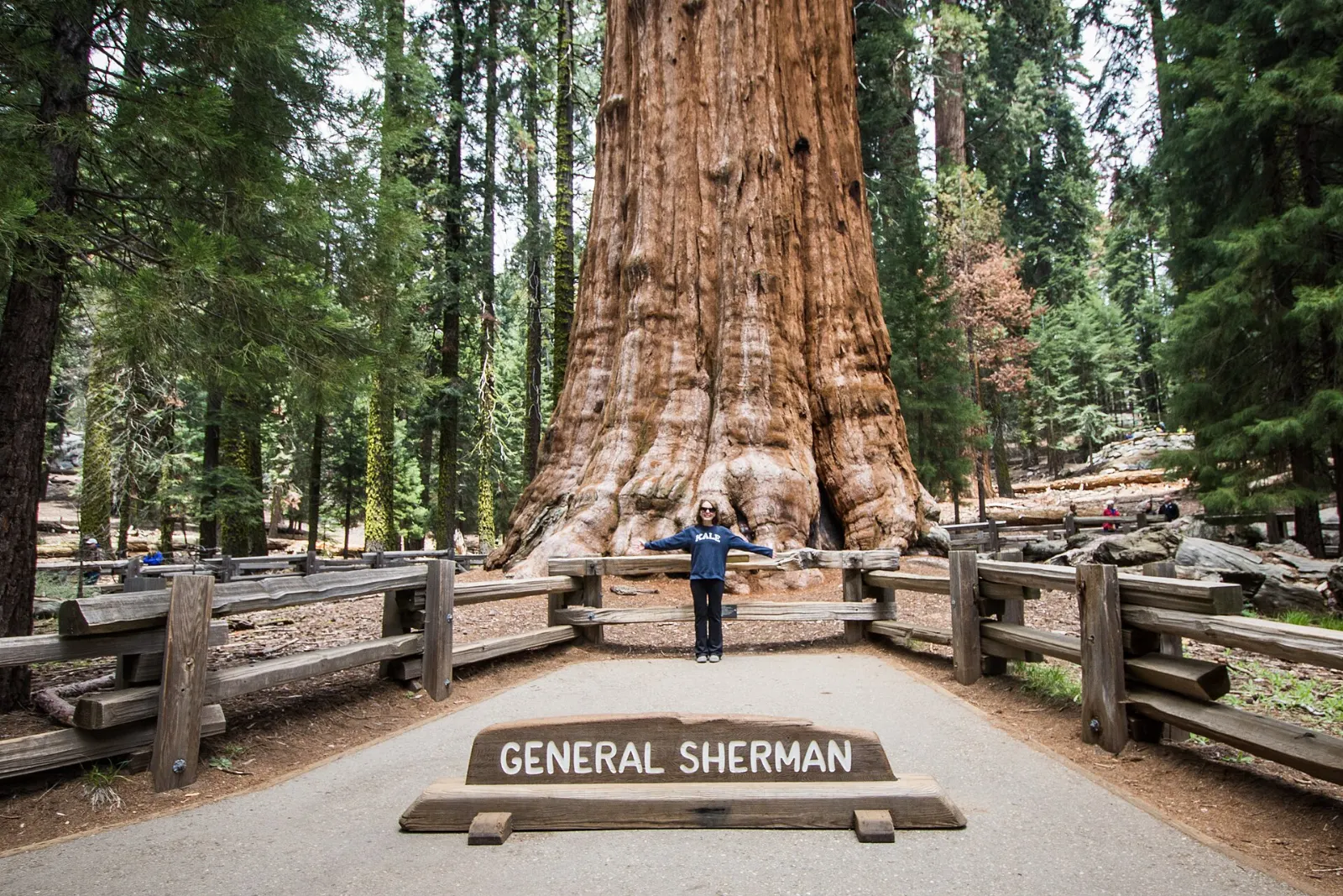
Near the south entrance, the Mariposa Grove is the park's largest stand of giant sequoias, with hundreds of mature trees.
The Grizzly Giant is one of the oldest and largest trees in the Mariposa Grove. Photo: Dietmar Rabich, Wikimedia Commons, CC BY-SA 4.0
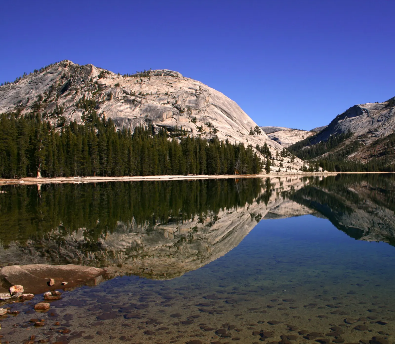
Tioga Road and Tenaya Lake
Tioga Road crosses the park from west to east, climbing into the high country to Tioga Pass. It usually opens in late spring or early summer and closes in fall; in 2026 it opened in mid-May.
Tenaya Lake lies beside Tioga Road in the Yosemite high country. Photo: Brocken Inaglory, Wikimedia Commons, CC BY-SA 3.0
Tuolumne Meadows
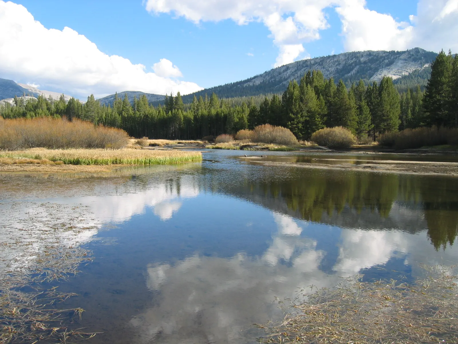
At around eighty-six hundred feet, Tuolumne Meadows is a vast subalpine meadow cut by the Tuolumne River and ringed by granite domes. Walk out to Soda Springs and Parsons Memorial Lodge, or hike to Cathedral Lakes or Elizabeth Lake for a longer day.
Tuolumne Meadows is one of the largest subalpine meadows in the Sierra Nevada. Photo: Moppet65535, Wikimedia Commons, CC BY-SA 3.0
Hetch Hetchy
In the northwest corner of the park, the Hetch Hetchy Reservoir fills a valley once compared to Yosemite Valley itself. A trail across O'Shaughnessy Dam and along the shore leads to Wapama Falls, which thunders in spring.
Ad
Food and local flavors
Inside the park, food is mostly casual: food courts, a pizza deck, delis and grocery stores in Yosemite Valley, plus a few historic dining rooms that are worth booking ahead for a special dinner.
Outside the park, the gateway towns reflect Gold Rush history and the farm country of the Central Valley.
Popular dishes to try in Yosemite National Park
Peaches Along Highway 140 and Highway 120 you will find fruit stands selling local peaches, cherries and almonds in season, and Mariposa and Groveland have historic main streets with…Photo: Zenyrgarden, Wikimedia Commons, CC BY-SA 4.0Cherries Along Highway 140 and Highway 120 you will find fruit stands selling local peaches, cherries and almonds in season, and Mariposa and Groveland have historic main streets with…Photo: George Chernilevsky, Wikimedia Commons, Public domainAlmonds Along Highway 140 and Highway 120 you will find fruit stands selling local peaches, cherries and almonds in season, and Mariposa and Groveland have historic main streets with…Photo: Ivar Leidus, Wikimedia Commons, CC BY-SA 4.0Pizza Food and local flavorsInside the park, food is mostly casual: food courts, a pizza deck, delis and grocery stores in Yosemite Valley, plus a few historic dining rooms that are…Photo: Petar Milošević, Wikimedia Commons, CC BY-SA 4.0
Where to stay
Yosemite Valley. Staying in the Valley, whether in a lodge room, tent cabin or campsite, puts you at the trailheads before the crowds arrive.
El Portal and Mariposa. On Highway 140 along the Merced River, El Portal is just outside the park and Mariposa is about an hour from the Valley.
Groveland. On Highway 120 west of the park, Groveland suits travelers coming from the Bay Area and visitors to Hetch Hetchy.
Lee Vining. When Tioga Road is open, this small town on the east side makes a base for Tuolumne Meadows and Mono Lake.
Where to stay in Yosemite National Park
Mariposa Grove Wawona, inside the park near the Mariposa Grove, and the town of Oakhurst on Highway 41 are convenient for the sequoias and Glacier Point.Photo: Keystone View Co., Wikimedia Commons, Public domainOakhurst Oakhurst suits families wanting more choice of lodging and food.Photo: Ken Lund, Wikimedia Commons, CC BY-SA 2.0Glacier Point Wawona, inside the park near the Mariposa Grove, and the town of Oakhurst on Highway 41 are convenient for the sequoias and Glacier Point.Photo: Tuxyso, Wikimedia Commons, CC BY-SA 3.0Mariposa Wawona, inside the park near the Mariposa Grove, and the town of Oakhurst on Highway 41 are convenient for the sequoias and Glacier Point.Photo: Carol M. Highsmith, Wikimedia Commons, Public domain
Ad
Best time to visit
Late spring, from May to June, is waterfall season, when snowmelt sends Yosemite, Bridalveil and Vernal Falls roaring and the meadows turn green.
In mid to late February, if conditions line up, the setting sun lights Horsetail Fall on El Capitan so it glows like a stream of fire, an event called Firefall that draws big crowds.
Getting there and getting around
Yosemite Valley is roughly four hours by car from San Francisco and about two hours from Fresno.
In the Valley, park once and use the free shuttle, your feet or a bicycle; a free bike share is available in summer. Tire chains may be required in winter, so carry them from about November to March.
Ad
A suggested itinerary
First day
Arrive via Wawona Road and stop at Tunnel View. Spend the afternoon in the Valley at Bridalveil Fall, El Capitan Meadow and Lower Yosemite Fall, then visit the Yosemite Museum and village.
Second day
Start early on the Mist Trail to the top of Vernal Fall, or to Nevada Fall if you feel strong.
Third day
Head south to the Mariposa Grove for a morning among the sequoias.
Practical tips
Book lodging and campsites inside or near the park as soon as reservations open.
Store all food, drinks and scented items in bear lockers; never leave them in your car.
Arrive before about nine in the morning in summer to find parking near the trailheads.
Fill your fuel tank before entering; gas is limited inside the park.
Stay out of rivers and off wet rocks near waterfalls, especially in spring.
Carry tire chains in winter and check road status before driving Glacier Point or Tioga Roads.
Ad
Find local businesses in Mariposa on WiserMap
Mariposa is a historic gateway town on the year-round Highway 140 route into Yosemite, with places to eat, stay and stock up before heading into the park.