WiserMap — Choose wisely. Connect locally.Choose wisely. Connect locally.Add your business
Calakmul, Campeche · Travel guide

Calakmul Mexico Jungle Maya City and Biosphere Ruins

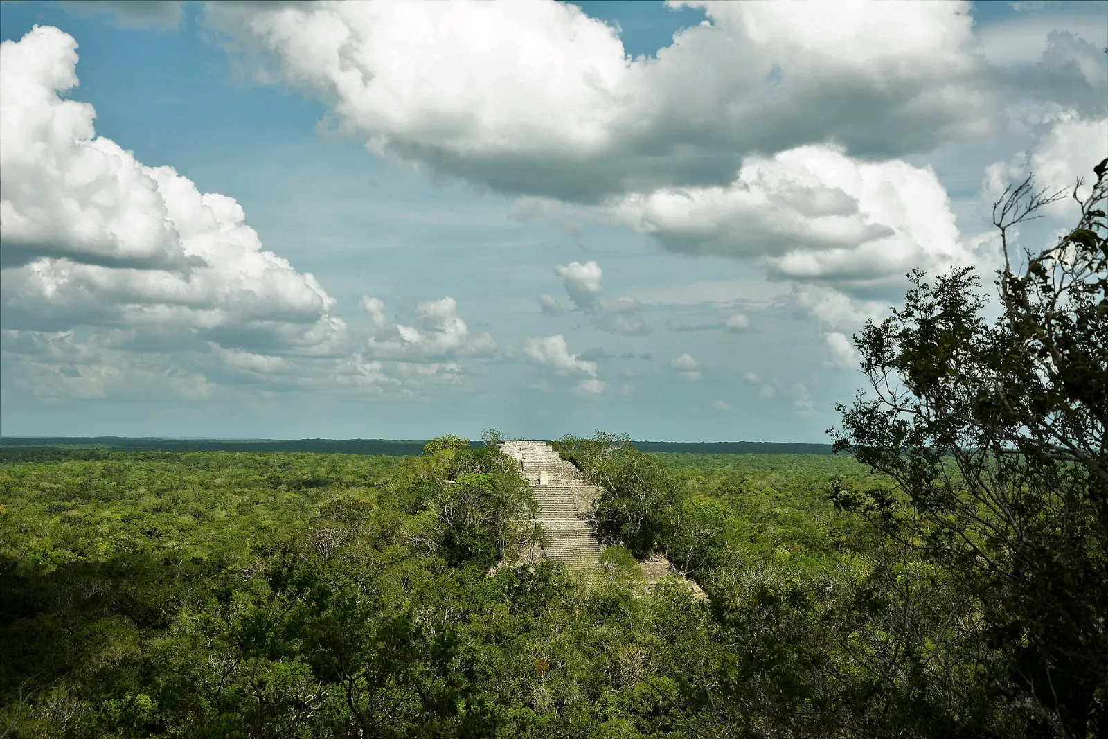
Calakmul is a Maya city rising out of the largest intact tropical forest in Mexico. Its great pyramids look over an endless green canopy, and the howl of monkeys carries across the plazas.

By WiserMap TravelUpdated October 2026 9 places9 min read
FacebookXLinkedIn
At a glance Calakmul
  1. Best timeThe dry season makes roads and trails easier, while the rainy summer is hot and humid.
  2. How longAllow two days to see Calakmul properly, or three with the nearby sites.
  3. Getting thereDrive Route 186 to Xpujil and then on to the reserve entrance.

Why visit Calakmul

Calakmul was a major Maya power for centuries. Its rulers belonged to the Kaan dynasty, often called the Snake Kingdom, and the city rivalled Tikal for control of the region. The site and the surrounding biosphere reserve together form a UNESCO World Heritage Site, protected as both a cultural landscape and a vast stretch of forest.

The ruins are remote, and there is little commercial development inside the reserve. That is much of the appeal: you can climb a temple, scan the treetops for toucans and spot monkeys without a crowd around you.

The reserve and the ancient city

Dense tropical forest inside the Calakmul Biosphere Reserve, Campeche

Calakmul Biosphere Reserve

More than 720,000 hectares are protected here. A single road runs from the main entrance to the ruins, about 60 kilometres through undeveloped forest, so allow plenty of time for the drive.

The Calakmul Biosphere Reserve protects the largest intact tropical forest in Mexico. Photo: Norberto_Fotografía_Negrete, Wikimedia Commons, CC BY-SA 3.0
Visitors climbing the stairway of Structure II at Calakmul, Campeche

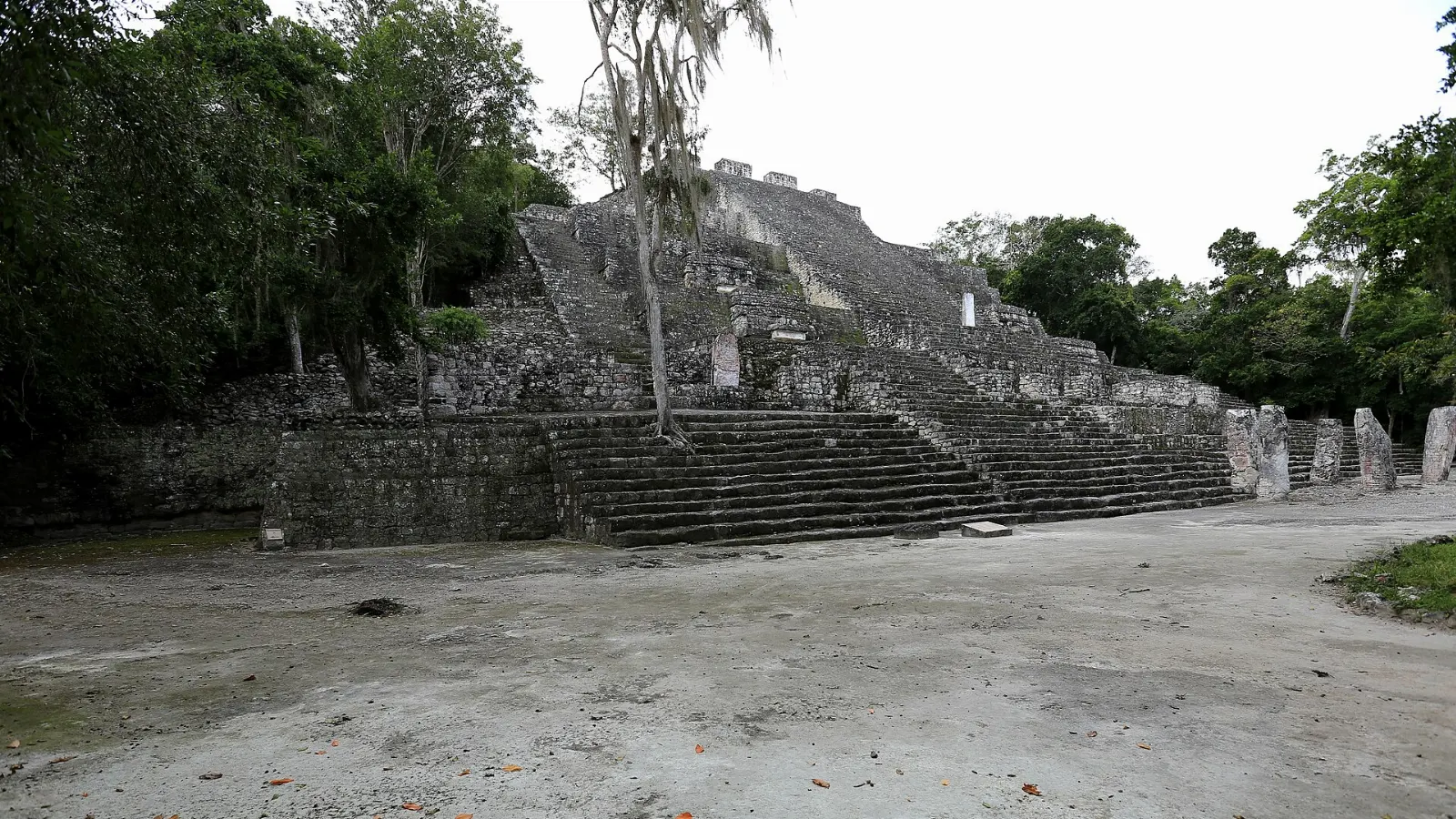
Structure II

The great pyramid is more than 45 metres high and is the highlight of the site. Climb it for a view across a flat green canopy broken only by other temple tops.

Structure II rises more than 45 metres above the plaza at Calakmul. Photo: panza-rayada, Wikimedia Commons, CC BY-SA 3.0

Carved stone stelae standing in front of a temple at Calakmul, Campeche

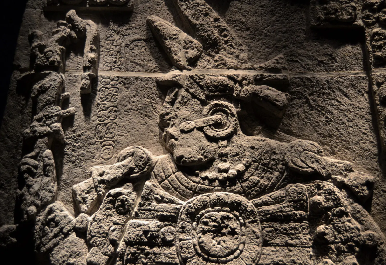
The stelae and plazas

Archaeologists have found well over a hundred carved stelae at Calakmul, many of them recording rulers, alliances and wars. Walk the plazas with a guide from the entrance if you can, since the inscriptions mean far more with context.

Calakmul has more than a hundred carved stelae recording its rulers and alliances. Photo: Joanbanjo, Wikimedia Commons, CC BY-SA 4.0

A howler monkey in the trees of the Calakmul jungle, Campeche

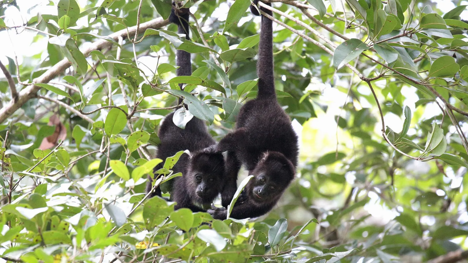
Wildlife along the trails

Howler monkeys are common and spider monkeys live here too. Toucans, parrots and many other birds are easier to see early in the day, and jaguars and other cats live in the forest but are rarely seen. Bring strong insect repellent, because mosquitoes here can be fierce.

Howler and spider monkeys live in the forest around the ruins. Photo: panza-rayada, Wikimedia Commons, CC BY-SA 3.0

Xpujil and nearby ruins

The towers of the Maya temple at Xpujil in Campeche, Calakmul, Campeche

Xpujil

This small town is the gateway for the region, with simple lodging, restaurants and transport on Route 186. Its own Maya ruins lie about one kilometre away, so they make an easy first stop on arrival.

The ruins at Xpujil lie about one kilometre from the modern town. Photo: Sharon Hahn Darlin, Wikimedia Commons, CC BY 2.0

Temple towers at the Maya site of Becán in Campeche, Calakmul, Campeche

Becán

About eight kilometres from Xpujil, Becán was once ringed by a deep ditch and ramparts, which is how it got its name.

Becán was once surrounded by a defensive ditch and ramparts. Photo: Infrogmation, Wikimedia Commons, CC BY-SA 4.0

The carved doorway of Structure II at Chicanná shaped like a serpent mouth, Calakmul, Campeche

Chicanná

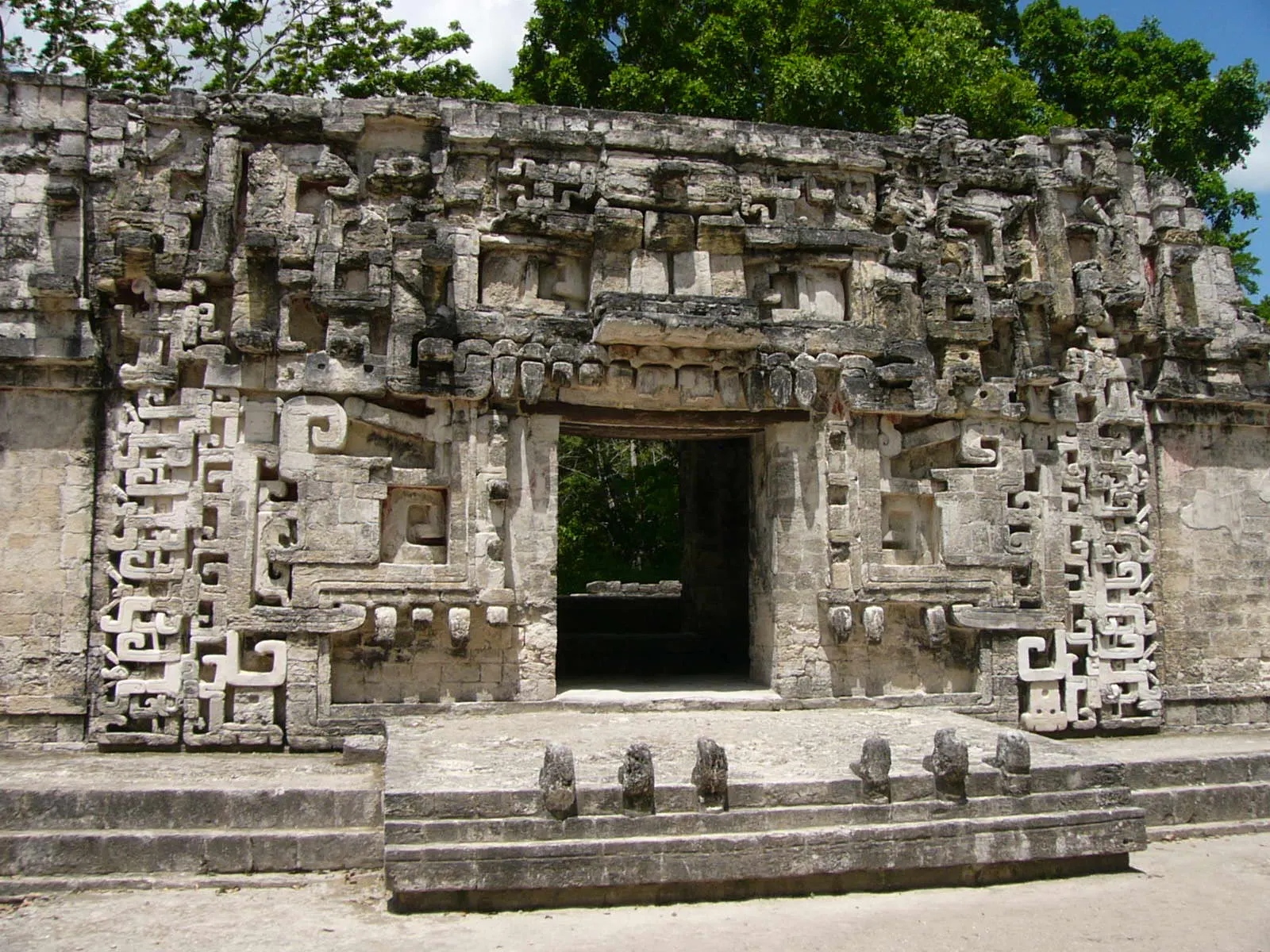
Only about two kilometres west of Becán, Chicanná is named for its Structure II, whose name means House of the Serpent Mouth.

The Structure II doorway at Chicanná is shaped like the open mouth of a serpent. Photo: Vargatamas at English Wikipedia, Wikimedia Commons, Public domain

A plaster frieze with jaguar figures at Balamkú, Calakmul, Campeche

Balamkú

About 50 kilometres from both Calakmul and Becán, Balamkú is a small site that protects one of the largest surviving stucco friezes in the Maya world.

Balamkú holds one of the largest surviving stucco friezes in the Maya world. Photo: Ridiculopathy, Wikimedia Commons, CC0

A tower temple in the Río Bec style among forest in southern Campeche, Calakmul, Campeche

Río Bec and Hormiguero

The Río Bec region gave its name to an architectural style with tall decorative towers and mosaic facades, and several sites in southern Campeche show it. Hormiguero is another site near Xpujil.

The Río Bec style is known for tall decorative towers and mosaic facades. Photo: Vicpeters, Wikimedia Commons, CC BY 4.0

Food and local flavors

There are no restaurants inside the reserve, so bring food and water for the day and eat in Xpujil or along Route 186. Campeche is known for seafood, and pan de cazón is the state signature: layers of tortilla filled with shredded shark, black beans and a spiced tomato sauce with habanero.

Look for tamales de chaya too. Chaya is a leafy green native to Mexico that is cooked much like spinach. The region is also known for honey, and beekeeping is part of local farming, so a jar from a roadside stand makes a useful souvenir.

Popular dishes to try in Calakmul

Pan de cazón in Calakmul, Campeche
Pan de cazón Campeche is known for seafood, and pan de cazón is the state signature: layers of tortilla filled with shredded shark, black beans and a spiced tomato sauce with habanero.Photo: amanderson2, Wikimedia Commons, CC BY 2.0
Tamales de chaya in Calakmul, Campeche
Tamales de chaya Look for tamales de chaya too.Photo: Alfonsobouchot, Wikimedia Commons, CC BY-SA 3.0
Honey in Calakmul, Campeche
Honey The region is also known for honey, and beekeeping is part of local farming, so a jar from a roadside stand makes a useful souvenir.Photo: Rajani Gairshail, Wikimedia Commons, CC BY-SA 4.0

Where to stay

There is no lodging inside the biosphere reserve, so you will sleep outside it. Xpujil is the most practical base.

Chicanná, a short distance from Becán, offers a quieter stay close to the forest. It suits visitors who prefer to wake near the ruins and want to reach them early in the morning, though choices are fewer.

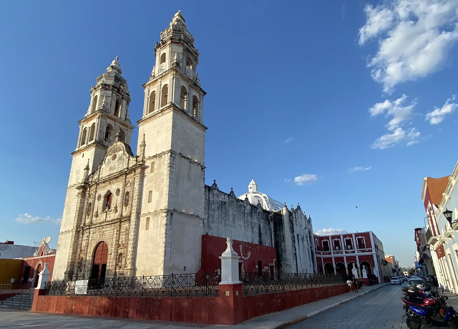
Campeche, the state capital, is a larger and more comfortable base with a historic walled centre. It suits travellers who want to combine Calakmul with colonial sights and other ruins such as Edzná, accepting a long drive on the day you visit.

Where to stay in Calakmul

Xpujil, Calakmul, Campeche
Xpujil Xpujil is the most practical base.Photo: cyril chermin, Wikimedia Commons, CC BY 2.0
Chicanná, Calakmul, Campeche
Chicanná Chicanná, a short distance from Becán, offers a quieter stay close to the forest.Photo: panza-rayada, Wikimedia Commons, CC BY-SA 3.0
Campeche, Calakmul
Campeche Campeche, the state capital, is a larger and more comfortable base with a historic walled centre.Photo: Lugares INAH, Wikimedia Commons, CC BY-SA 4.0

Best time to visit

The reserve has a humid climate with summer rains, and temperatures average roughly 24 to 28 degrees Celsius over the year. Annual rainfall is high, and many reserve roads are seasonal tracks that are passable only in the dry season, so the drier months are the safest time to go.

Plan to arrive early, when it is cooler and animals are more active. Midday heat is strong, and the walk between structures adds up, especially if you climb several pyramids in one visit.

Getting there and getting around

Federal Route 186 is a paved highway across the southern Yucatán Peninsula, and Xpujil lies on it about 153 kilometres east of Escárcega and 120 kilometres west of Chetumal. Renting a car is the easiest way to visit.

Without a car, take a bus from Xpujil, where the first service leaves early in the morning, and ask to be let off at the park entrance. From there the ruins are still a long drive away, and there are no buses inside the reserve.

A suggested itinerary

First day

Arrive in Xpujil, visit the nearby ruins of Xpujil in the afternoon and continue to Becán and Chicanná before sunset.

Second day

Leave at first light for Calakmul. Spend the morning on Structure II, the stelae and the plazas, then drive back through the reserve before the heat peaks.

Third day

Visit Balamkú or the Río Bec sites with a local guide, depending on road conditions, then continue along Route 186 to your next stop. If you have extra time, ask in Xpujil about the smaller sites that archaeologists are still clearing and studying.

Practical tips

  • Fill the fuel tank in Xpujil, because there are no services inside the reserve.
  • Carry plenty of water and food for the whole day, as nothing is sold at the ruins.
  • Use strong insect repellent, since mosquitoes in this region can carry tropical diseases.
  • Wear a hat, light long sleeves and sturdy shoes for the stairs and uneven ground.
  • Hire a guide at the entrance if you want help reading the inscriptions and architecture.
CalakmulWISERMAP PLACECalakmul: photos, reviews & things to doSee traveler photos and reviews, or share your own →

More places to visit

All travel guides →