Sequoia and Kings Canyon National Parks, California · Travel guide
Sequoia and Kings Canyon California General Sherman Tree
Sequoia and Kings Canyon are two neighboring national parks on the western slope of California's southern Sierra Nevada, managed together and covered by a single entrance pass.
By WiserMap TravelUpdated October 20269 places12 min read
This guide focuses on the parts you can reach by car and on day hikes: Giant Forest and Lodgepole in Sequoia, Grant Grove and Cedar Grove in Kings Canyon, and the remote valley of Mineral King. For each place you will find what to see, how much time to allow and practical tips, along with advice on seasons, roads, where to stay and how to plan your days.
At a glance Sequoia and Kings Canyon National Parks
Best timeLate May to October, when all main roads are usually open; September offers warm days and thinner crowds.
How longTwo full days covers Giant Forest and Grant Grove; allow three or four to add Cedar Grove or Mineral King.
Getting thereDrive in from the west only: Highway 198 via Three Rivers or Highway 180 from Fresno. The closest commercial airport is Fresno.
Ad
Why visit Sequoia and Kings Canyon
Nothing quite prepares you for standing beside a giant sequoia. These trees are not the tallest in the world, a title that belongs to coast redwoods, but they are the most massive, with trunks so broad that a group of people holding hands cannot circle them.
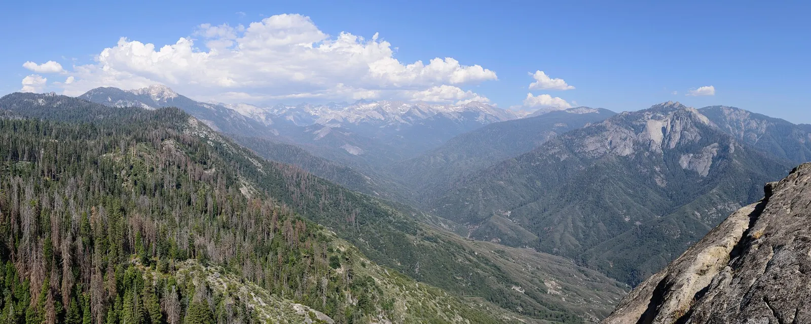
The scenery changes dramatically with elevation. The park entrance near Three Rivers sits among oak woodland and chaparral in the foothills, while the road climbs through mixed conifer forest to the sequoia belt, and beyond lie alpine lakes and peaks over fourteen thousand feet.
The parks also carry visible reminders of recent wildfires. Several large fires since 2015, including the 2020 Castle Fire and the 2021 KNP Complex Fire, killed a significant share of mature giant sequoias.
Giant Forest and Lodgepole in Sequoia
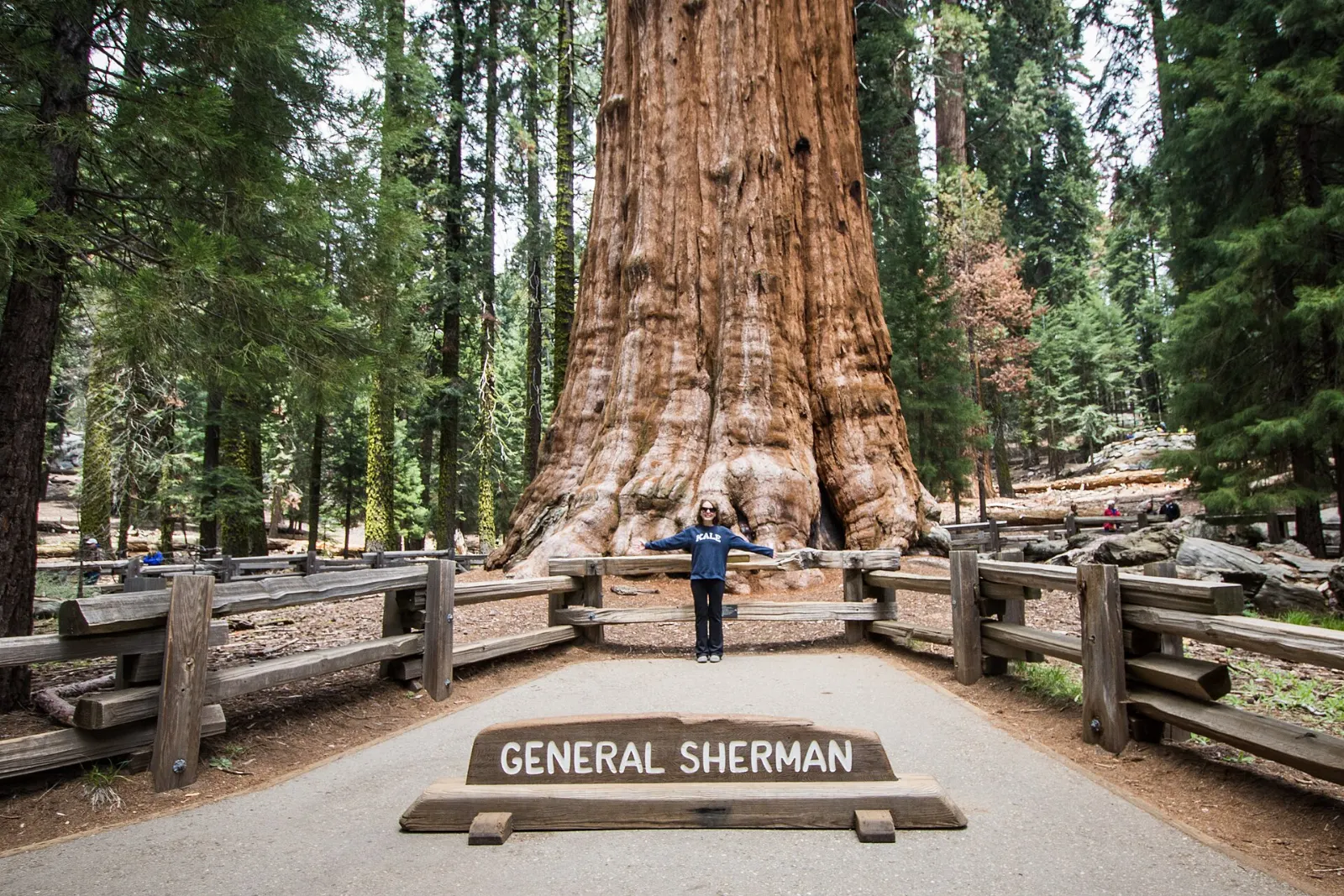
General Sherman Tree
The best-known tree in the park is, by volume, the largest known living single-stem tree on the planet, standing about 275 feet tall with a base over thirty feet across.
Congress Trail
From the General Sherman Tree, continue on the Congress Trail, a mostly paved loop of roughly two to three miles through the heart of Giant Forest. It passes named trees such as the President and the McKinley Tree, and two dense clusters called the House and the Senate.
The Congress Trail loops past groups of giant sequoias such as the House and the Senate in Giant Forest. Photo: Pierre André Leclercq, Wikimedia Commons, CC BY 4.0
Giant Forest Museum
Housed in a historic market building on the Generals Highway, the small museum explains sequoia ecology, the role of fire and how the park removed buildings from the grove to protect tree roots. It is a useful first stop and the trailhead for the short, accessible Big Trees Trail around Round Meadow.
Moro Rock
This granite dome rises from the edge of Giant Forest, and a stairway built in 1931 climbs to its narrow summit, with more than 350 steps and handrails along the exposed sections. From the top you look across the Kaweah River canyon to the jagged Great Western Divide and, on clear days, west toward the Central Valley.
Moro Rock is a granite dome whose summit stairway was built by the National Park Service in 1931. Photo: King of Hearts, Wikimedia Commons, CC BY-SA 4.0
Crescent Meadow Road and Tunnel Log
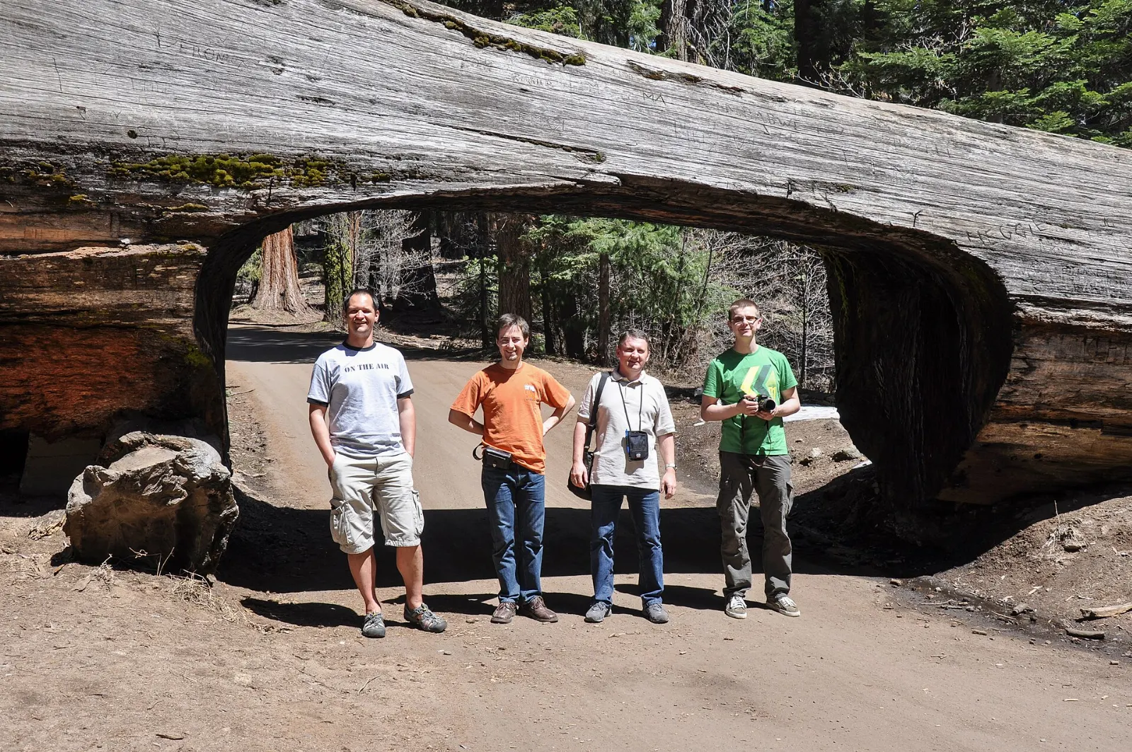
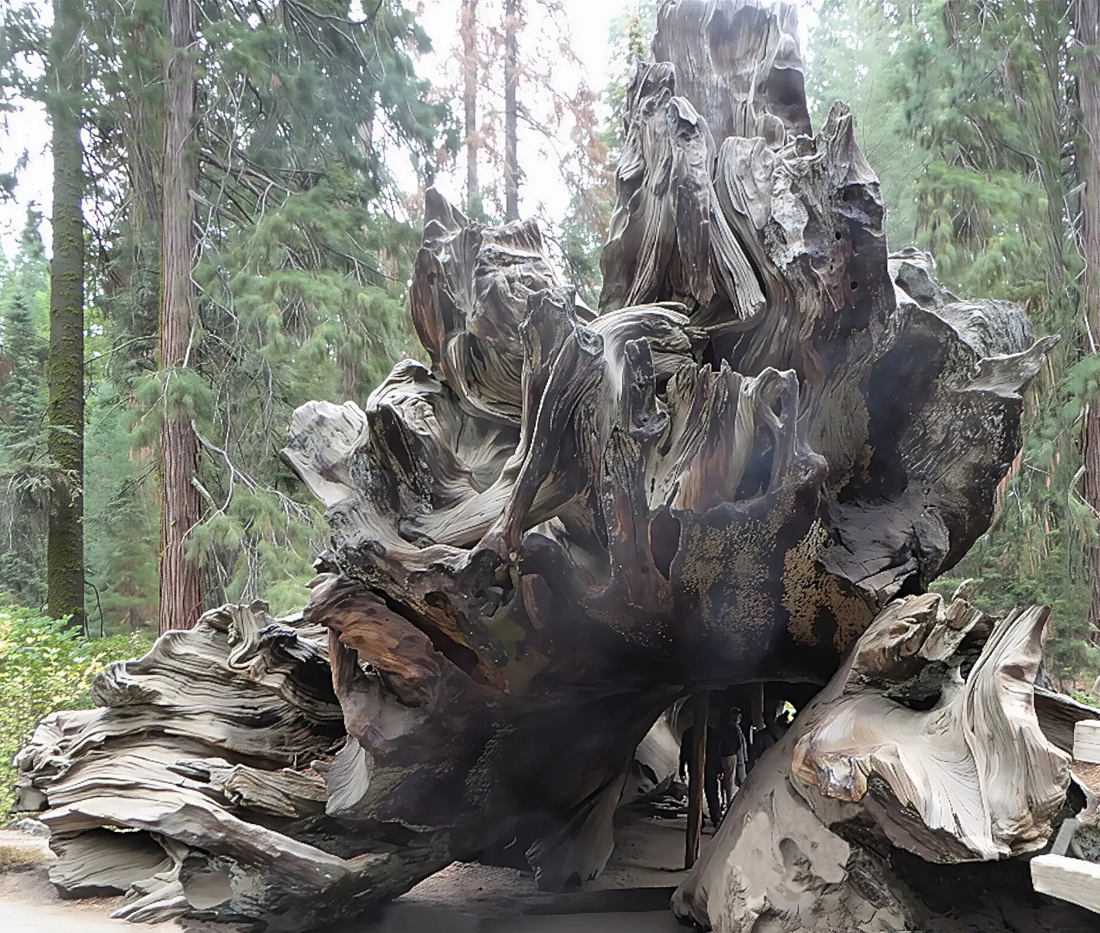
Beyond the Moro Rock turnoff, Crescent Meadow Road leads to Tunnel Log, a sequoia that fell across the road in 1937 and was later cut through so cars could pass, with a bypass for taller vehicles.
Tunnel Log is a fallen giant sequoia on Crescent Meadow Road with a passage cut through its trunk. Photo: Waldek Wróblewski, Wikimedia Commons, CC BY-SA 3.0
Tokopah Falls
From the Lodgepole Campground area, an easy trail of about two miles each way follows the Marble Fork of the Kaweah River into a glacier-carved valley and ends below Tokopah Falls, which cascades down a granite cliff. The falls are at their fullest in late spring and early summer.
Tokopah Falls tumbles down granite cliffs at the end of a trail along the Marble Fork of the Kaweah River. Photo: NPS photo, Wikimedia Commons, Public domain
Crystal Cave
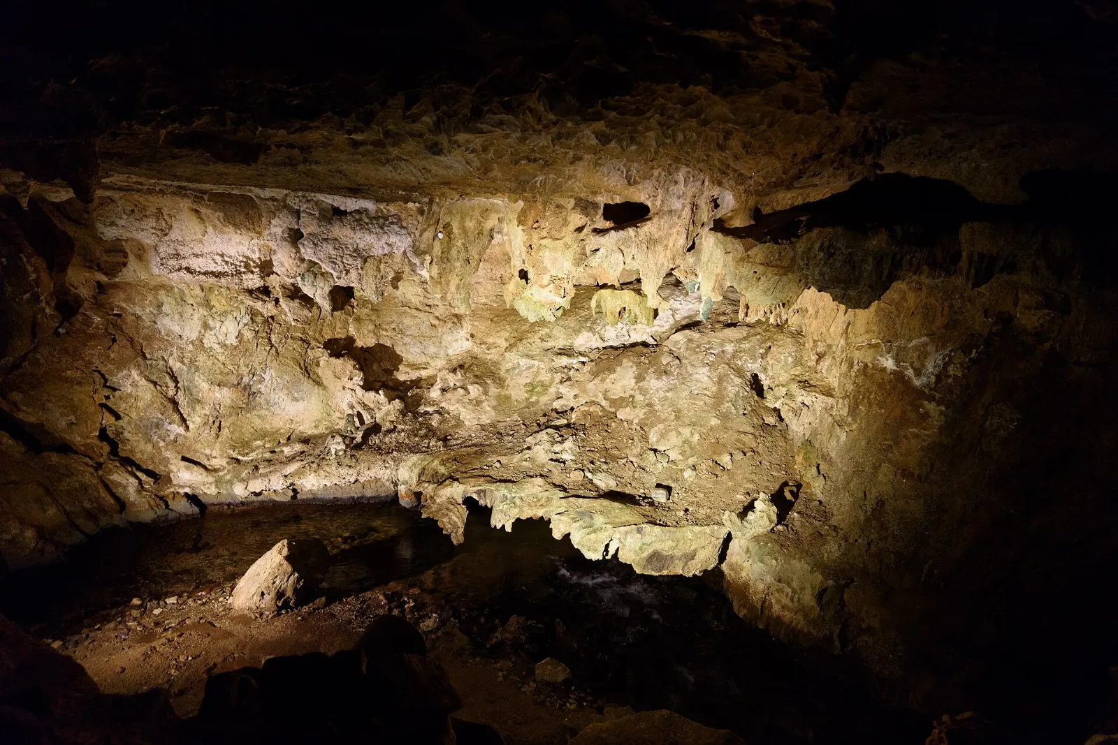
Crystal Cave, located between the Foothills and Giant Forest, is a marble cave with polished walls and delicate formations, kept at a constant cool temperature, so bring a jacket even in July. It is the only one of the park's many caves open to the public and can be visited only on guided tours run by the Sequoia Parks Conservancy.
Crystal Cave is a marble cave in Sequoia National Park visited only on guided tours. Photo: King of Hearts, Wikimedia Commons, CC BY-SA 4.0
Ad
Grant Grove and the Kings Canyon
General Grant Tree and Grant Grove
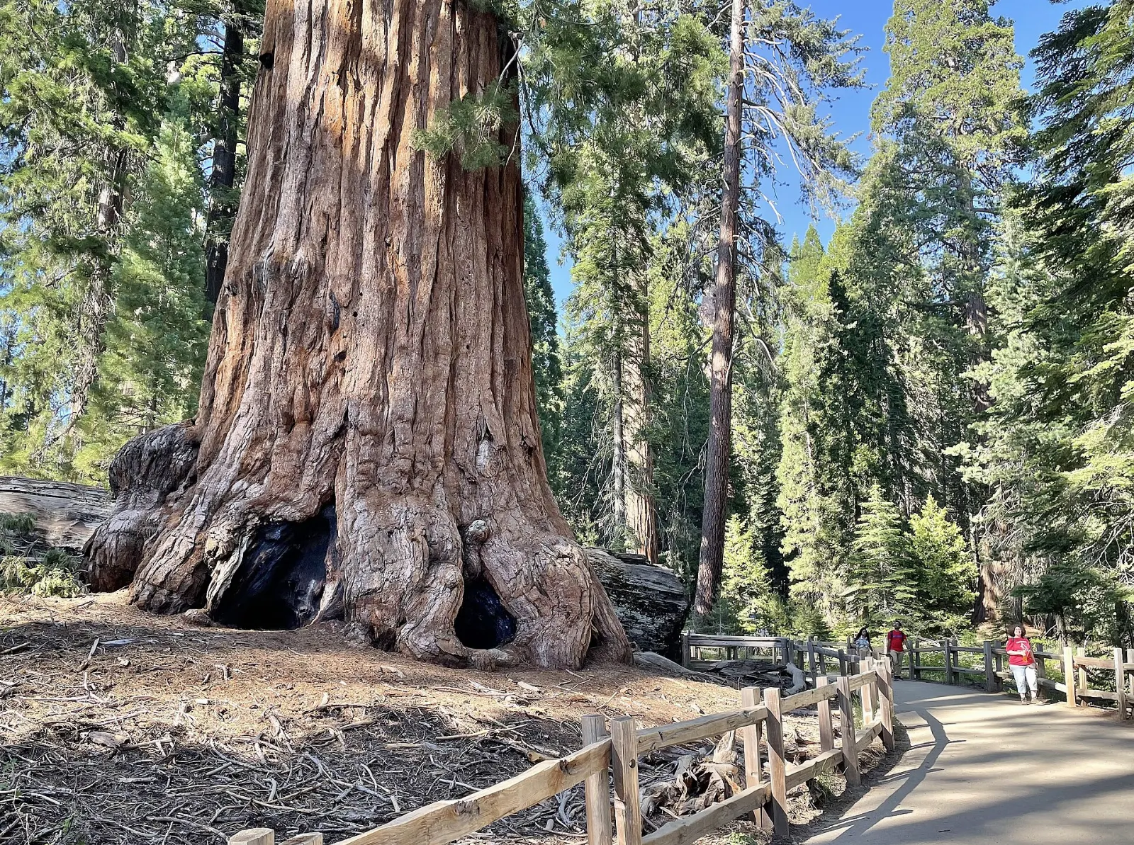
Just inside the Big Stump Entrance on Highway 180, Grant Grove is the main hub of Kings Canyon National Park. A paved loop of about a third of a mile leads to the General Grant Tree, the second-largest giant sequoia in the world.
The General Grant Tree was proclaimed the Nation's Christmas Tree by President Calvin Coolidge in 1926. Photo: Marty Aligata, Wikimedia Commons, CC BY-SA 4.0
Panoramic Point and Big Stump
A narrow road climbs from Grant Grove Village to Panoramic Point, where a short paved path leads to a viewpoint over the High Sierra and down into Kings Canyon. The road is not suitable for trailers and closes in winter.
Kings Canyon Scenic Byway to Cedar Grove
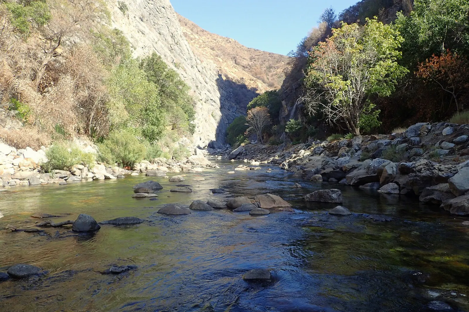
From Grant Grove, Highway 180 winds down for about thirty miles into the canyon of the South Fork of the Kings River, one of the deepest canyons in North America. Stop at Junction View for a sweeping look into the gorge, and at Boyden Cavern pullouts and roadside waterfalls on the way down.
Highway 180 descends into Kings Canyon toward Cedar Grove along the South Fork of the Kings River. Photo: Krzysztof Ziarnek, Kenraiz, Wikimedia Commons, CC BY-SA 4.0
Zumwalt Meadow, Roaring River Falls and Mist Falls
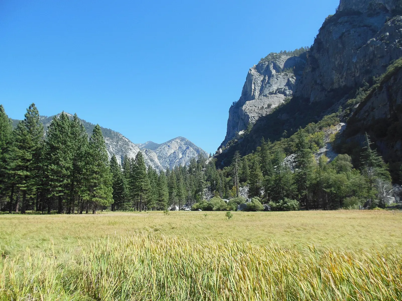
Near the end of the road, Roaring River Falls is a short paved walk to a powerful chute of water. Zumwalt Meadow offers an easy loop of about a mile and a half between the river and the canyon walls, with views of North Dome and Grand Sentinel.
Zumwalt Meadow lies on the floor of Kings Canyon beneath towering granite walls near Cedar Grove. Photo: Schwaltz, Wikimedia Commons, CC BY-SA 3.0
Mineral King and the foothills
Mineral King
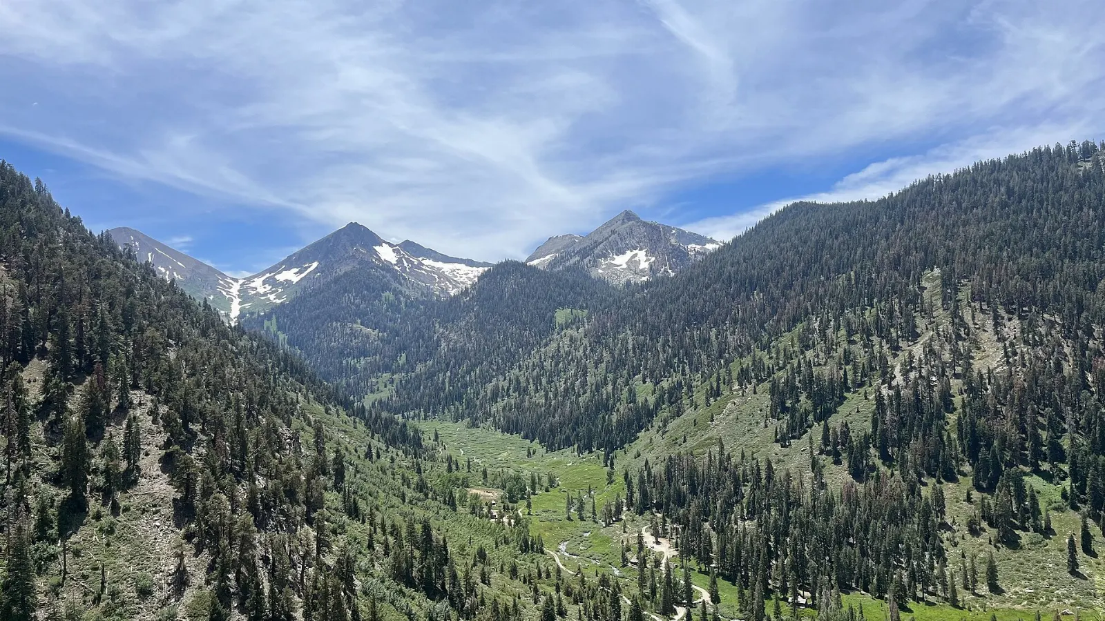
In the southern part of Sequoia, Mineral King is a former mining valley at about 7,500 feet, surrounded by colorful peaks and reached by a separate road that leaves Highway 198 in Three Rivers. The road is narrow, winding and partly unpaved, with about 25 miles of slow driving that takes around ninety minutes each way.
Mineral King is a high subalpine valley in the southern part of Sequoia National Park reached by a narrow mountain road. Photo: Peter J. Caprio, Wikimedia Commons, CC BY-SA 4.0
Foothills and the Kaweah River
Near the Ash Mountain Entrance, the Foothills Visitor Center introduces the oak woodland that is the parks' most biologically diverse zone. Short walks near Hospital Rock show Native American bedrock mortars and pictographs left by the Western Mono people.
Ad
Food and local flavors
Dining inside the parks is limited, so plan your meals.
The gateway town of Three Rivers, along the Kaweah River just below the Ash Mountain Entrance, has cafés, barbecue and family restaurants, and is a good place to stock up.
Popular dishes to try in Sequoia and Kings Canyon National Parks
Peaches The San Joaquin Valley below is one of the most productive farming regions in the country, so look for roadside fruit stands selling peaches, citrus and other seasonal produce,…Photo: Zenyrgarden, Wikimedia Commons, CC BY-SA 4.0Citrus The San Joaquin Valley below is one of the most productive farming regions in the country, so look for roadside fruit stands selling peaches, citrus and other seasonal produce,…Photo: Scott Bauer, USDA, Wikimedia Commons, Public domainBarbecue The gateway town of Three Rivers, along the Kaweah River just below the Ash Mountain Entrance, has cafés, barbecue and family restaurants, and is a good place to stock up.Photo: Razvan Socol, Wikimedia Commons, CC BY-SA 3.0Dried fruit The San Joaquin Valley below is one of the most productive farming regions in the country, so look for roadside fruit stands selling peaches, citrus and other seasonal produce,…Photo: Sanjay Acharya, Wikimedia Commons, CC BY-SA 4.0
Where to stay
Inside the parks, lodges near Lodgepole and in Grant Grove Village, plus summer-only lodging in Cedar Grove, put you minutes from the trees and let you enjoy sunrise and sunset without the long drive.
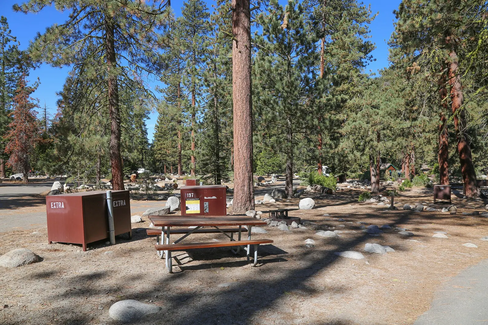
Campgrounds such as Lodgepole, Dorst Creek, those in Grant Grove and several around Cedar Grove suit families and hikers; many require reservations through Recreation.gov in season.
Three Rivers is the most convenient town for Sequoia's southern entrance and Mineral King, with motels, cabins and vacation rentals along the river, although the drive up to Giant Forest takes about an hour.
Where to stay in Sequoia and Kings Canyon National Parks
Lodgepole Where to stayInside the parks, lodges near Lodgepole and in Grant Grove Village, plus summer-only lodging in Cedar Grove, put you minutes from the trees and let you enjoy…Photo: Unknown authorUnknown author, Wikimedia Commons, Public domainGrant Grove Village Where to stayInside the parks, lodges near Lodgepole and in Grant Grove Village, plus summer-only lodging in Cedar Grove, put you minutes from the trees and let you enjoy…Photo: NPS photo, Wikimedia Commons, Public domainCedar Grove Where to stayInside the parks, lodges near Lodgepole and in Grant Grove Village, plus summer-only lodging in Cedar Grove, put you minutes from the trees and let you enjoy…Photo: NPS staff, Wikimedia Commons, Public domainGrant Grove Where to stayInside the parks, lodges near Lodgepole and in Grant Grove Village, plus summer-only lodging in Cedar Grove, put you minutes from the trees and let you enjoy…Photo: Marty Aligata, Wikimedia Commons, CC BY-SA 4.0
Ad
Best time to visit
Summer, from June to August, is the main season: all roads are normally open, high trails are clearing of snow and services operate fully.
Late spring brings the strongest waterfalls and wildflowers in the foothills, though snow can linger at higher levels into June.
Getting there and getting around
The parks can only be entered by road from the west. From Southern California, most visitors take Highway 198 through Visalia and Three Rivers to the Ash Mountain Entrance.
The Generals Highway links Giant Forest with Grant Grove, a drive of roughly an hour. The section between the Foothills and Giant Forest has many tight switchbacks, and the park advises against vehicles over about 22 feet on that stretch, so RVs and trailers should enter via Highway 180.
Ad
A suggested itinerary
First day
Enter early from Three Rivers, stop at the Foothills Visitor Center and Hospital Rock, then climb to the Giant Forest Museum.
Second day
Walk the Congress Trail in the cool of the morning, then hike to Tokopah Falls from Lodgepole.
Third day
Drive the Kings Canyon Scenic Byway to Cedar Grove with stops at Junction View and Roaring River Falls, then walk the Zumwalt Meadow loop, or start early for the hike to Mist Falls.
Practical tips
One entrance pass covers both parks for several consecutive days; check the official National Park Service website for current fees and any reservation requirements.
Store all food and scented items in bear lockers, and never leave them in a parked car.
Fill your tank before entering, since fuel is not sold in the parks.
Carry tire chains between late autumn and spring and check road status before driving.
Download offline maps; cell coverage is patchy at best.
Altitude is significant in the sequoia belt, so drink plenty of water and pace your walks.