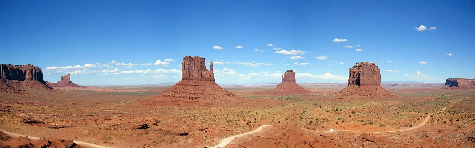
Few landscapes are as instantly recognizable as Monument Valley.
AT A GLANCE
Best time
March to May and September to October for mild days and clear light.
How long
At least one night; two lets you add a guided tour and nearby sights.
Getting there
Drive US Route 163 from Kayenta, Arizona, or from Mexican Hat, Utah.
Why visit Monument Valley
Monument Valley is the image many people carry of the American West. Director John Ford filmed Stagecoach here in 1939 and returned for The Searchers and other Westerns, and the valley has appeared in countless films, commercials and road trip photos since.
It is also a living homeland. Navajo families have lived in and around the valley for generations, raising sheep and horses, weaving and guiding visitors.
The geology is striking, too. The buttes are layered remnants of an ancient plateau, with soft shale at the base, a thick cliff of de Chelly Sandstone in the middle and a harder cap on top.
The visitor center and the Valley Drive
The visitor center and the Mittens
The tribal park's visitor center sits on a rise above the valley, with a long terrace facing West Mitten Butte, East Mitten Butte and Merrick Butte. This is the classic view, and it changes by the hour as shadows move across the rock.
Wildcat Trail
The only self-guided hiking trail in the park drops from near the visitor center onto the valley floor and loops around West Mitten Butte, roughly three miles round trip. It is the best way to feel the scale of the buttes on foot.
The Valley Drive
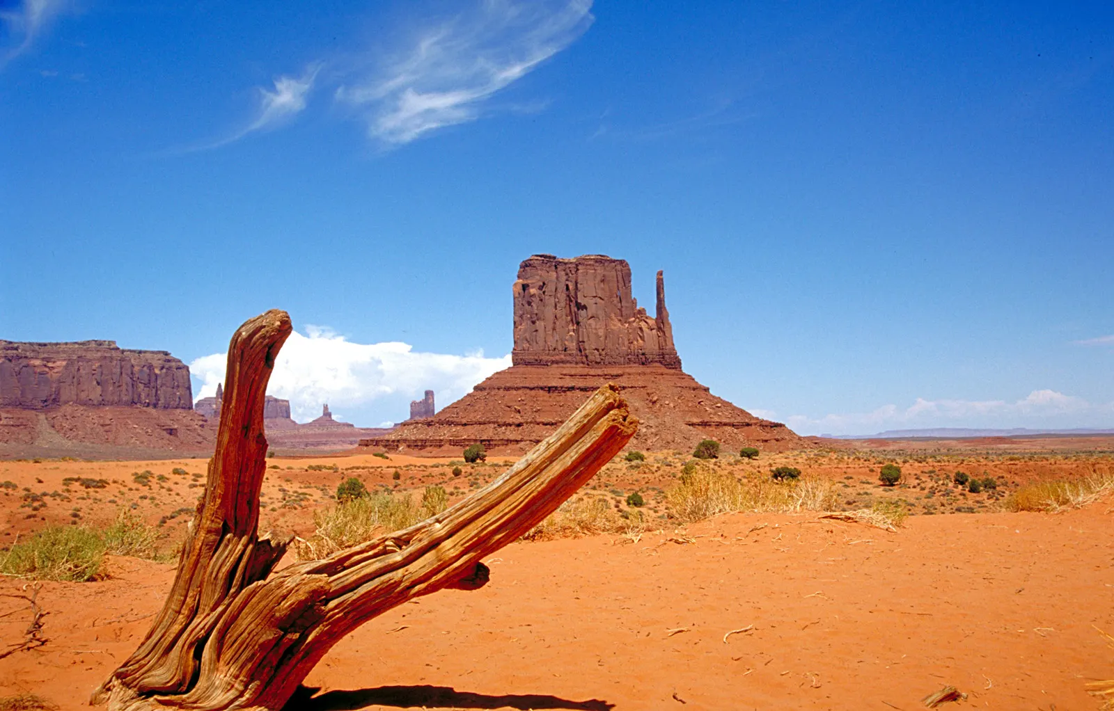
A seventeen-mile unpaved loop leaves from the visitor center and winds among the major formations, and it is the only part of the valley floor you may drive on your own. Stops include the Elephant Butte and Camel Butte viewpoints, the slender Three Sisters spires, and a series of overlooks deeper in the loop.
John Ford's Point
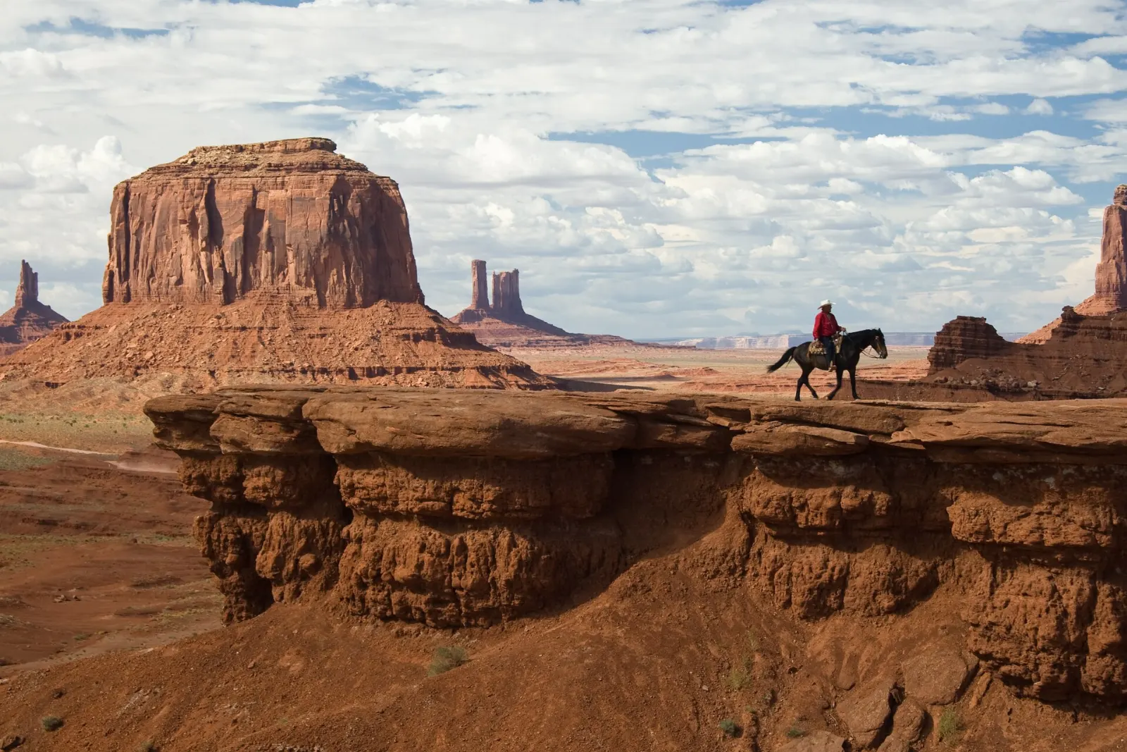
This rocky ledge is one of the most famous viewpoints in the valley, named for the director whose films made the landscape famous. A wide panorama of buttes spreads before you, and on many days a Navajo horseman waits on the point for photographs, usually for a tip.
Artist's Point and North Window
Farther along the loop, Artist's Point looks out over a broad sweep of the valley with distant mesas framing the view, while North Window is a gap between formations that frames the buttes back toward the Mittens. Both are quieter than the early stops.
The Totem Pole
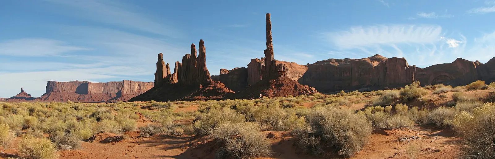
Near the southern end of the open drive, a viewpoint looks toward the Totem Pole, a remarkably thin spire, and the cluster of rocks beside it known as the Yei Bi Chei. Closer access lies in the restricted backcountry.
Guided backcountry tours
Navajo-guided valley tours
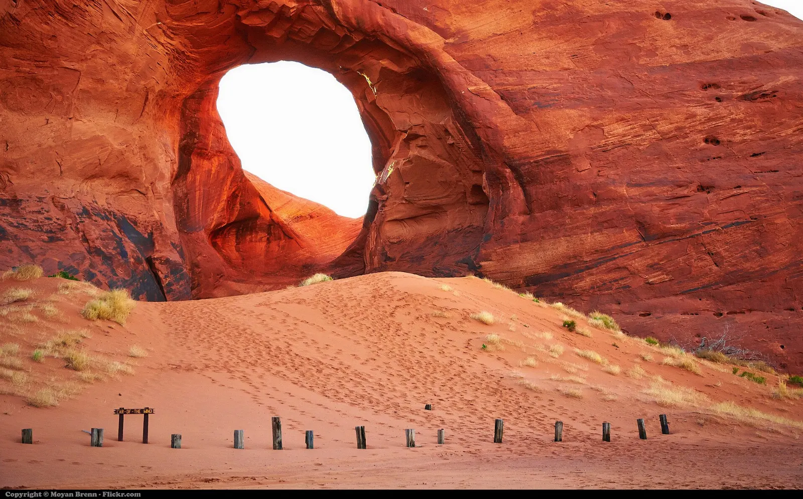
Most of the valley's backcountry can be entered only with an authorized Navajo guide. Tours run from about ninety minutes to a full day in open-air trucks, jeeps or on horseback, and the longer trips visit arches such as Ear of the Wind and Big Hogan, along with petroglyphs, sand dunes and areas around family homesteads.
Mystery Valley and Hunts Mesa
Mystery Valley, southwest of the main park, holds small arches, rock art and Ancestral Puebloan ruins tucked into alcoves, and is reached only on guided tours. Hunts Mesa, on the southern edge of the valley, offers one of the most celebrated high views over the formations, typically on guided sunrise trips or overnight outings.
Highway viewpoints and nearby sights
Forrest Gump Point
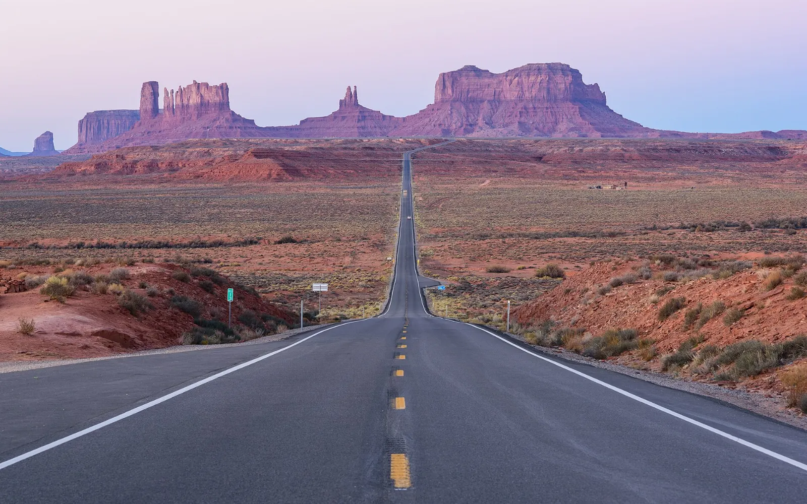
North of the valley on US Route 163 in Utah, the highway runs straight toward the buttes on the horizon. This is where Forrest Gump ended his famous cross-country run in the film, and the spot draws a steady stream of photographers.
Goulding's Trading Post Museum
West of the highway near the tribal park turnoff, the historic Goulding's trading post now holds a small museum.
Goosenecks State Park
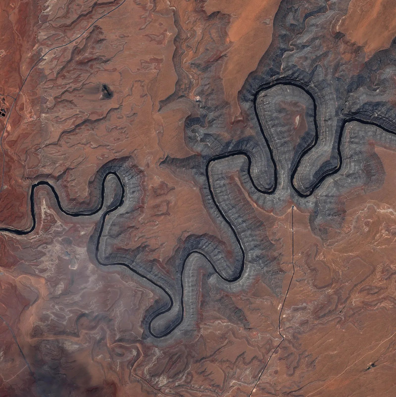
About half an hour north of the valley near the town of Mexican Hat, the San Juan River twists through a series of tight meanders carved more than a thousand feet into the rock.
Valley of the Gods and the Moki Dugway
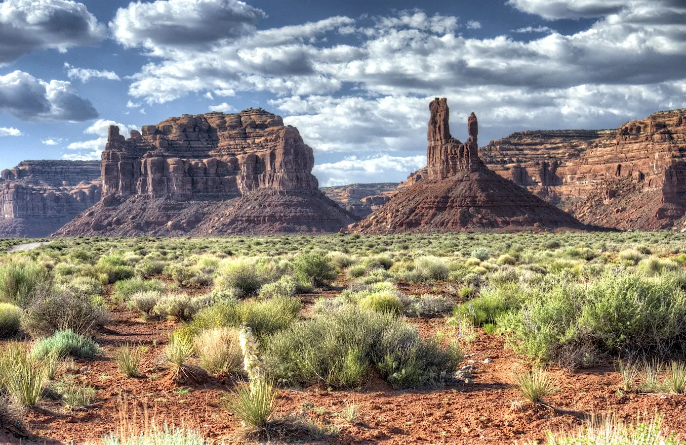
Just north of Mexican Hat, a seventeen-mile gravel road winds through the Valley of the Gods, a quieter cousin of Monument Valley with towers and buttes on public land. Its western end meets Utah State Route 261, which climbs Cedar Mesa on the Moki Dugway, a steep gravel section of tight switchbacks.
Navajo National Monument
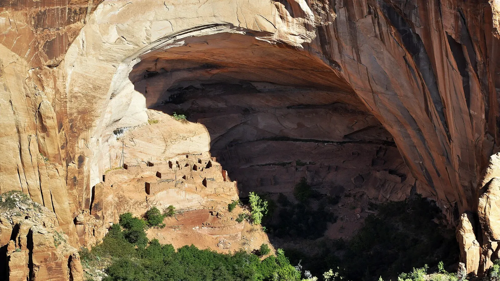
West of Kayenta, this small National Park Service site protects Ancestral Puebloan cliff dwellings. An easy paved trail leads to an overlook facing Betatakin, a village built into an enormous alcove in a canyon wall, and ranger-led hikes to the dwellings are offered seasonally.
 Planning a trip to Monument Valley?Compare hotels, flights and vacation rentals for Monument Valley on Expedia.Book now
Food and local flavors
Dining options are limited, so plan meals ahead.
Kayenta has the area's largest grocery store and several fast food outlets, and Mexican Hat and Bluff in Utah have a few cafes.
Popular dishes to try in Monument Valley


Where to stay
Inside the tribal park, the lodge, cabins and campground near the visitor center face the Mittens directly.
Goulding's and Oljato, just west of the park entrance, offer a lodge, a campground and services with views of the surrounding cliffs, and they suit travelers who want easy access with a few more amenities.
Kayenta, about twenty-five miles south, has chain hotels, restaurants and a grocery store.
Mexican Hat and Bluff in Utah are small towns to the north and northeast with motels and a few inns, good for combining the valley with Goosenecks, Valley of the Gods and the canyon country beyond.
Where to stay in Monument Valley


Best time to visit
The valley sits at around five thousand feet, so it avoids the worst desert heat. Spring and fall are the most comfortable seasons, with warm days and cool nights.
Light matters more than season here. Plan to be on the visitor center terrace or the Valley Drive at sunrise and sunset, when the buttes turn deep red and long shadows stretch across the sand.
Getting there and getting around
You need a car. The tribal park turnoff is on US Route 163, which runs north from Kayenta, Arizona, through the valley to Mexican Hat, Utah.
The tribal park charges its own entry fee, and national park passes are not accepted; check the official website for current fees.
A suggested itinerary
First day
Arrive in the afternoon via Kayenta or Mexican Hat and stop at Forrest Gump Point if you are coming from the north.
Second day
Rise for sunrise behind the Mittens, then hike the Wildcat Trail before the heat builds. Spend the late morning on a Navajo-guided backcountry tour to see arches and rock art, then visit Goulding's Trading Post Museum in the afternoon and stay out for the stars.
Third day
Head north to Goosenecks State Park, drive the Valley of the Gods loop and, if your vehicle is suitable, climb the Moki Dugway for the view from the top.
Practical tips
- Book lodging inside or near the park months ahead for spring and fall.
- Ask permission before photographing Navajo people, homes or livestock, and offer a tip when appropriate.
- Do not climb on formations or enter restricted areas without a guide; the valley is sacred to the Navajo.
- Drones are not allowed without tribal permits, so leave yours packed.
- Carry plenty of water, sunscreen and a hat, and protect cameras from fine red dust.
- Fill your fuel tank in Kayenta, Mexican Hat or Bluff, since stations are few and far apart.
Find local businesses in Kayenta on WiserMap
Kayenta is the main gateway town for Monument Valley.