WiserMap — Choose wisely. Connect locally.Choose wisely. Connect locally.Add your business
Page (Horseshoe Bend and Antelope Canyon), Arizona · Travel guide

Page Arizona Horseshoe Bend Antelope Canyon and Lake Powell

Page sits on a mesa above the Colorado River in northern Arizona, a small town surrounded by some of the most photographed landscapes in the American Southwest.

By WiserMap TravelUpdated October 2026 8 places10 min read
FacebookXLinkedIn

Page was founded in the late 1950s as a camp for workers building the dam, and it still has the feel of a practical, friendly base town. This guide explains how to see its highlights, including how to book Antelope Canyon properly with Navajo-authorized tour operators, when to go, where to stay and how to plan two or three days in the area.

At a glance Page (Horseshoe Bend and Antelope Canyon)
  1. Best timeSpring and autumn for mild weather; summer for the famous light beams in Upper Antelope Canyon.
  2. How longTwo days for the highlights, three or more with time on Lake Powell.
  3. Getting thereAbout four and a half hours by car from Phoenix or Las Vegas on scenic highways.

Why visit Page

The landscape around Page is built from Navajo Sandstone, ancient dunes turned to stone and then sculpted by water. The Colorado River cut down through this rock as the region was uplifted over millions of years, creating Glen Canyon, the tight meanders of Horseshoe Bend and, farther downstream, the Grand Canyon itself.

Page also sits at a cultural crossroads. The town borders the Navajo Nation, and Antelope Canyon lies on Navajo land as part of Lake Powell Navajo Tribal Park, so visiting is an opportunity to learn from Navajo guides about the canyon and the land around it.

Horseshoe Bend and the slot canyons

The two sights that put Page on the map are a few miles apart, and many visitors see both on the same day. Antelope Canyon requires advance planning; Horseshoe Bend simply requires good timing.

Horseshoe Bend

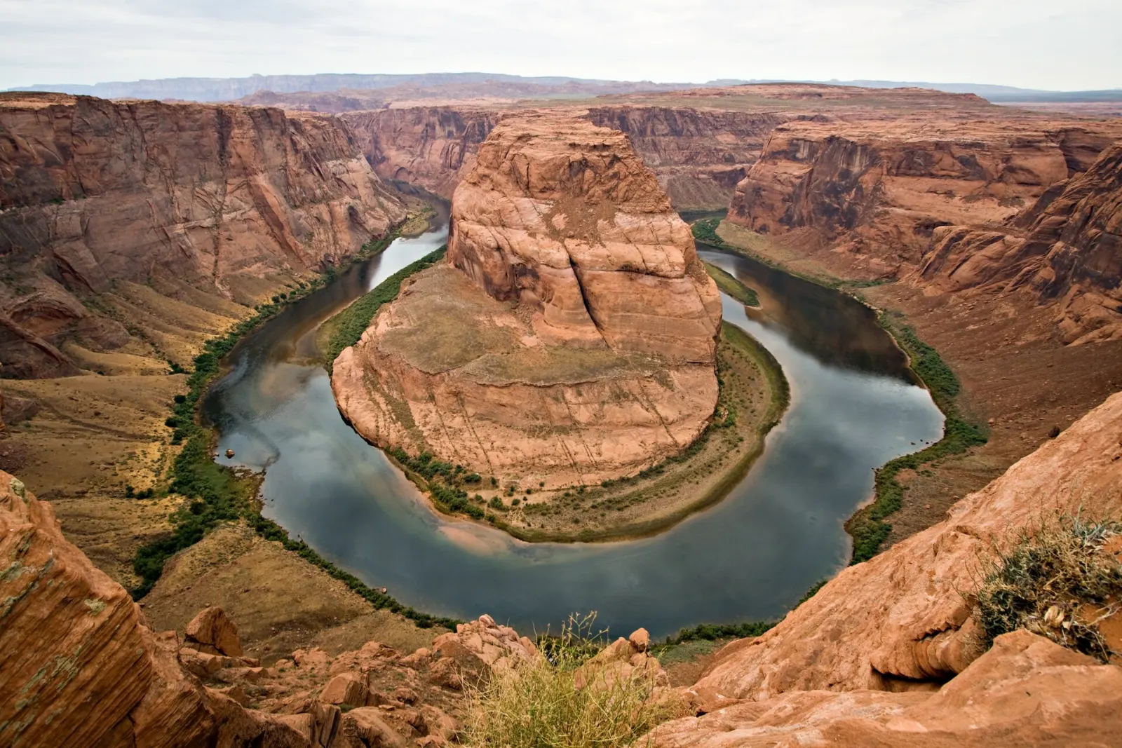
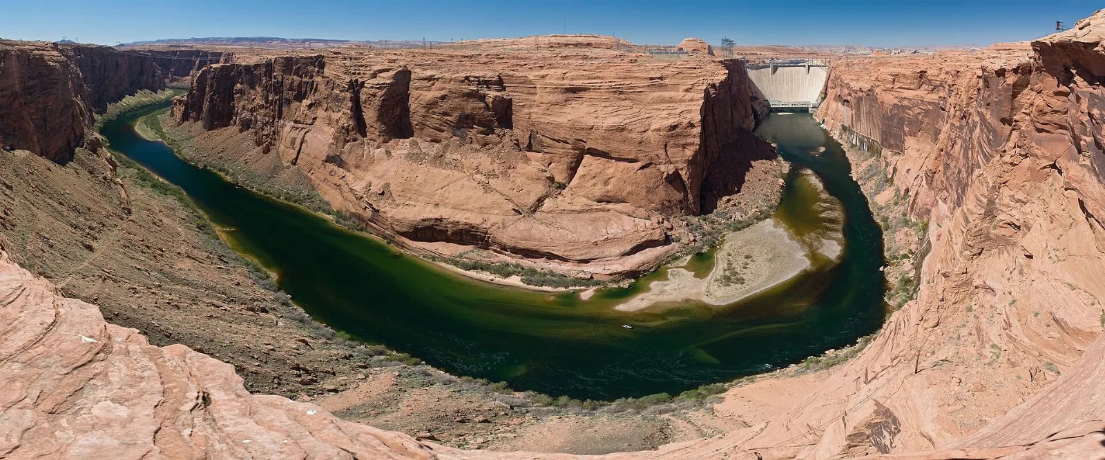
Just south of town off U.S. Route 89, a trail of about one and a half miles round trip leads from a parking area to an overlook above a dramatic loop of the Colorado River. The river lies roughly a thousand feet below the rim, wrapping around a sandstone butte in a near-perfect horseshoe.

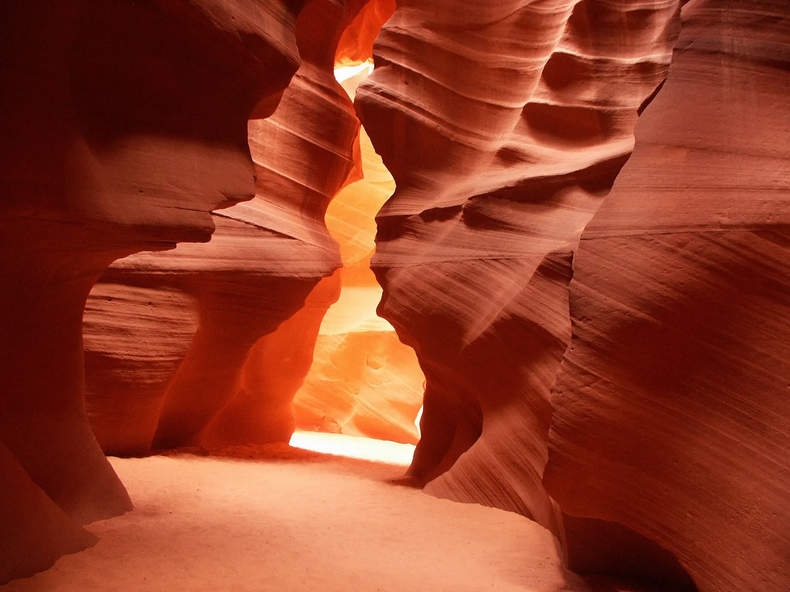
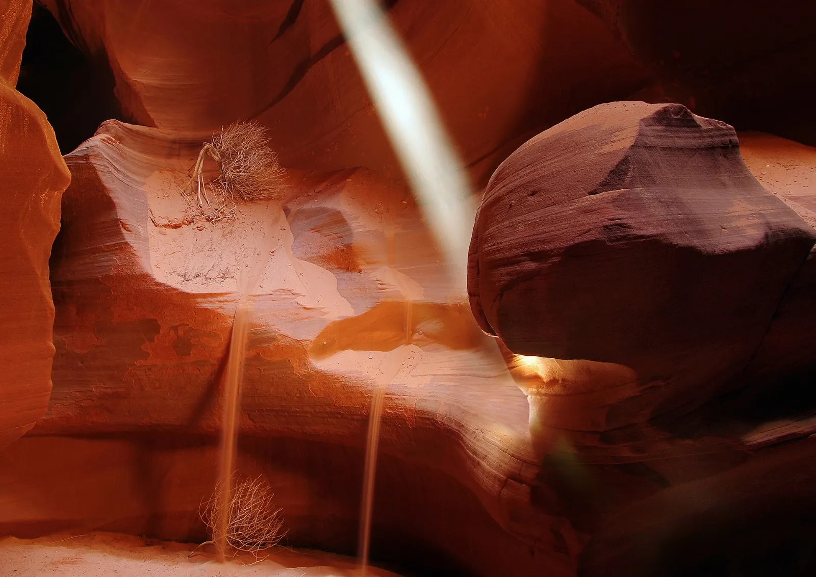
A shaft of sunlight falling into the curved orange walls of Upper Antelope Canyon, Page (Horseshoe Bend and Antelope Canyon), Arizona

Upper Antelope Canyon

Known in Navajo by a name often translated as the place where water runs through rocks, Upper Antelope Canyon is the most visited slot. Its entrance is at ground level and the walk is fairly flat and sandy, making it the easier option for most people.

Beams of sunlight reach the floor of Upper Antelope Canyon around midday in the warmer months. Photo: Mferbfriske, Wikimedia Commons, CC BY-SA 2.0
Narrow, twisting sandstone walls glowing orange and purple inside Lower Antelope Canyon, Page (Horseshoe Bend and Antelope Canyon), Arizona

Lower Antelope Canyon

Lower Antelope Canyon, sometimes called the Corkscrew, is longer and narrower, with a series of steep metal staircases bolted into the rock to help you descend and climb out. The walls twist and fold in deep oranges, reds and purples, and the light is good through much of the day.

Lower Antelope Canyon is a narrow slot carved into Navajo Sandstone by flash floods. Photo: Uploaded by Meckimac, Wikimedia Commons, CC BY-SA 3.0

Visiting Antelope Canyon responsibly

Antelope Canyon can only be visited on a guided tour with an operator authorized by the Navajo Nation; you cannot enter on your own. Guided access became standard after a flash flood in August 1997 killed eleven visitors in Lower Antelope Canyon, triggered by a storm miles upstream while very little rain fell at the canyon itself.

Kayaks on calm water between tall sandstone walls at the flooded end of Antelope Canyon, Page (Horseshoe Bend and Antelope Canyon), Arizona

Antelope Canyon from the water

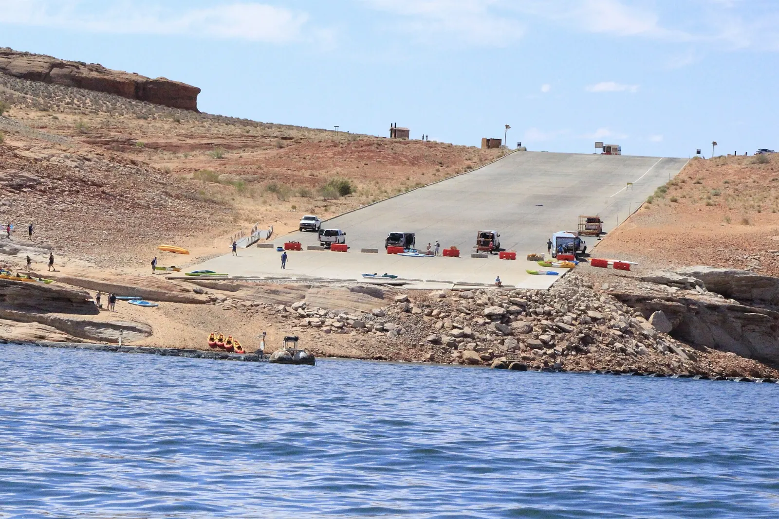
Where Antelope Canyon reaches Lake Powell, the canyon floor slips under the water. From Antelope Point you can paddle a kayak or paddleboard into the flooded canyon between tall walls, then, depending on water levels, beach your craft and continue on foot.

The lower end of Antelope Canyon meets Lake Powell and can be explored by kayak. Photo: NPS, Wikimedia Commons, Public domain

Glen Canyon Dam and Lake Powell

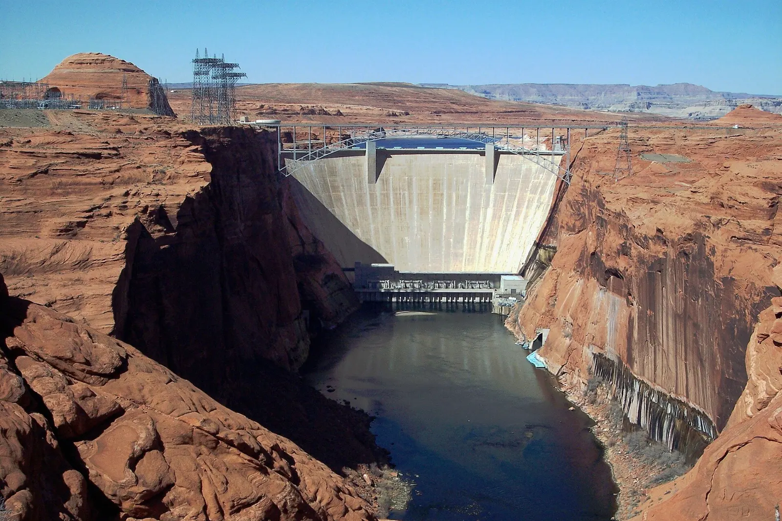
The curved concrete Glen Canyon Dam holding back Lake Powell between canyon walls, Page (Horseshoe Bend and Antelope Canyon), Arizona

Glen Canyon Dam and the Carl Hayden Visitor Center

Completed in the 1960s, Glen Canyon Dam rises in a smooth concrete curve between sandstone walls just outside town. The Carl Hayden Visitor Center beside the dam has exhibits on the dam's construction, the river and the region's geology, along with big windows facing the structure.

Glen Canyon Dam on the Colorado River created Lake Powell, one of the largest reservoirs in the United States. Photo: Christian Mehlführer, User:Chmehl, Wikimedia Commons, CC BY 2.5

A steel arch bridge spanning a deep sandstone canyon beside Glen Canyon Dam, Page (Horseshoe Bend and Antelope Canyon), Arizona

Glen Canyon Dam Overlook and Glen Canyon Bridge

For a free view of the dam from below, drive to the Glen Canyon Dam Overlook at the end of a short road off Scenic View Drive, where a brief walk leads to a ledge looking up at the dam and down at the river.

Glen Canyon Bridge carries U.S. Route 89 high above the Colorado River just below the dam. Photo: Adbar, Wikimedia Commons, CC BY-SA 3.0

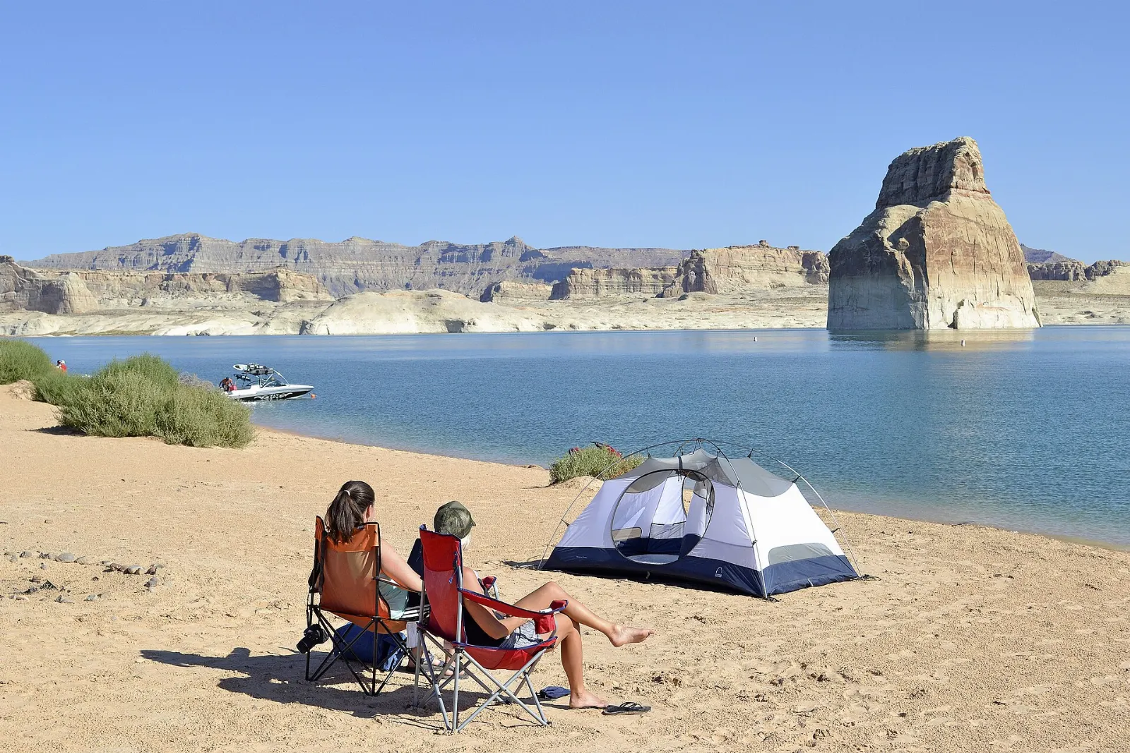
A solitary sandstone butte rising out of Lake Powell near a sandy shoreline, Page (Horseshoe Bend and Antelope Canyon), Arizona

Lake Powell, Wahweap and Lone Rock

The dam holds back Lake Powell, which stretches far into Utah through flooded side canyons. Near Page, Wahweap Marina and Antelope Point offer boat rentals, tours and swimming.

Lone Rock stands in Wahweap Bay on the Utah side of Lake Powell. Photo: NPS Photo/Peter Krocek, Wikimedia Commons, Public domain

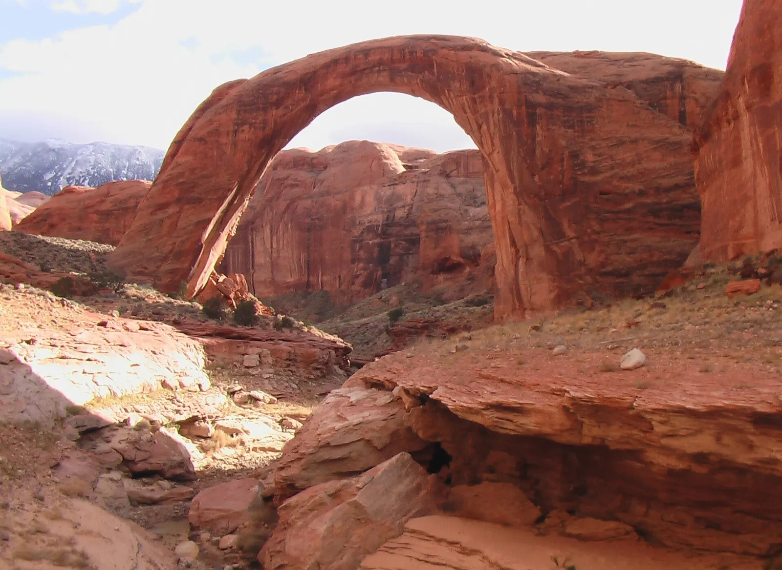
A massive natural sandstone arch spanning a desert canyon, Page (Horseshoe Bend and Antelope Canyon), Arizona

Rainbow Bridge National Monument

One of the largest natural bridges in the world, Rainbow Bridge is a sacred place for several Native American peoples and lies in a remote side canyon of Lake Powell.

Rainbow Bridge is one of the largest known natural bridges in the world. Photo: Jason Hickey, Wikimedia Commons, CC BY 2.0

Rimview Trail and the Hanging Garden

For an easy walk without crowds, the Rimview Trail loops around the edge of the mesa on which Page sits, with views of Lake Powell, the Navajo Mountain skyline and the desert below. Short sections make a good sunset stroll.

Food and local flavors

Page's dining scene is casual and road-trip friendly, with most restaurants along Lake Powell Boulevard and in the small downtown blocks around it.

Look out for Navajo fry bread, a puffy fried dough served with honey and powdered sugar or topped with beans, meat, lettuce and cheese as a Navajo taco.

Popular dishes to try in Page (Horseshoe Bend and Antelope Canyon)

Navajo taco in Page (Horseshoe Bend and Antelope Canyon), Arizona
Navajo taco Look out for Navajo fry bread, a puffy fried dough served with honey and powdered sugar or topped with beans, meat, lettuce and cheese as a Navajo taco.Photo: Alan Levine, Wikimedia Commons, CC BY 2.0
Fry bread in Page (Horseshoe Bend and Antelope Canyon), Arizona
Fry bread Look out for Navajo fry bread, a puffy fried dough served with honey and powdered sugar or topped with beans, meat, lettuce and cheese as a Navajo taco.Photo: Gaurav Dhwaj Khadka, Wikimedia Commons, CC BY-SA 4.0
Burger in Page (Horseshoe Bend and Antelope Canyon), Arizona
Burger You will find barbecue and smokehouse grills, Mexican and Southwestern dishes, diners serving hearty breakfasts, pizza, burgers and a few Asian restaurants.Photo: Luke, Wikimedia Commons, Public domain
Barbecue in Page (Horseshoe Bend and Antelope Canyon), Arizona
Barbecue You will find barbecue and smokehouse grills, Mexican and Southwestern dishes, diners serving hearty breakfasts, pizza, burgers and a few Asian restaurants.Photo: Razvan Socol, Wikimedia Commons, CC BY-SA 3.0

Where to stay

Most visitors stay in Page itself, where motels and hotels line Lake Powell Boulevard and the streets near it.

For a lakeside stay, Wahweap and Lake Powell's marinas offer resort lodging and campgrounds near the water, and some travelers rent houseboats for several days on the lake. Campers can also choose Lone Rock Beach for primitive shoreline camping.

Where to stay in Page (Horseshoe Bend and Antelope Canyon)

Horseshoe Bend, Page (Horseshoe Bend and Antelope Canyon), Arizona
Horseshoe Bend Staying in town puts you within a few minutes of Horseshoe Bend, the Antelope Canyon tour offices and the dam, which matters when tours start early.Photo: Frank Stickel, Wikimedia Commons, CC BY-SA 3.0
Marble Canyon, Page (Horseshoe Bend and Antelope Canyon), Arizona
Marble Canyon Further south, the small settlement at Marble Canyon near Lees Ferry has limited lodging and is popular with anglers and river runners.Photo: Chris Woodrich, Wikimedia Commons, CC BY-SA 4.0
Lees Ferry, Page (Horseshoe Bend and Antelope Canyon), Arizona
Lees Ferry Further south, the small settlement at Marble Canyon near Lees Ferry has limited lodging and is popular with anglers and river runners.Photo: Tiggr222, Wikimedia Commons, CC BY-SA 4.0

Best time to visit

Spring, from March to May, and autumn, from September to October, bring the most comfortable temperatures for walking to Horseshoe Bend and exploring around town.

Winter is quiet and crisp, with cold nights and occasional snow, but it is a peaceful time to see Horseshoe Bend and the slot canyons with fewer people, and the softer light inside the canyons suits photography.

Getting there and getting around

Page is a driving destination. It lies about four and a half hours north of Phoenix and a similar distance east of Las Vegas, making it a natural stop on loops that include the Grand Canyon, Zion, Bryce Canyon and Monument Valley.

You need a car to get around, since public transport is minimal. Distances between sights are short, and most tour companies collect you at their offices in town or near the canyon entrances.

A suggested itinerary

First day

Walk to Horseshoe Bend at sunrise, then take a late-morning or midday tour of Upper Antelope Canyon.

Second day

Tour Lower Antelope Canyon or Canyon X in the morning, then spend the afternoon on Lake Powell, swimming at Lone Rock Beach or joining a boat tour from Wahweap.

Twin steel arch bridges spanning the deep gorge of Marble Canyon, Page (Horseshoe Bend and Antelope Canyon), Arizona

Third day

Paddle into the flooded end of Antelope Canyon from Antelope Point, then drive south to Marble Canyon.

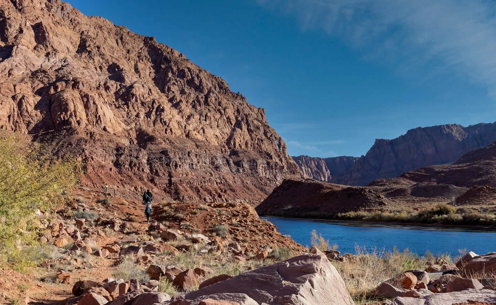
At Lees Ferry, explore the historic buildings and the riverbank, where the cold, clear Colorado flows beneath tall red cliffs.

The Navajo Bridges cross Marble Canyon near Lees Ferry, south of Page. Photo: Ray Redstone, Wikimedia Commons, CC BY-SA 4.0

The Colorado River flowing past red cliffs at Lees Ferry, Page (Horseshoe Bend and Antelope Canyon), Arizona
Lees Ferry is the traditional starting point for river trips through the Grand Canyon.Photo: Ray Redstone, Wikimedia Commons, CC BY-SA 4.0

Practical tips

  • Book Antelope Canyon only with Navajo-authorized tour operators, and reserve weeks ahead in spring and summer.
  • Confirm whether your tour time follows Arizona time or Navajo Nation daylight time.
  • Carry plenty of water and sun protection on the Horseshoe Bend trail, especially in summer.
  • Stay back from unfenced cliff edges at Horseshoe Bend; drone flying is restricted, so check the rules first.
  • Expect strict bag rules in the slot canyons; carry only a phone or camera and water if allowed.
  • Monsoon storms can close the canyons with little notice, so keep your schedule flexible.

Find local businesses in Page on WiserMap

Planning your visit to Horseshoe Bend and Antelope Canyon?

Explore local businesses

Page (Horseshoe Bend and Antelope Canyon)WISERMAP PLACEPage (Horseshoe Bend and Antelope Canyon): photos, reviews & things to doSee traveler photos and reviews, or share your own →

More places to visit

All travel guides →