WiserMap — Choose wisely. Connect locally.Choose wisely. Connect locally.Add your business
Golden Circle, Iceland · Travel guide

Golden Circle Iceland Thingvellir Geysir and Gullfoss

The Golden Circle is a loop of roughly three hundred kilometres that runs from Reykjavik into the southern uplands of Iceland and back.

By WiserMap TravelUpdated October 2026 9 places10 min read
FacebookXLinkedIn

Most people race through it in a single day on a tour bus. If you drive yourself and give it more time, you can add a volcanic crater lake, a historic bishopric, a string of blue waterfalls, geothermal bathing pools and greenhouse lunches.

At a glance Golden Circle
  1. Best timeJune to August for long days and open trails; September to March for northern lights and snow.
  2. How longOne full day for the main sights; two days to add pools, waterfalls and Kerid at an easy pace.
  3. Getting thereFly into Keflavik, then drive from Reykjavik; Thingvellir is about forty kilometres northeast of the city.

Why visit the Golden Circle

Few short drives anywhere pack in this much geology and history. At Thingvellir you walk along the exposed edge of the North American plate in a rift valley on the crest of the Mid-Atlantic Ridge.

The route also tells Iceland's story. Thingvellir was the site of the Althing, the national assembly, from 930 until 1798, and it remains a place of deep national meaning; it was declared a national park in 1930 and became a UNESCO World Heritage Site in 2004. Skalholt was a centre of church and learning for centuries.

Thingvellir National Park

Most drivers start the loop here, coming in from Reykjavik on Route 36. The park lies in a rift valley with Thingvallavatn, Iceland's largest natural lake, to the south.

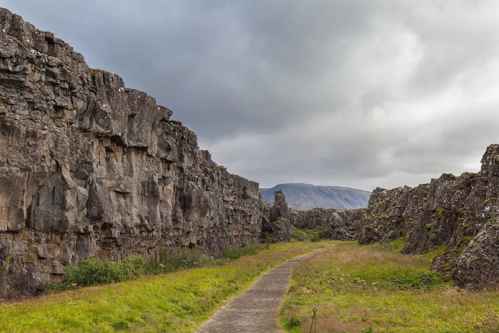
Path running between high basalt walls in the Almannagja gorge at Thingvellir, Golden Circle, Iceland

Almannagja gorge and the Law Rock

From the Hakid visitor centre at the top of the escarpment, a viewing platform looks across the whole valley before a path drops into Almannagja, a long gorge between a towering rock wall and a lower ridge.

The Almannagja gorge marks the edge of the North American plate in Thingvellir National Park. Photo: Diego Delso, Wikimedia Commons, CC BY-SA 4.0
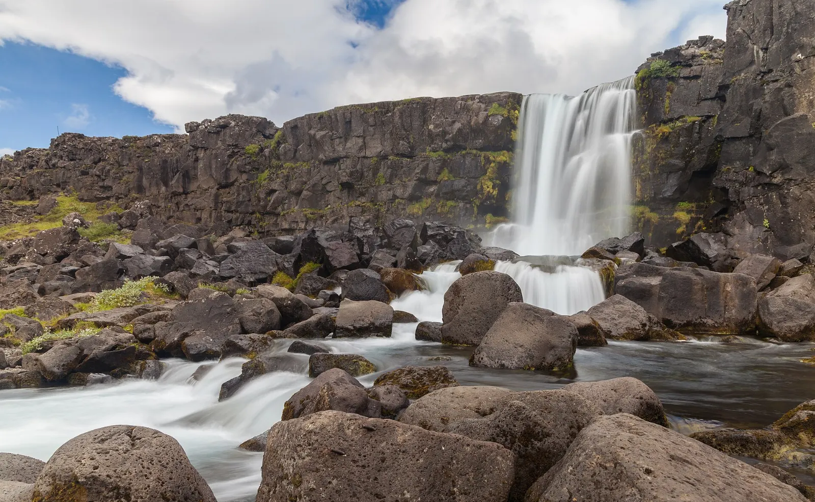
The Oxarar river spilling over a dark cliff into the rift at Oxararfoss, Golden Circle, Iceland

Oxararfoss waterfall

A short walk north from the main path brings you to Oxararfoss, where the Oxara river spills over the rift wall into the valley. It is not the tallest waterfall in Iceland, but the setting, with the fall dropping between dark cliffs of the fault, is striking.

Oxararfoss waterfall pours over the wall of the Almannagja fault into the Thingvellir valley. Photo: Diego Delso, Wikimedia Commons, CC BY-SA 4.0
Thingvellir church and the old assembly site

Across the river, the small white Thingvallakirkja and the old farmhouse beside it sit on the plain where the assembly once camped. The ground here is scattered with the turf-and-stone remains of booths used by chieftains during the annual gathering.

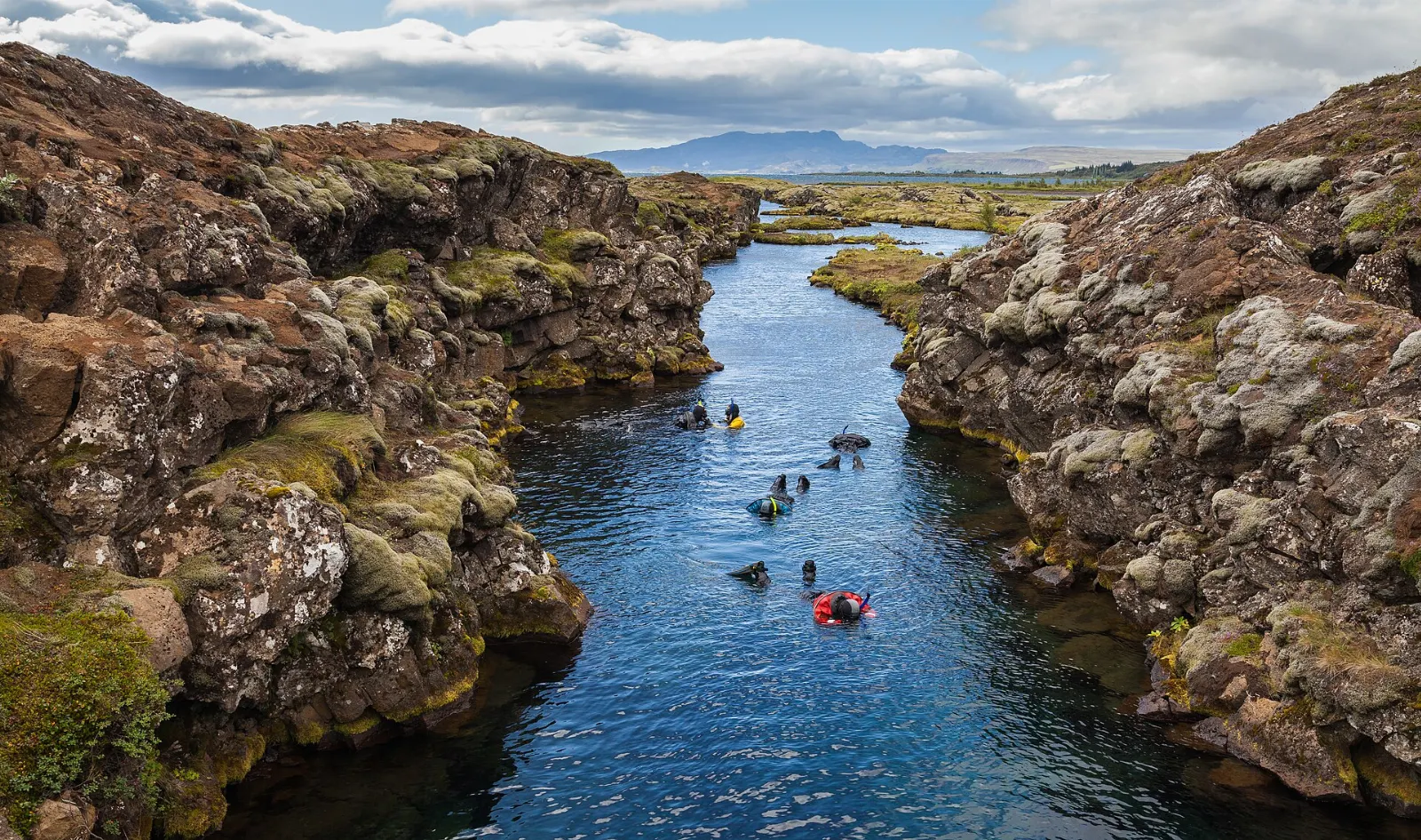
Clear blue water over rocks in the Silfra fissure at Thingvellir, Golden Circle, Iceland

Silfra fissure

At the lake's northern shore, Silfra is a water-filled crack between the plates, fed by groundwater that has filtered through porous lava for decades after melting from the Langjokull glacier.

Silfra is a water-filled fissure fed by filtered glacial groundwater at the edge of Thingvallavatn. Photo: Diego Delso, Wikimedia Commons, CC BY-SA 4.0
Geysir, Gullfoss and the upper valley

From Thingvellir, the road crosses heath and passes the lake town of Laugarvatn before reaching the Haukadalur valley. Gullfoss lies about ten kilometres further up the road.

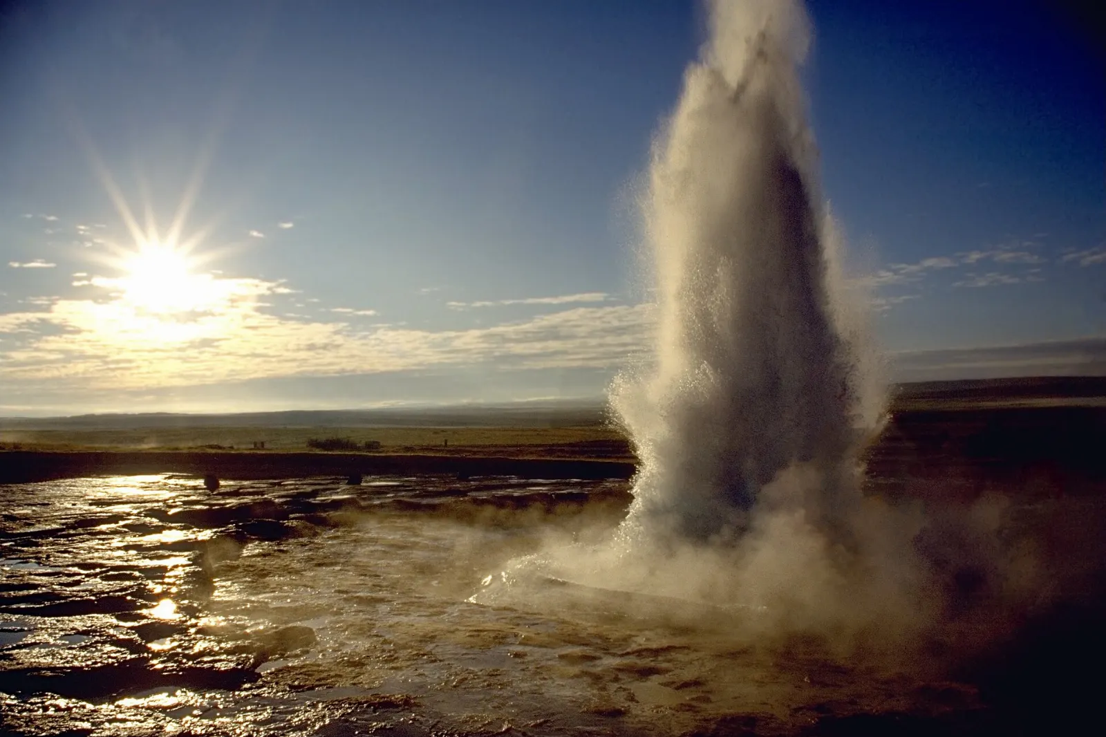
Strokkur geyser shooting a column of boiling water and steam into the air, Golden Circle, Iceland

Haukadalur geothermal area: Geysir and Strokkur

The great Geysir, the spring that gave the English word geyser its name, is mostly dormant today. Its neighbour Strokkur, about fifty metres away, is the star: it erupts every few minutes, usually to fifteen or twenty metres and sometimes higher.

Strokkur in the Haukadalur geothermal area erupts every few minutes, usually to fifteen to twenty metres. Photo: Andreas Tille, Wikimedia Commons, CC BY-SA 3.0

Gullfoss

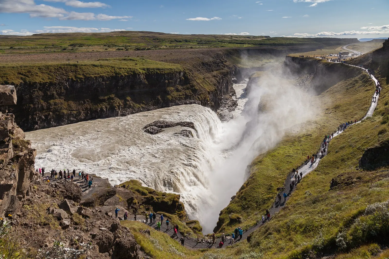
At Gullfoss, the Hvita river turns sharply, flows down a wide three-step staircase and then plunges in two stages into a narrow canyon about thirty-two metres deep.

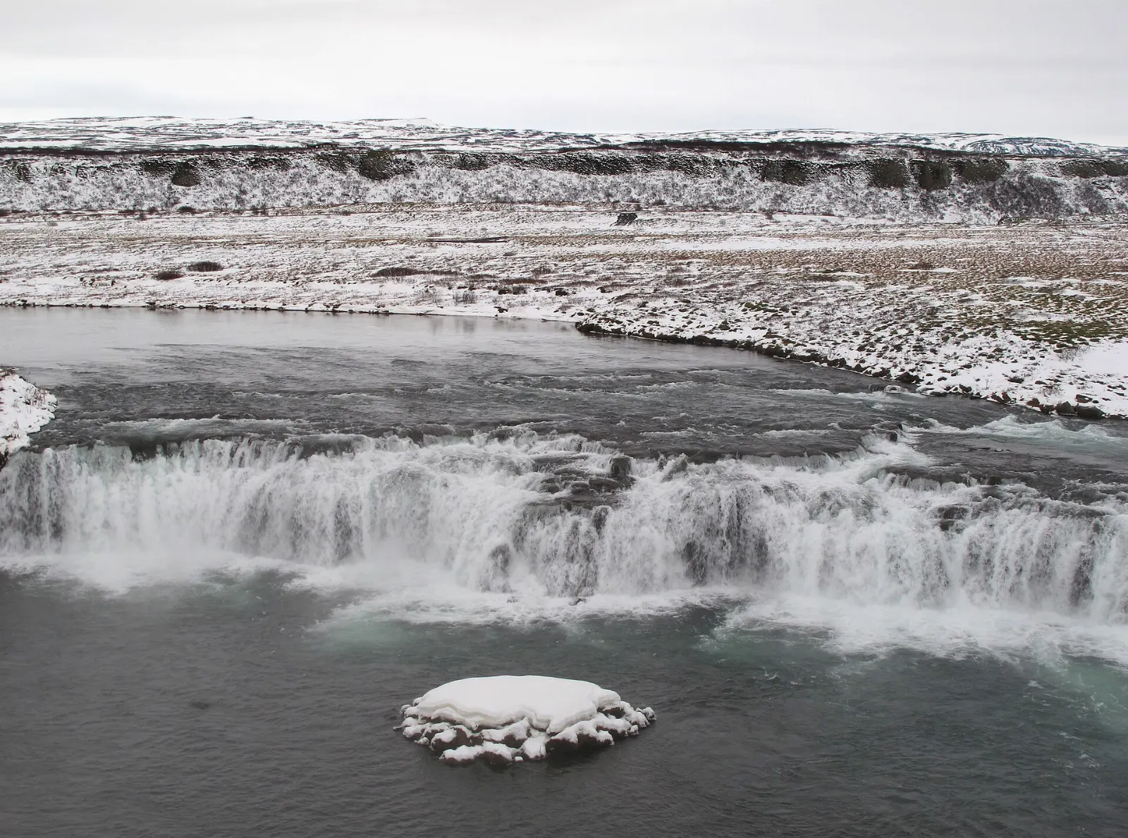
Wide low waterfall at Faxi on the Tungufljot river with a salmon ladder beside it, Golden Circle, Iceland

Faxi waterfall

On the way south from Geysir, a short side road leads to Faxi, also called Vatnsleysufoss, a broad waterfall on the Tungufljot river with a salmon ladder alongside. It is quieter than the headline stops and pleasant for a fifteen-minute break; a small parking fee may apply.

Faxi, also called Vatnsleysufoss, is a broad waterfall on the Tungufljot river. Photo: Acediscovery, Wikimedia Commons, CC BY 4.0

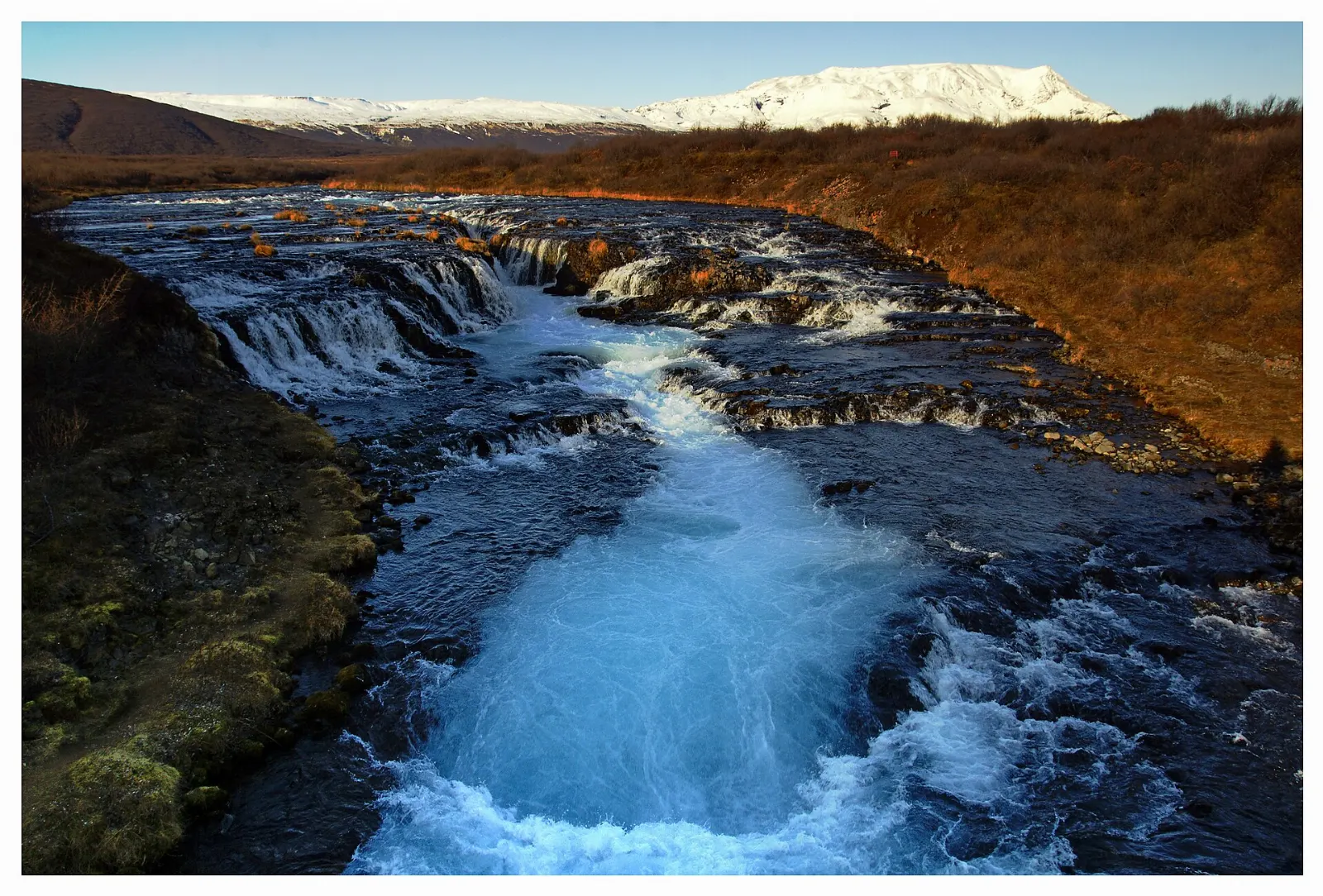
Bright blue glacial water rushing through a split in the rock at Bruarfoss, Golden Circle, Iceland

Bruarfoss

Bruarfoss is famous for the startling blue of the Bruara river as it pours into a split in the rock. Reach it from the designated parking area and follow the signed path along the river; do not park along the summer-house roads, where access is restricted.

Bruarfoss is known for the vivid blue water of the Bruara river. Photo: Milan Nykodym from Kutna Hora, Czech Republic, Wikimedia Commons, CC BY-SA 2.0

Craters, churches and hot springs on the return

White Skalholt cathedral with its tower standing in green farmland, Golden Circle, Iceland

Skalholt

On the road back toward Selfoss, Skalholt was one of Iceland's two episcopal sees from 1056 until 1785 and the site of the country's first school. The present church, built in the twentieth century, has fine modern stained glass, and an underground passage leads to a small exhibition about the old bishopric.

Skalholt was one of Iceland's two bishoprics from 1056 until 1785. Photo: Diego Delso, Wikimedia Commons, CC BY-SA 4.0
Aquamarine lake inside the red volcanic crater of Kerid, Golden Circle, Iceland

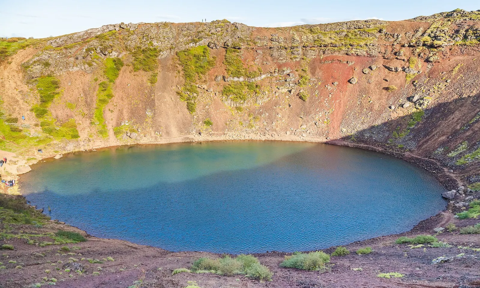
Kerid crater

In the Grimsnes area, Kerid is a volcanic crater about fifty-five metres deep and two hundred and seventy metres across, its red and black scoria walls dropping to a shallow aquamarine lake.

Kerid is a volcanic crater about fifty-five metres deep with a shallow aquamarine lake at its base. Photo: Diego Delso, Wikimedia Commons, CC BY-SA 4.0

Laugarvatn, Fludir and the bathing pools

The small lake town of Laugarvatn has geothermal springs under the lake, and its lakeside spa offers warm pools, steam rooms and a chance to dip in the lake itself; staff often demonstrate rye bread baked in the hot ground.

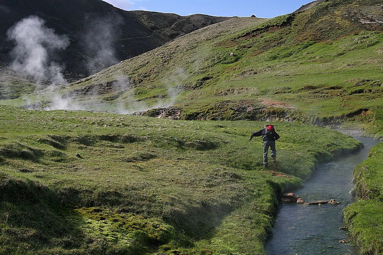
Steaming warm stream winding through a green valley with wooden boardwalks at Reykjadalur, Golden Circle, Iceland

Hveragerdi and Reykjadalur

On Route 1 about forty-five kilometres east of Reykjavik, Hveragerdi is a greenhouse town heated by volcanic springs, with steaming vents even in the town park.

The warm stream in Reykjadalur valley above Hveragerdi is a popular place to bathe after a hike. Photo: Guillaume Baviere from Uppsala, Sweden, Wikimedia Commons, CC BY 2.0

Food and local flavors

The Golden Circle runs through some of Iceland's richest farmland, and the food reflects it.

Geothermal greenhouses produce tomatoes, cucumbers and peppers year-round. The best-known stop is Fridheimar in Reykholt, a working tomato greenhouse where you eat tomato soup and fresh bread among the vines; reservations are strongly recommended.

Popular dishes to try in Golden Circle

Skyr in Golden Circle, Iceland
Skyr Look for kjotsupa, a hearty soup of Icelandic lamb with root vegetables, and for skyr, the thick cultured dairy that is eaten plain, with berries or in desserts.Photo: Xfigpower, Wikimedia Commons, CC BY-SA 3.0
Tomato soup in Golden Circle, Iceland
Tomato soup The best-known stop is Fridheimar in Reykholt, a working tomato greenhouse where you eat tomato soup and fresh bread among the vines; reservations are strongly recommended.Photo: William Stadtwald Demchick, Wikimedia Commons, CC BY 3.0
Hot dog in Golden Circle, Iceland
Hot dog Petrol station cafes along the route serve the Icelandic hot dog, a quick, cheap lunch for drivers.Photo: Tim Lindenschmidt, Wikimedia Commons, Public domain

Where to stay

Reykjavik is the easiest base for a single-day loop, with the widest choice of accommodation, restaurants and tours. It suits first-time visitors and anyone without a car who will join a coach tour.

To slow down, spend a night inside the loop. Laugarvatn suits travellers who want lakeside quiet and early access to Thingvellir and Geysir. The Fludir and Reykholt area has guesthouses, cabins and farm stays close to the hot spring pools and greenhouses, and is good for families.

Where to stay in Golden Circle

Thingvellir, Golden Circle, Iceland
Thingvellir Laugarvatn suits travellers who want lakeside quiet and early access to Thingvellir and Geysir.Photo: Almir de Freitas from São Paulo, Brasil, Wikimedia Commons, CC BY 2.0
Geysir, Golden Circle, Iceland
Geysir Laugarvatn suits travellers who want lakeside quiet and early access to Thingvellir and Geysir.Photo: Nick Argyle nickargyle, Wikimedia Commons, CC0
Reykholt, Golden Circle, Iceland
Reykholt The Fludir and Reykholt area has guesthouses, cabins and farm stays close to the hot spring pools and greenhouses, and is good for families.Photo: Steinninn, Wikimedia Commons, CC BY 4.0
Golden Circle old town, Golden Circle, Iceland
Golden Circle old town One of the best areas to base yourself in Golden Circle.Photo: Charles O'Rear, Wikimedia Commons, Public domain

Best time to visit

June to August brings long days, with near round-the-clock light around the solstice, green landscapes and the mildest weather, though it is rarely hot.

September and October offer autumn colour, fewer visitors and the return of dark skies for the northern lights.

Getting there and getting around

International flights land at Keflavik Airport, about fifty minutes from Reykjavik by road. The classic loop runs from Reykjavik on Route 1 and Route 36 to Thingvellir, east via Route 365 past Laugarvatn, then on Route 37 and Route 35 to Geysir and Gullfoss.

A rental car gives you the most freedom; all main roads are paved, and an ordinary car is fine in summer.

A suggested itinerary

First day

Leave Reykjavik early and reach Thingvellir before the coaches. Walk Almannagja to the Law Rock and Oxararfoss, or snorkel Silfra if you have booked.

Second day

Have lunch among the vines at the tomato greenhouse in Reykholt, then visit Faxi and walk the trail to Bruarfoss. Stop at Skalholt on the way south and reach Kerid in the late afternoon light.

Practical tips

  • Book Silfra snorkelling or diving, the greenhouse lunch and bathing pools in advance, especially from June to August.
  • Carry a card that works with a PIN; parking machines, fuel pumps and most shops are cashless in practice.
  • Check the road and weather forecasts every morning in winter, and register your travel plans on Iceland's official safety website if you plan longer hikes.
  • Never step beyond ropes in geothermal areas; the water is boiling and the ground can collapse.
  • Pack waterproof jacket and trousers, a warm hat and grippy shoes; Gullfoss spray and sudden showers soak unprepared visitors.
  • Do not drive off road anywhere; it is illegal and leaves lasting scars on moss and soil.
Golden CircleWISERMAP PLACEGolden Circle: photos, reviews & things to doSee traveler photos and reviews, or share your own →

More places to visit

All travel guides →