WiserMap — Find local businesses. Choose wisely.Find local businesses. Choose wisely.Join free
Precision Aerial Services LLC in Evansville, IN

Precision Aerial Services LLC

Evansville, IN

Mapping Service

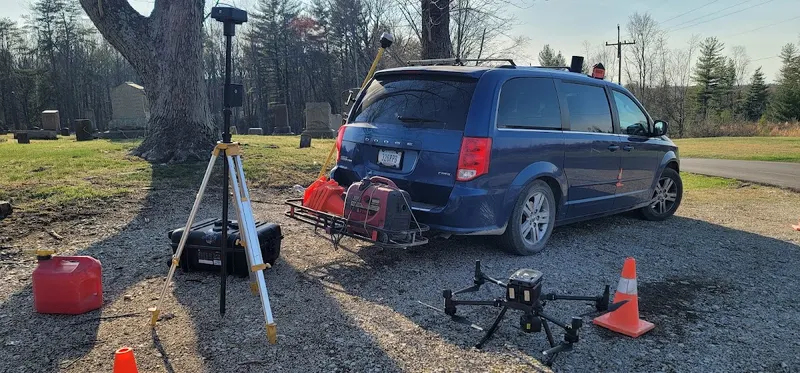
Precision Aerial Services LLC is a drone services business serving Evansville, IN, specializing in UAV lidar surveying, photogrammetry, and construction progress photography.

About Precision Aerial Services LLC

Precision Aerial Services LLC is a drone services business serving Evansville, Indiana, and surrounding areas. Precision Aerial Services LLC provides budget-friendly UAV lidar surveying, aerial photogrammetry, drone mapping, 3D lidar imaging, and volumetric stockpile reports. The business also offers construction progress photography, 360 inspection services, and construction video documentation. Precision Aerial Services LLC focuses on survey-grade unmanned aerial lidar and drone surveying to support geospatial engineering and construction projects. Precision Aerial Services LLC operates… Read moreRead less
Precision Aerial Services LLC is a drone services business serving Evansville, Indiana, and surrounding areas. Precision Aerial Services LLC provides budget-friendly UAV lidar surveying, aerial photogrammetry, drone mapping, 3D lidar imaging, and volumetric stockpile reports. The business also offers construction progress photography, 360 inspection services, and construction video documentation. Precision Aerial Services LLC focuses on survey-grade unmanned aerial lidar and drone surveying to support geospatial engineering and construction projects. Precision Aerial Services LLC operates with certifications relevant to drone and lidar surveying and serves clients in Indiana, Kentucky, and Ohio.

Photos 1

Hours

  • Sunday 6:00 AM – 8:00 PM
  • MondayOpen 24 hours
  • TuesdayOpen 24 hours
  • WednesdayOpen 24 hours
  • ThursdayOpen 24 hours
  • FridayOpen 24 hours
  • SaturdayOpen 24 hours

Times shown in the business’s local time (Central Time).

Services

  • UAV Lidar Surveying
  • Aerial Photogrammetry
  • Drone Mapping
  • 3D Lidar Imaging
  • Volumetric Stockpile Reports
  • Construction Progress Photography
  • 360 Inspection Services
  • Construction Video Documentation

Frequently asked questions

What types of drone surveying services does Precision Aerial Services LLC offer?
Precision Aerial Services LLC offers UAV lidar surveying, aerial photogrammetry, drone mapping, and 3D lidar imaging services.
Does Precision Aerial Services LLC provide construction progress documentation?
Precision Aerial Services LLC provides construction progress photography and construction video documentation services.
Which geographic areas does Precision Aerial Services LLC serve?
Precision Aerial Services LLC serves clients in Indiana, Kentucky, and Ohio.
What specialized inspection services are available?
Precision Aerial Services LLC offers 360 inspection services using drone technology.
Where is Precision Aerial Services LLC located?
Precision Aerial Services LLC is located at 2633 Beech Drive, Evansville, IN 47714.

No reviews on WiserMap yetBe the first to share your experience with Precision Aerial Services LLC.

Details are provided by the business or gathered by WiserMap and may change. Please confirm hours before visiting. Report a correction
Featured platformPartsDueAppliance repair software for WordPress. Booking, parts on order, return visits and warranty claims in one place.See PartsDue